Steinwenden elevation
Steinwenden (Rheinland-Pfalz), Germany elevation is 243 meters and Steinwenden elevation in feet is 797 ft above sea level [src 1]. Steinwenden is a seat of a fourth-order administrative division (feature code) with elevation that is 15 meters (49 ft) smaller than average city elevation in Germany.
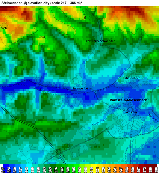
Below is the Elevation map of Steinwenden, which displays elevation range with different colors. Scale of the first map is from 217 to 386 m (712 to 1266 ft) with average elevation of 265.6 meters (=871 ft) [note 1]
These maps also provides idea of topography and contour of this city, they are displayed at different zoom levels. More info about maps, scale and edge coordinates you can find below images.
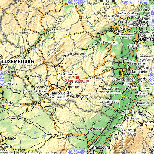
| \ | Map #1 | Topo.Map |
| Scale [m] | 217..386 m | × |
| Scale [ft] | 712..1266 ft | × |
| Average | 265.6 m = 871 ft | × |
| Width | 6.35 km = 3.9 mi | 203.3 km = 126.3 mi |
| Height | 6.35 km = 3.9 mi | 203.3 km = 126.3 mi |
| ↑Max Latitude | 49.485637° | 50.36266° |
| Latitude at center | 49.45708° | 49.45708° |
| ↓Min Latitude | 49.428506° | 48.53445° |
| ← Min Longitude | 7.483315° | 6.12101° |
| Longitude center | 7.52726° | 7.52726° |
| →Max Longitude | 7.571205° | 8.93351° |
Nearby cities:
Cities around Steinwenden sort by population:
• Landstuhl elevation 250 m
5.8 km,  147°
147°
• Ramstein-Miesenbach 242 m
2.5 km,  124°
124°
• Hütschenhausen 227 m
5.5 km,  215°
215°
• Kindsbach 255 m
7.9 km, 124°
• Mackenbach 276 m
4.2 km,  75°
75°
• Niedermohr 223 m
4.2 km,  272°
272°
• Reichenbach-Steegen 340 m
5 km,  18°
18°
• Kottweiler-Schwanden 281 m
3 km,  8°
8°
• Hauptstuhl 235 m
7.1 km,  206°
206°
• Nanzdietschweiler 280 m
5.6 km,  261°
261°
• Glan-Münchweiler 226 m
6.4 km,  285°
285°
• Schwedelbach 253 m
6.4 km,  48°
48°
Multilingual:
 En español:
Steinwenden elevación 243 m.
 En France:
Steinwenden élévation 243 m.
 Auf Deutsch:
Steinwenden höhe über dem Meeresspiegel ist 243 m.

Sources and notes:
- [note 1] Map square and city borders are not equal. Map elevation data is calculated only from area inside that square.
- [src 1] Elevation data from geonames database provided with same terms of usage.
- [src 2] The elevation map of Steinwenden is generated using elevation data from NASA's 3 arcsec (90m) resolution SRTM data.
- [src 3] Base (background) map © OpenStreetMap contributors tiles are generated by Geofabrik and OpenTopoMap.
Copyright & License:
This Steinwenden Elevation Map is licensed under CC BY-SA. You may reuse any part from this page, if you give a proper credit by linking to this URL:
 More info on terms of use page.