Stockstadt am Main elevation
Stockstadt am Main (Bavaria, Regierungsbezirk Unterfranken), Germany elevation is 118 meters and Stockstadt am Main elevation in feet is 387 ft above sea level [src 1]. Stockstadt am Main is a populated place (feature code) with elevation that is 140 meters (459 ft) smaller than average city elevation in Germany.
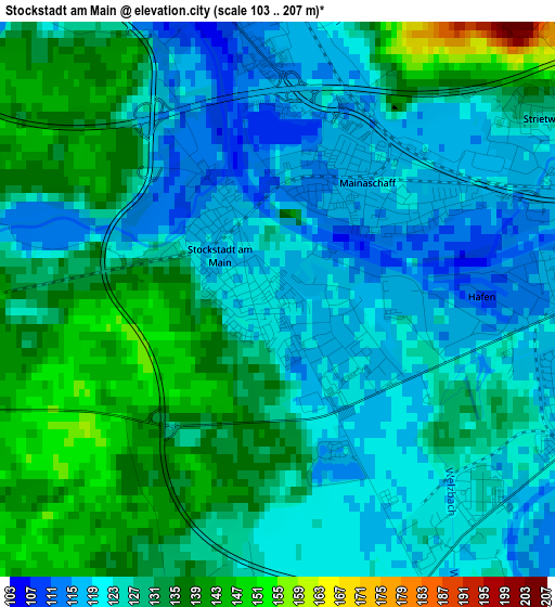
Below is the Elevation map of Stockstadt am Main, which displays elevation range with different colors. Scale of the first map is from 103 to 207 m (338 to 679 ft) with average elevation of 126.9 meters (=416 ft) [note 1]
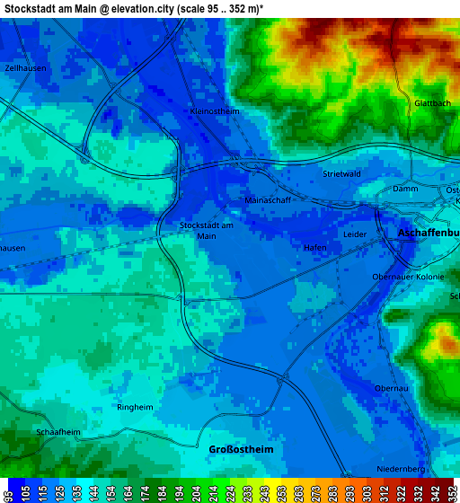
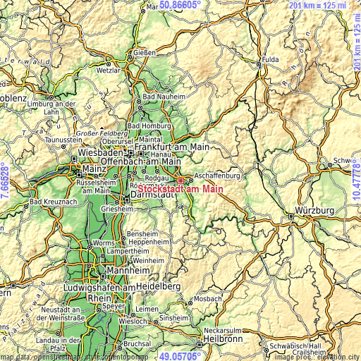
These maps also provides idea of topography and contour of this city, they are displayed at different zoom levels. More info about maps, scale and edge coordinates you can find below images.
| \ | Map #1 | Map #2 | Topo.Map |
| Scale [m] | 103..207 m | 95..352 m | × |
| Scale [ft] | 338..679 ft | 312..1155 ft | × |
| Average | 126.9 m = 416 ft | 144.8 m = 475 ft | × |
| Width | 6.29 km = 3.9 mi | 12.57 km = 7.8 mi | 201.1 km = 125 mi |
| Height | 6.29 km = 3.9 mi | 12.57 km = 7.8 mi | 201.1 km = 125 mi |
| ↑Max Latitude | 49.998307° | 50.026547° | 50.86605° |
| Latitude at center | 49.97005° | 49.97005° | 49.97005° |
| ↓Min Latitude | 49.941777° | 49.913487° | 49.05705° |
| ← Min Longitude | 9.027585° | 8.983639° | 7.66528° |
| Longitude center | 9.07153° | 9.07153° | 9.07153° |
| →Max Longitude | 9.115475° | 9.159421° | 10.47778° |
Nearby cities:
Cities around Stockstadt am Main sort by population:
• Aschaffenburg elevation 140 m
5.8 km,  82°
82°
• Babenhausen 127 m
8.6 km,  266°
266°
• Großostheim 133 m
5.6 km,  176°
176°
• Goldbach 144 m
8.7 km,  67°
67°
• Schaafheim 151 m
6.8 km,  221°
221°
• Haibach 279 m
9.7 km,  93°
93°
• Kleinostheim 113 m
3.3 km,  354°
354°
• Mainaschaff 119 m
1.8 km,  45°
45°
• Sulzbach am Main 129 m
8.7 km,  138°
138°
• Niedernberg 122 m
8 km, 143°
• Johannesberg 342 m
8.5 km,  36°
36°
• Glattbach 197 m
6.5 km,  59°
59°
Multilingual:
 En español:
Stockstadt am Main elevación 118 m.
 En France:
Stockstadt am Main élévation 118 m.
 Auf Deutsch:
Stockstadt am Main höhe über dem Meeresspiegel ist 118 m.
 На русском:
Stockstadt am Main высота над уровнем моря 118 м
Sources and notes:
- [note 1] Map square and city borders are not equal. Map elevation data is calculated only from area inside that square.
- [src 1] Elevation data from geonames database provided with same terms of usage.
- [src 2] The elevation map of Stockstadt am Main is generated using elevation data from NASA's 3 arcsec (90m) resolution SRTM data.
- [src 3] Base (background) map © OpenStreetMap contributors tiles are generated by Geofabrik and OpenTopoMap.
Copyright & License:
This Stockstadt am Main Elevation Map is licensed under CC BY-SA. You may reuse any part from this page, if you give a proper credit by linking to this URL:
 More info on terms of use page.