Syke elevation
Syke (Lower Saxony), Germany elevation is 22 meters and Syke elevation in feet is 72 ft above sea level [src 1]. Syke is a populated place (feature code) with elevation that is 236 meters (774 ft) smaller than average city elevation in Germany.
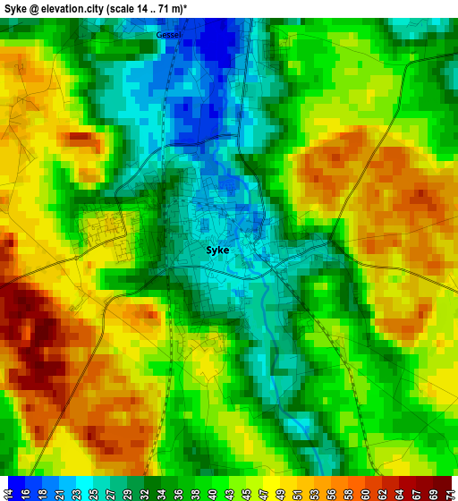
Below is the Elevation map of Syke, which displays elevation range with different colors. Scale of the first map is from 14 to 71 m (46 to 233 ft) with average elevation of 40.7 meters (=134 ft) [note 1]
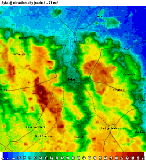
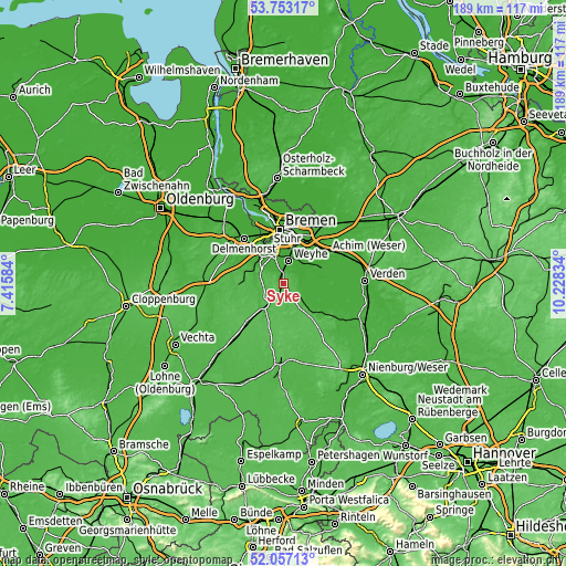
These maps also provides idea of topography and contour of this city, they are displayed at different zoom levels. More info about maps, scale and edge coordinates you can find below images.
| \ | Map #1 | Map #2 | Topo.Map |
| Scale [m] | 14..71 m | 4..71 m | × |
| Scale [ft] | 46..233 ft | 13..233 ft | × |
| Average | 40.7 m = 134 ft | 33.5 m = 110 ft | × |
| Width | 5.89 km = 3.7 mi | 11.79 km = 7.3 mi | 188.6 km = 117.2 mi |
| Height | 5.89 km = 3.7 mi | 11.79 km = 7.3 mi | 188.6 km = 117.2 mi |
| ↑Max Latitude | 52.939942° | 52.966417° | 53.75317° |
| Latitude at center | 52.91345° | 52.91345° | 52.91345° |
| ↓Min Latitude | 52.886942° | 52.860418° | 52.05713° |
| ← Min Longitude | 8.778145° | 8.734199° | 7.41584° |
| Longitude center | 8.82209° | 8.82209° | 8.82209° |
| →Max Longitude | 8.866035° | 8.909981° | 10.22834° |
Nearby cities:
Cities around Syke sort by population:
• Stuhr elevation 3 m
14.2 km,  340°
340°
• Bassum 43 m
9.4 km,  222°
222°
• Bruchhausen-Vilsen 17 m
14.7 km,  129°
129°
• Thedinghausen 7 m
14.3 km,  65°
65°
• Riede 6 m
10.4 km,  55°
55°
• Schwarme 12 m
13.1 km,  96°
96°
• Emtinghausen 10 m
9.9 km,  77°
77°
• Süstedt 20 m
8.8 km, 130°
• Kirchseelte 14 m
10.1 km,  293°
293°
• Dünsen 38 m
12.2 km,  277°
277°
• Engeln 58 m
14.8 km,  154°
154°
• Sudwalde 51 m
13.4 km,  175°
175°
Multilingual:
 En español:
Syke elevación 22 m.
 En France:
Syke élévation 22 m.


Sources and notes:
- [note 1] Map square and city borders are not equal. Map elevation data is calculated only from area inside that square.
- [src 1] Elevation data from geonames database provided with same terms of usage.
- [src 2] The elevation map of Syke is generated using elevation data from NASA's 3 arcsec (90m) resolution SRTM data.
- [src 3] Base (background) map © OpenStreetMap contributors tiles are generated by Geofabrik and OpenTopoMap.
Copyright & License:
This Syke Elevation Map is licensed under CC BY-SA. You may reuse any part from this page, if you give a proper credit by linking to this URL:
 More info on terms of use page.