Tacherting elevation
Tacherting (Bavaria, Upper Bavaria), Germany elevation is 475 meters and Tacherting elevation in feet is 1558 ft above sea level [src 1]. Tacherting is a seat of a fourth-order administrative division (feature code) with elevation that is 217 meters (712 ft) bigger than average city elevation in Germany.
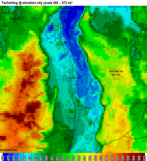
Below is the Elevation map of Tacherting, which displays elevation range with different colors. Scale of the first map is from 450 to 573 m (1476 to 1880 ft) with average elevation of 502.8 meters (=1650 ft) [note 1]
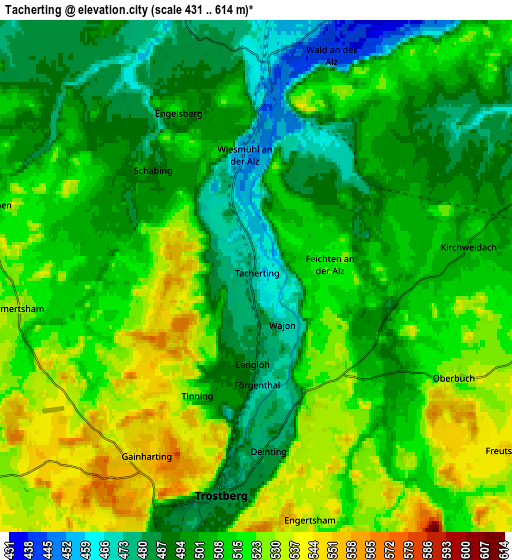
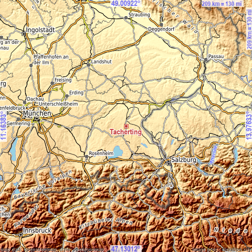
These maps also provides idea of topography and contour of this city, they are displayed at different zoom levels. More info about maps, scale and edge coordinates you can find below images.
| \ | Map #1 | Map #2 | Topo.Map |
| Scale [m] | 450..573 m | 431..614 m | × |
| Scale [ft] | 1476..1880 ft | 1414..2014 ft | × |
| Average | 502.8 m = 1650 ft | 508.4 m = 1668 ft | × |
| Width | 6.53 km = 4.1 mi | 13.06 km = 8.1 mi | 208.9 km = 129.8 mi |
| Height | 6.53 km = 4.1 mi | 13.06 km = 8.1 mi | 208.9 km = 129.8 mi |
| ↑Max Latitude | 48.107602° | 48.136938° | 49.00922° |
| Latitude at center | 48.07825° | 48.07825° | 48.07825° |
| ↓Min Latitude | 48.048881° | 48.019495° | 47.13012° |
| ← Min Longitude | 12.526135° | 12.482189° | 11.16383° |
| Longitude center | 12.57008° | 12.57008° | 12.57008° |
| →Max Longitude | 12.614025° | 12.657971° | 13.97633° |
Nearby cities:
Cities around Tacherting sort by population:
• Traunreut elevation 552 m
13 km,  172°
172°
• Trostberg an der Alz 482 m
5.7 km,  189°
189°
• Garching an der Alz 459 m
6.3 km,  7°
7°
• Tittmoning 386 m
14.8 km,  97°
97°
• Seeon-Seebruck 574 m
14.6 km,  211°
211°
• Palling 529 m
9.8 km,  149°
149°
• Unterneukirchen 459 m
10.4 km,  19°
19°
• Engelsberg 515 m
4.7 km,  334°
334°
• Kirchweidach 508 m
5.6 km,  81°
81°
• Kienberg 550 m
9.3 km,  238°
238°
• Taufkirchen 486 m
12 km,  311°
311°
• Tyrlaching 528 m
7.3 km, 100°
Multilingual:
 En español:
Tacherting elevación 475 m.
 En France:
Tacherting élévation 475 m.
 Auf Deutsch:
Tacherting höhe über dem Meeresspiegel ist 475 m.

Sources and notes:
- [note 1] Map square and city borders are not equal. Map elevation data is calculated only from area inside that square.
- [src 1] Elevation data from geonames database provided with same terms of usage.
- [src 2] The elevation map of Tacherting is generated using elevation data from NASA's 3 arcsec (90m) resolution SRTM data.
- [src 3] Base (background) map © OpenStreetMap contributors tiles are generated by Geofabrik and OpenTopoMap.
Copyright & License:
This Tacherting Elevation Map is licensed under CC BY-SA. You may reuse any part from this page, if you give a proper credit by linking to this URL:
 More info on terms of use page.