Teltow elevation
Teltow (Brandenburg), Germany elevation is 39 meters and Teltow elevation in feet is 128 ft above sea level [src 1]. Teltow is a populated place (feature code) with elevation that is 219 meters (719 ft) smaller than average city elevation in Germany.
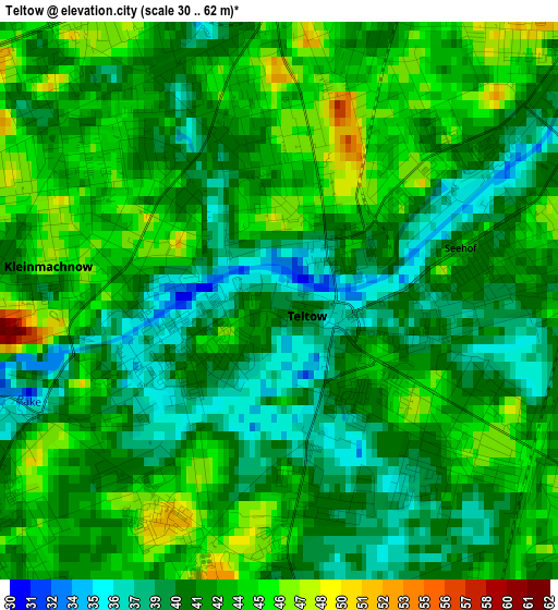
Below is the Elevation map of Teltow, which displays elevation range with different colors. Scale of the first map is from 30 to 62 m (98 to 203 ft) with average elevation of 41.7 meters (=137 ft) [note 1]
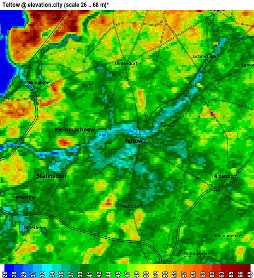
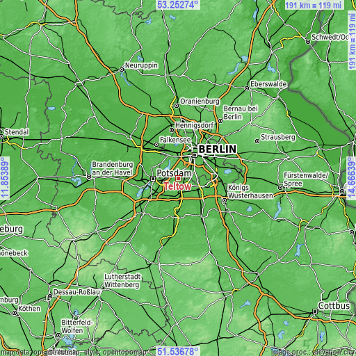
These maps also provides idea of topography and contour of this city, they are displayed at different zoom levels. More info about maps, scale and edge coordinates you can find below images.
| \ | Map #1 | Map #2 | Topo.Map |
| Scale [m] | 30..62 m | 26..68 m | × |
| Scale [ft] | 98..203 ft | 85..223 ft | × |
| Average | 41.7 m = 137 ft | 44.4 m = 146 ft | × |
| Width | 5.96 km = 3.7 mi | 11.92 km = 7.4 mi | 190.8 km = 118.6 mi |
| Height | 5.96 km = 3.7 mi | 11.92 km = 7.4 mi | 190.8 km = 118.6 mi |
| ↑Max Latitude | 52.429903° | 52.45669° | 53.25274° |
| Latitude at center | 52.4031° | 52.4031° | 52.4031° |
| ↓Min Latitude | 52.376281° | 52.349445° | 51.53678° |
| ← Min Longitude | 13.216195° | 13.172249° | 11.85389° |
| Longitude center | 13.26014° | 13.26014° | 13.26014° |
| →Max Longitude | 13.304085° | 13.348031° | 14.66639° |
Nearby cities:
Cities around Teltow sort by population:
• Lichterfelde elevation 47 m
4.7 km,  43°
43°
• Steglitz 51 m
7.6 km, 39°
• Zehlendorf 46 m
3.4 km,  348°
348°
• Lankwitz 43 m
6.9 km,  57°
57°
• Marienfelde 44 m
7.5 km,  76°
76°
• Schmargendorf 47 m
8.3 km,  14°
14°
• Kleinmachnow 47 m
2.4 km,  282°
282°
• Nikolassee 42 m
5.3 km,  310°
310°
• Dahlem 54 m
6.4 km,  16°
16°
• Stahnsdorf 43 m
3.7 km,  233°
233°
• Wannsee 40 m
7.3 km, 284°
• Großbeeren 42 m
6 km,  145°
145°
Multilingual:
 En español:
Teltow elevación 39 m.
 En France:
Teltow élévation 39 m.


Sources and notes:
- [note 1] Map square and city borders are not equal. Map elevation data is calculated only from area inside that square.
- [src 1] Elevation data from geonames database provided with same terms of usage.
- [src 2] The elevation map of Teltow is generated using elevation data from NASA's 3 arcsec (90m) resolution SRTM data.
- [src 3] Base (background) map © OpenStreetMap contributors tiles are generated by Geofabrik and OpenTopoMap.
Copyright & License:
This Teltow Elevation Map is licensed under CC BY-SA. You may reuse any part from this page, if you give a proper credit by linking to this URL:
 More info on terms of use page.