Tessin elevation
Tessin (Mecklenburg-Vorpommern), Germany elevation is 15 meters and Tessin elevation in feet is 49 ft above sea level [src 1]. Tessin is a populated place (feature code) with elevation that is 243 meters (797 ft) smaller than average city elevation in Germany.
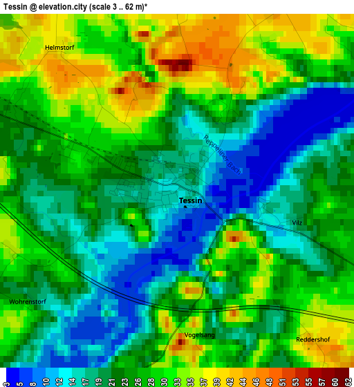
Below is the Elevation map of Tessin, which displays elevation range with different colors. Scale of the first map is from 3 to 62 m (10 to 203 ft) with average elevation of 24.9 meters (=82 ft) [note 1]
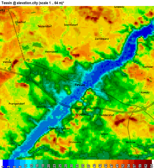
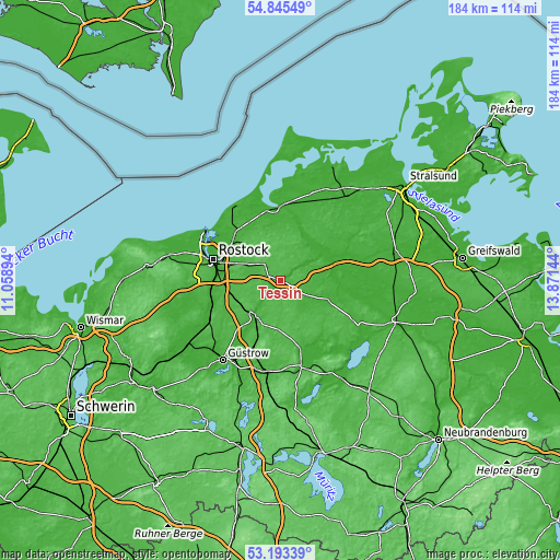
These maps also provides idea of topography and contour of this city, they are displayed at different zoom levels. More info about maps, scale and edge coordinates you can find below images.
| \ | Map #1 | Map #2 | Topo.Map |
| Scale [m] | 3..62 m | 1..64 m | × |
| Scale [ft] | 10..203 ft | 3..210 ft | × |
| Average | 24.9 m = 82 ft | 32.2 m = 106 ft | × |
| Width | 5.74 km = 3.6 mi | 11.48 km = 7.1 mi | 183.7 km = 114.1 mi |
| Height | 5.74 km = 3.6 mi | 11.48 km = 7.1 mi | 183.7 km = 114.1 mi |
| ↑Max Latitude | 54.053445° | 54.079234° | 54.84549° |
| Latitude at center | 54.02764° | 54.02764° | 54.02764° |
| ↓Min Latitude | 54.001819° | 53.975981° | 53.19339° |
| ← Min Longitude | 12.421245° | 12.377299° | 11.05894° |
| Longitude center | 12.46519° | 12.46519° | 12.46519° |
| →Max Longitude | 12.509135° | 12.553081° | 13.87144° |
Nearby cities:
Cities around Tessin sort by population:
• Marlow elevation 29 m
15.7 km,  26°
26°
• Laage 24 m
13.7 km,  214°
214°
• Gnoien 18 m
17.4 km,  112°
112°
• Broderstorf 42 m
14.4 km,  294°
294°
• Tribsees 3 m
20.5 km,  68°
68°
• Dummerstorf 46 m
15.5 km,  264°
264°
• Bentwisch 19 m
19.6 km,  299°
299°
• Roggentin 33 m
17.7 km, 285°
• Bad Sülze 8 m
15.7 km,  54°
54°
• Jördenstorf 50 m
19.3 km,  149°
149°
• Kavelstorf 39 m
18.1 km, 262°
• Wardow 33 m
11.4 km,  199°
199°
Multilingual:
 En español:
Tessin elevación 15 m.
 En France:
Tessin élévation 15 m.


Sources and notes:
- [note 1] Map square and city borders are not equal. Map elevation data is calculated only from area inside that square.
- [src 1] Elevation data from geonames database provided with same terms of usage.
- [src 2] The elevation map of Tessin is generated using elevation data from NASA's 3 arcsec (90m) resolution SRTM data.
- [src 3] Base (background) map © OpenStreetMap contributors tiles are generated by Geofabrik and OpenTopoMap.
Copyright & License:
This Tessin Elevation Map is licensed under CC BY-SA. You may reuse any part from this page, if you give a proper credit by linking to this URL:
 More info on terms of use page.