Twistringen elevation
Twistringen (Lower Saxony), Germany elevation is 56 meters and Twistringen elevation in feet is 184 ft above sea level [src 1]. Twistringen is a populated place (feature code) with elevation that is 202 meters (663 ft) smaller than average city elevation in Germany.
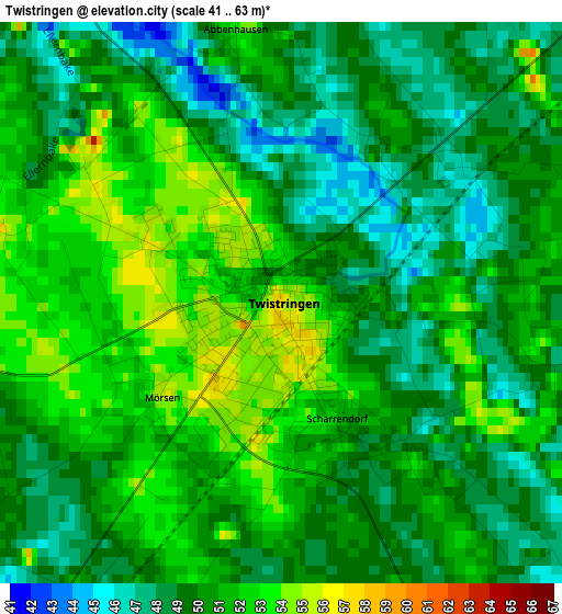
Below is the Elevation map of Twistringen, which displays elevation range with different colors. Scale of the first map is from 41 to 63 m (135 to 207 ft) with average elevation of 50 meters (=164 ft) [note 1]
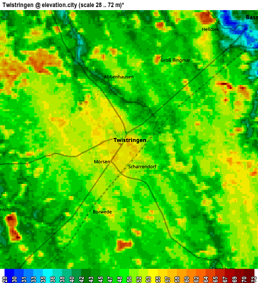
These maps also provides idea of topography and contour of this city, they are displayed at different zoom levels. More info about maps, scale and edge coordinates you can find below images.
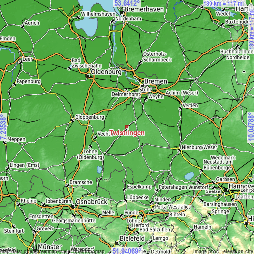
| \ | Map #1 | Map #2 | Topo.Map |
| Scale [m] | 41..63 m | 28..72 m | × |
| Scale [ft] | 135..207 ft | 92..236 ft | × |
| Average | 50 m = 164 ft | 48.9 m = 160 ft | × |
| Width | 5.91 km = 3.7 mi | 11.82 km = 7.3 mi | 189.1 km = 117.5 mi |
| Height | 5.91 km = 3.7 mi | 11.82 km = 7.3 mi | 189.1 km = 117.5 mi |
| ↑Max Latitude | 52.825822° | 52.852367° | 53.6412° |
| Latitude at center | 52.79926° | 52.79926° | 52.79926° |
| ↓Min Latitude | 52.772682° | 52.746088° | 51.94069° |
| ← Min Longitude | 8.597685° | 8.553739° | 7.23538° |
| Longitude center | 8.64163° | 8.64163° | 8.64163° |
| →Max Longitude | 8.685575° | 8.729521° | 10.04788° |
Nearby cities:
Cities around Twistringen sort by population:
• Bassum elevation 43 m
8.1 km,  45°
45°
• Goldenstedt 36 m
14.1 km,  265°
265°
• Barnstorf 33 m
13.6 km,  223°
223°
• Harpstedt 33 m
12.7 km,  344°
344°
• Eydelstedt 35 m
13.5 km,  208°
208°
• Ehrenburg 44 m
6.7 km,  144°
144°
• Schwaförden 59 m
14.4 km,  118°
118°
• Kirchseelte 14 m
17 km,  9°
9°
• Dünsen 38 m
14.3 km,  0°
0°
• Sudwalde 51 m
13.1 km,  92°
92°
• Neuenkirchen 55 m
7.7 km,  109°
109°
• Drentwede 46 m
8 km, 219°
Multilingual:
 En español:
Twistringen elevación 56 m.
 En France:
Twistringen élévation 56 m.
 Auf Deutsch:
Twistringen höhe über dem Meeresspiegel ist 56 m.

Sources and notes:
- [note 1] Map square and city borders are not equal. Map elevation data is calculated only from area inside that square.
- [src 1] Elevation data from geonames database provided with same terms of usage.
- [src 2] The elevation map of Twistringen is generated using elevation data from NASA's 3 arcsec (90m) resolution SRTM data.
- [src 3] Base (background) map © OpenStreetMap contributors tiles are generated by Geofabrik and OpenTopoMap.
Copyright & License:
This Twistringen Elevation Map is licensed under CC BY-SA. You may reuse any part from this page, if you give a proper credit by linking to this URL:
 More info on terms of use page.