Voerde elevation
Voerde (North Rhine-Westphalia, Düsseldorf District), Germany elevation is 27 meters and Voerde elevation in feet is 89 ft above sea level [src 1]. Voerde is a populated place (feature code) with elevation that is 231 meters (758 ft) smaller than average city elevation in Germany.
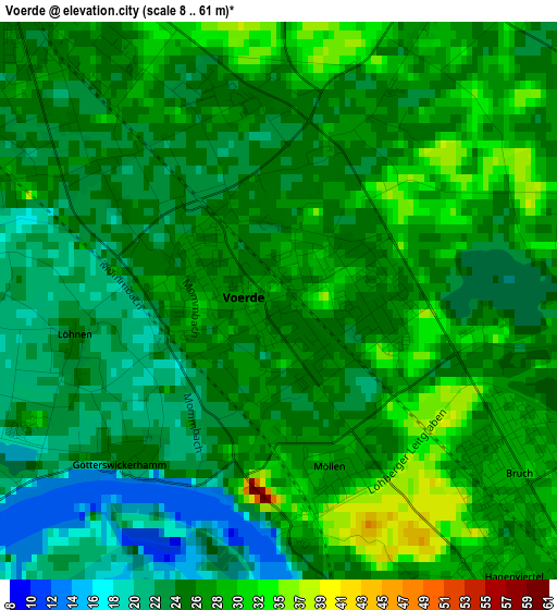
Below is the Elevation map of Voerde, which displays elevation range with different colors. Scale of the first map is from 8 to 61 m (26 to 200 ft) with average elevation of 26.3 meters (=86 ft) [note 1]
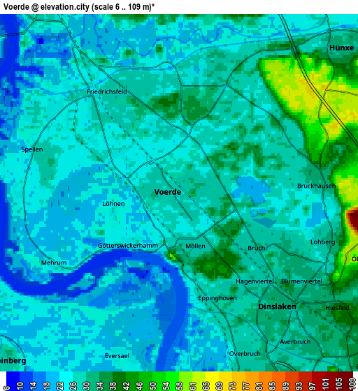
These maps also provides idea of topography and contour of this city, they are displayed at different zoom levels. More info about maps, scale and edge coordinates you can find below images.
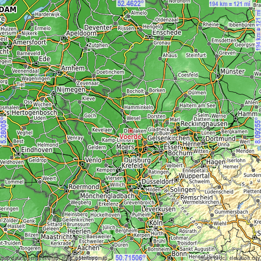
| \ | Map #1 | Map #2 | Topo.Map |
| Scale [m] | 8..61 m | 6..109 m | × |
| Scale [ft] | 26..200 ft | 20..358 ft | × |
| Average | 26.3 m = 86 ft | 27.4 m = 90 ft | × |
| Width | 6.07 km = 3.8 mi | 12.14 km = 7.5 mi | 194.3 km = 120.7 mi |
| Height | 6.07 km = 3.8 mi | 12.14 km = 7.5 mi | 194.2 km = 120.7 mi |
| ↑Max Latitude | 51.62432° | 51.651594° | 52.4622° |
| Latitude at center | 51.59703° | 51.59703° | 51.59703° |
| ↓Min Latitude | 51.569723° | 51.542401° | 50.71506° |
| ← Min Longitude | 6.642355° | 6.598409° | 5.28005° |
| Longitude center | 6.6863° | 6.6863° | 6.6863° |
| →Max Longitude | 6.730245° | 6.774191° | 8.09255° |
Nearby cities:
Cities around Voerde sort by population:
• Oberhausen elevation 44 m
18 km,  137°
137°
• Moers 29 m
16.4 km,  193°
193°
• Dinslaken 34 m
5.5 km,  134°
134°
• Wesel 23 m
9 km,  329°
329°
• Meiderich 30 m
15.5 km,  159°
159°
• Kamp-Lintfort 30 m
14.1 km,  223°
223°
• Rheinberg 25 m
8.4 km,  228°
228°
• Hamminkeln 25 m
16.5 km,  336°
336°
• Xanten 24 m
17.5 km,  293°
293°
• Hünxe 25 m
4.2 km,  10°
10°
• Schermbeck 32 m
15.7 km,  52°
52°
• Alpen 22 m
11.8 km,  262°
262°
Multilingual:
 En español:
Voerde elevación 27 m.
 En France:
Voerde élévation 27 m.


Sources and notes:
- [note 1] Map square and city borders are not equal. Map elevation data is calculated only from area inside that square.
- [src 1] Elevation data from geonames database provided with same terms of usage.
- [src 2] The elevation map of Voerde is generated using elevation data from NASA's 3 arcsec (90m) resolution SRTM data.
- [src 3] Base (background) map © OpenStreetMap contributors tiles are generated by Geofabrik and OpenTopoMap.
Copyright & License:
This Voerde Elevation Map is licensed under CC BY-SA. You may reuse any part from this page, if you give a proper credit by linking to this URL:
 More info on terms of use page.