Wachenheim elevation
Wachenheim (Rheinland-Pfalz), Germany elevation is 160 meters and Wachenheim elevation in feet is 525 ft above sea level [src 1]. Wachenheim is a populated place (feature code) with elevation that is 98 meters (322 ft) smaller than average city elevation in Germany.
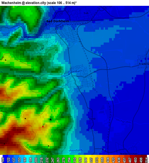
Below is the Elevation map of Wachenheim, which displays elevation range with different colors. Scale of the first map is from 106 to 514 m (348 to 1686 ft) with average elevation of 190.7 meters (=626 ft) [note 1]
These maps also provides idea of topography and contour of this city, they are displayed at different zoom levels. More info about maps, scale and edge coordinates you can find below images.
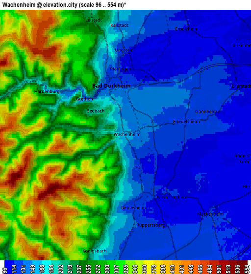
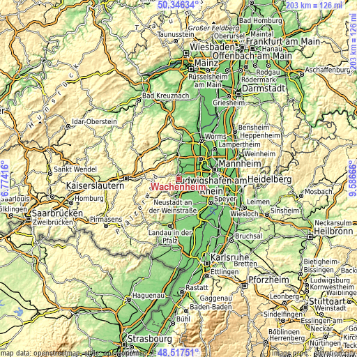
| \ | Map #1 | Map #2 | Topo.Map |
| Scale [m] | 106..514 m | 96..554 m | × |
| Scale [ft] | 348..1686 ft | 315..1818 ft | × |
| Average | 190.7 m = 626 ft | 212.3 m = 697 ft | × |
| Width | 6.35 km = 3.9 mi | 12.71 km = 7.9 mi | 203.3 km = 126.3 mi |
| Height | 6.35 km = 3.9 mi | 12.71 km = 7.9 mi | 203.3 km = 126.3 mi |
| ↑Max Latitude | 49.469017° | 49.497567° | 50.34634° |
| Latitude at center | 49.44045° | 49.44045° | 49.44045° |
| ↓Min Latitude | 49.411867° | 49.383267° | 48.51751° |
| ← Min Longitude | 8.136465° | 8.092519° | 6.77416° |
| Longitude center | 8.18041° | 8.18041° | 8.18041° |
| →Max Longitude | 8.224355° | 8.268301° | 9.58666° |
Nearby cities:
Cities around Wachenheim sort by population:
• Bad Dürkheim elevation 133 m
2.4 km,  346°
346°
• Deidesheim 124 m
3.6 km,  175°
175°
• Meckenheim 114 m
5.8 km,  133°
133°
• Birkenheide 101 m
7.4 km,  52°
52°
• Rödersheim-Gronau 107 m
6 km,  101°
101°
• Niederkirchen bei Deidesheim 114 m
3.5 km,  142°
142°
• Ellerstadt 114 m
6.2 km,  67°
67°
• Friedelsheim 123 m
3.2 km,  76°
76°
• Gönnheim 119 m
4.3 km, 78°
• Ruppertsberg 123 m
4.6 km,  165°
165°
• Erpolzheim 109 m
6.3 km,  30°
30°
• Kallstadt 146 m
5.6 km,  356°
356°
Multilingual:
 En español:
Wachenheim elevación 160 m.
 En France:
Wachenheim élévation 160 m.
 Auf Deutsch:
Wachenheim an der Weinstraße höhe über dem Meeresspiegel ist 160 m.

Sources and notes:
- [note 1] Map square and city borders are not equal. Map elevation data is calculated only from area inside that square.
- [src 1] Elevation data from geonames database provided with same terms of usage.
- [src 2] The elevation map of Wachenheim is generated using elevation data from NASA's 3 arcsec (90m) resolution SRTM data.
- [src 3] Base (background) map © OpenStreetMap contributors tiles are generated by Geofabrik and OpenTopoMap.
Copyright & License:
This Wachenheim Elevation Map is licensed under CC BY-SA. You may reuse any part from this page, if you give a proper credit by linking to this URL:
 More info on terms of use page.