Wemding elevation
Wemding (Bavaria, Swabia), Germany elevation is 458 meters and Wemding elevation in feet is 1503 ft above sea level [src 1]. Wemding is a populated place (feature code) with elevation that is 200 meters (656 ft) bigger than average city elevation in Germany.
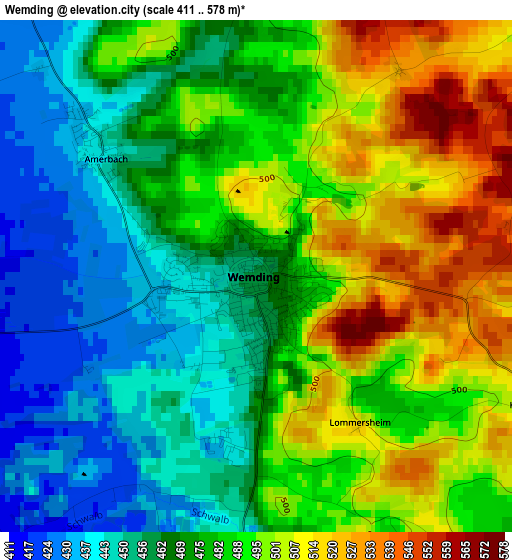
Below is the Elevation map of Wemding, which displays elevation range with different colors. Scale of the first map is from 411 to 578 m (1348 to 1896 ft) with average elevation of 479 meters (=1572 ft) [note 1]
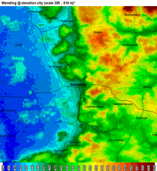
These maps also provides idea of topography and contour of this city, they are displayed at different zoom levels. More info about maps, scale and edge coordinates you can find below images.
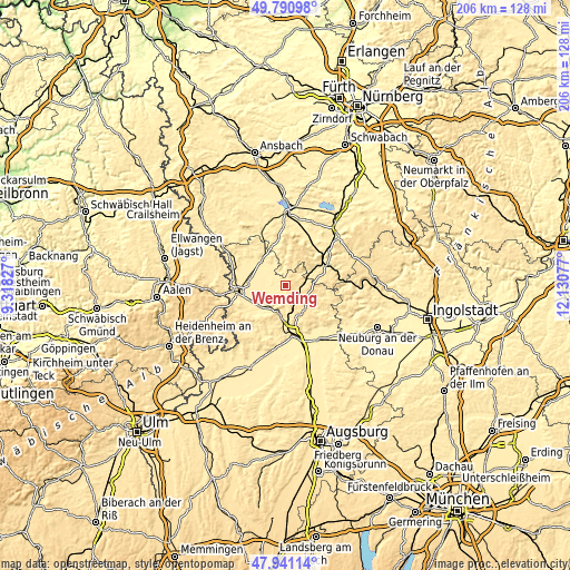
| \ | Map #1 | Map #2 | Topo.Map |
| Scale [m] | 411..578 m | 398..616 m | × |
| Scale [ft] | 1348..1896 ft | 1306..2021 ft | × |
| Average | 479 m = 1572 ft | 475.1 m = 1559 ft | × |
| Width | 6.43 km = 4 mi | 12.86 km = 8 mi | 205.7 km = 127.8 mi |
| Height | 6.43 km = 4 mi | 12.85 km = 8 mi | 205.7 km = 127.8 mi |
| ↑Max Latitude | 48.903505° | 48.932383° | 49.79098° |
| Latitude at center | 48.87461° | 48.87461° | 48.87461° |
| ↓Min Latitude | 48.845698° | 48.81677° | 47.94114° |
| ← Min Longitude | 10.680575° | 10.636629° | 9.31827° |
| Longitude center | 10.72452° | 10.72452° | 10.72452° |
| →Max Longitude | 10.768465° | 10.812411° | 12.13077° |
Nearby cities:
Cities around Wemding sort by population:
• Harburg elevation 411 m
10.1 km,  194°
194°
• Monheim 497 m
10.4 km,  109°
109°
• Möttingen 416 m
12.2 km,  233°
233°
• Deiningen 421 m
11.6 km,  265°
265°
• Polsingen 446 m
5.2 km,  349°
349°
• Munningen 417 m
10.2 km,  297°
297°
• Alerheim 413 m
8.4 km,  250°
250°
• Huisheim 446 m
5.7 km,  195°
195°
• Hainsfarth 431 m
11.8 km,  321°
321°
• Wechingen 412 m
8.4 km,  283°
283°
• Fünfstetten 501 m
5.6 km,  147°
147°
• Wolferstadt 491 m
5.2 km,  52°
52°
Multilingual:
 En español:
Wemding elevación 458 m.
 En France:
Wemding élévation 458 m.


Sources and notes:
- [note 1] Map square and city borders are not equal. Map elevation data is calculated only from area inside that square.
- [src 1] Elevation data from geonames database provided with same terms of usage.
- [src 2] The elevation map of Wemding is generated using elevation data from NASA's 3 arcsec (90m) resolution SRTM data.
- [src 3] Base (background) map © OpenStreetMap contributors tiles are generated by Geofabrik and OpenTopoMap.
Copyright & License:
This Wemding Elevation Map is licensed under CC BY-SA. You may reuse any part from this page, if you give a proper credit by linking to this URL:
 More info on terms of use page.