Wirges elevation
Wirges (Rheinland-Pfalz), Germany elevation is 271 meters and Wirges elevation in feet is 889 ft above sea level [src 1]. Wirges is a populated place (feature code) with elevation that is 13 meters (43 ft) bigger than average city elevation in Germany.
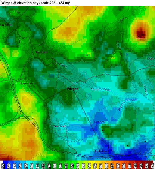
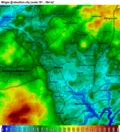
Below is the Elevation map of Wirges, which displays elevation range with different colors. Scale of the first map is from 222 to 434 m (728 to 1424 ft) with average elevation of 296.9 meters (=974 ft) [note 1]
These maps also provides idea of topography and contour of this city, they are displayed at different zoom levels. More info about maps, scale and edge coordinates you can find below images.
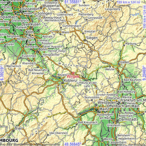
| \ | Map #1 | Map #2 | Topo.Map |
| Scale [m] | 222..434 m | 181..564 m | × |
| Scale [ft] | 728..1424 ft | 594..1850 ft | × |
| Average | 296.9 m = 974 ft | 321.9 m = 1056 ft | × |
| Width | 6.22 km = 3.9 mi | 12.44 km = 7.7 mi | 199 km = 123.7 mi |
| Height | 6.22 km = 3.9 mi | 12.44 km = 7.7 mi | 199 km = 123.7 mi |
| ↑Max Latitude | 50.499911° | 50.527855° | 51.35851° |
| Latitude at center | 50.47195° | 50.47195° | 50.47195° |
| ↓Min Latitude | 50.443972° | 50.415978° | 49.56845° |
| ← Min Longitude | 7.754495° | 7.710549° | 6.39219° |
| Longitude center | 7.79844° | 7.79844° | 7.79844° |
| →Max Longitude | 7.842385° | 7.886331° | 9.20469° |
Nearby cities:
Cities around Wirges sort by population:
• Montabaur elevation 256 m
4.4 km,  156°
156°
• Ransbach-Baumbach 305 m
5 km,  261°
261°
• Siershahn 307 m
2.1 km,  320°
320°
• Dernbach 256 m
1.9 km,  198°
198°
• Heiligenroth 225 m
5.4 km,  116°
116°
• Ötzingen 323 m
4 km,  38°
38°
• Ebernhahn 304 m
2 km,  272°
272°
• Mogendorf 282 m
3.7 km,  312°
312°
• Holler 222 m
6.6 km, 158°
• Helferskirchen 336 m
4.4 km,  12°
12°
• Ruppach-Goldhausen 301 m
6 km,  95°
95°
• Großholbach 313 m
6.5 km,  112°
112°
Multilingual:
 En español:
Wirges elevación 271 m.
 En France:
Wirges élévation 271 m.


Sources and notes:
- [note 1] Map square and city borders are not equal. Map elevation data is calculated only from area inside that square.
- [src 1] Elevation data from geonames database provided with same terms of usage.
- [src 2] The elevation map of Wirges is generated using elevation data from NASA's 3 arcsec (90m) resolution SRTM data.
- [src 3] Base (background) map © OpenStreetMap contributors tiles are generated by Geofabrik and OpenTopoMap.
Copyright & License:
This Wirges Elevation Map is licensed under CC BY-SA. You may reuse any part from this page, if you give a proper credit by linking to this URL:
 More info on terms of use page.