Wirsberg elevation
Wirsberg (Bavaria, Upper Franconia), Germany elevation is 367 meters and Wirsberg elevation in feet is 1204 ft above sea level [src 1]. Wirsberg is a populated place (feature code) with elevation that is 109 meters (358 ft) bigger than average city elevation in Germany.
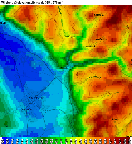
Below is the Elevation map of Wirsberg, which displays elevation range with different colors. Scale of the first map is from 325 to 576 m (1066 to 1890 ft) with average elevation of 440 meters (=1444 ft) [note 1]
These maps also provides idea of topography and contour of this city, they are displayed at different zoom levels. More info about maps, scale and edge coordinates you can find below images.
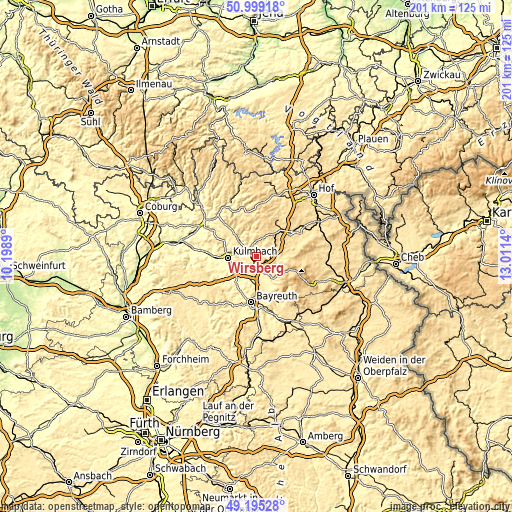
| \ | Map #1 | Topo.Map |
| Scale [m] | 325..576 m | × |
| Scale [ft] | 1066..1890 ft | × |
| Average | 440 m = 1444 ft | × |
| Width | 6.27 km = 3.9 mi | 200.6 km = 124.6 mi |
| Height | 6.27 km = 3.9 mi | 200.6 km = 124.6 mi |
| ↑Max Latitude | 50.133897° | 50.99918° |
| Latitude at center | 50.10572° | 50.10572° |
| ↓Min Latitude | 50.077526° | 49.19528° |
| ← Min Longitude | 11.561205° | 10.1989° |
| Longitude center | 11.60515° | 11.60515° |
| →Max Longitude | 11.649095° | 13.0114° |
Nearby cities:
Cities around Wirsberg sort by population:
• Bad Berneck im Fichtelgebirge elevation 412 m
8.2 km,  144°
144°
• Marktleugast 551 m
7.8 km,  15°
15°
• Himmelkron 356 m
4.4 km,  184°
184°
• Steinbach 535 m
6.2 km,  31°
31°
• Neuenmarkt 350 m
2.3 km,  229°
229°
• Stammbach 550 m
7.6 km,  54°
54°
• Untersteinach 390 m
7 km,  295°
295°
• Trebgast 332 m
5.9 km,  222°
222°
• Ködnitz 447 m
5.2 km,  262°
262°
• Marktschorgast 479 m
3.7 km,  109°
109°
• Kupferberg 474 m
4.2 km,  332°
332°
• Harsdorf 398 m
8.5 km,  198°
198°
Multilingual:
 En español:
Wirsberg elevación 367 m.
 En France:
Wirsberg élévation 367 m.
 Auf Deutsch:
Wirsberg höhe über dem Meeresspiegel ist 367 m.

Sources and notes:
- [note 1] Map square and city borders are not equal. Map elevation data is calculated only from area inside that square.
- [src 1] Elevation data from geonames database provided with same terms of usage.
- [src 2] The elevation map of Wirsberg is generated using elevation data from NASA's 3 arcsec (90m) resolution SRTM data.
- [src 3] Base (background) map © OpenStreetMap contributors tiles are generated by Geofabrik and OpenTopoMap.
Copyright & License:
This Wirsberg Elevation Map is licensed under CC BY-SA. You may reuse any part from this page, if you give a proper credit by linking to this URL:
 More info on terms of use page.