Wittingen elevation
Wittingen (Lower Saxony), Germany elevation is 84 meters and Wittingen elevation in feet is 276 ft above sea level [src 1]. Wittingen is a populated place (feature code) with elevation that is 174 meters (571 ft) smaller than average city elevation in Germany.
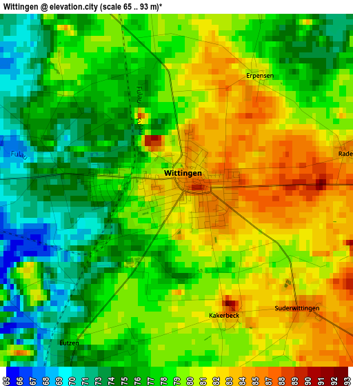
Below is the Elevation map of Wittingen, which displays elevation range with different colors. Scale of the first map is from 65 to 93 m (213 to 305 ft) with average elevation of 78.7 meters (=258 ft) [note 1]
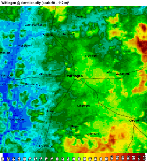
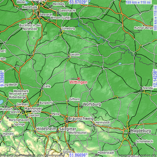
These maps also provides idea of topography and contour of this city, they are displayed at different zoom levels. More info about maps, scale and edge coordinates you can find below images.
| \ | Map #1 | Map #2 | Topo.Map |
| Scale [m] | 65..93 m | 60..112 m | × |
| Scale [ft] | 213..305 ft | 197..367 ft | × |
| Average | 78.7 m = 258 ft | 78.1 m = 256 ft | × |
| Width | 5.92 km = 3.7 mi | 11.84 km = 7.4 mi | 189.4 km = 117.7 mi |
| Height | 5.92 km = 3.7 mi | 11.84 km = 7.4 mi | 189.4 km = 117.7 mi |
| ↑Max Latitude | 52.753546° | 52.780135° | 53.57029° |
| Latitude at center | 52.72694° | 52.72694° | 52.72694° |
| ↓Min Latitude | 52.700318° | 52.67368° | 51.86696° |
| ← Min Longitude | 10.692185° | 10.648239° | 9.32988° |
| Longitude center | 10.73613° | 10.73613° | 10.73613° |
| →Max Longitude | 10.780075° | 10.824021° | 12.14238° |
Nearby cities:
Cities around Wittingen sort by population:
• Wesendorf elevation 61 m
19.7 km,  224°
224°
• Hankensbüttel 94 m
9.2 km,  274°
274°
• Wahrenholz 62 m
15.3 km, 216°
• Brome 72 m
19.6 km,  136°
136°
• Wieren 56 m
18.4 km,  343°
343°
• Groß Oesingen 77 m
20.4 km,  244°
244°
• Dedelstorf 93 m
16.2 km,  259°
259°
• Tülau 75 m
19.3 km,  150°
150°
• Stadensen 57 m
20.5 km,  323°
323°
• Sprakensehl 112 m
17 km,  285°
285°
• Lüder 68 m
10.2 km,  332°
332°
• Soltendieck 65 m
16.4 km,  5°
5°
Multilingual:
 En español:
Wittingen elevación 84 m.
 En France:
Wittingen élévation 84 m.
 Auf Deutsch:
Wittingen höhe über dem Meeresspiegel ist 84 m.

Sources and notes:
- [note 1] Map square and city borders are not equal. Map elevation data is calculated only from area inside that square.
- [src 1] Elevation data from geonames database provided with same terms of usage.
- [src 2] The elevation map of Wittingen is generated using elevation data from NASA's 3 arcsec (90m) resolution SRTM data.
- [src 3] Base (background) map © OpenStreetMap contributors tiles are generated by Geofabrik and OpenTopoMap.
Copyright & License:
This Wittingen Elevation Map is licensed under CC BY-SA. You may reuse any part from this page, if you give a proper credit by linking to this URL:
 More info on terms of use page.