Wöllstein elevation
Wöllstein (Rheinland-Pfalz), Germany elevation is 131 meters and Wöllstein elevation in feet is 430 ft above sea level [src 1]. Wöllstein is a seat of a fourth-order administrative division (feature code) with elevation that is 127 meters (417 ft) smaller than average city elevation in Germany.
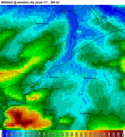
Below is the Elevation map of Wöllstein, which displays elevation range with different colors. Scale of the first map is from 111 to 264 m (364 to 866 ft) with average elevation of 153.5 meters (=504 ft) [note 1]
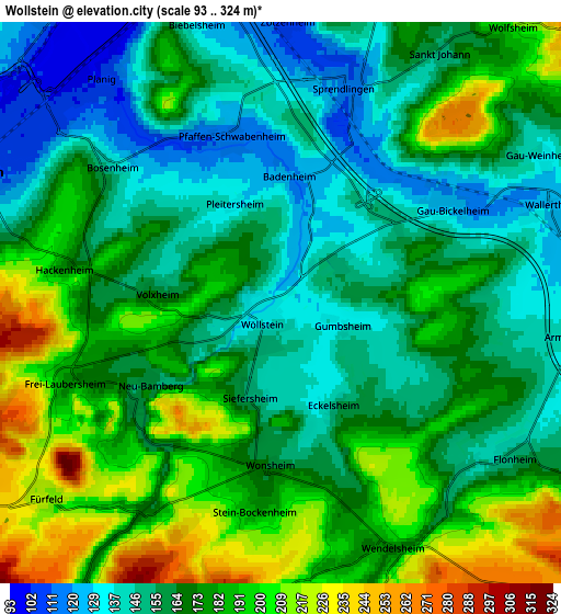
These maps also provides idea of topography and contour of this city, they are displayed at different zoom levels. More info about maps, scale and edge coordinates you can find below images.
| \ | Map #1 | Map #2 | Topo.Map |
| Scale [m] | 111..264 m | 93..324 m | × |
| Scale [ft] | 364..866 ft | 305..1063 ft | × |
| Average | 153.5 m = 504 ft | 170.3 m = 559 ft | × |
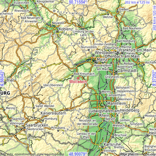
| Width | 6.31 km = 3.9 mi | 12.61 km = 7.8 mi | 201.8 km = 125.4 mi |
| Height | 6.31 km = 3.9 mi | 12.61 km = 7.8 mi | 201.8 km = 125.4 mi |
| ↑Max Latitude | 49.845017° | 49.873347° | 50.71554° |
| Latitude at center | 49.81667° | 49.81667° | 49.81667° |
| ↓Min Latitude | 49.788307° | 49.759927° | 48.90079° |
| ← Min Longitude | 7.922725° | 7.878779° | 6.56042° |
| Longitude center | 7.96667° | 7.96667° | 7.96667° |
| →Max Longitude | 8.010615° | 8.054561° | 9.37292° |
Nearby cities:
Cities around Wöllstein sort by population:
• Sprendlingen elevation 111 m
5.7 km,  12°
12°
• Armsheim 141 m
6.5 km,  96°
96°
• Flonheim 154 m
6.3 km,  123°
123°
• Gau-Bickelheim 128 m
4.4 km,  61°
61°
• Hackenheim 180 m
4.9 km,  281°
281°
• Wallertheim 128 m
6.4 km,  70°
70°
• Fürfeld 219 m
6.9 km,  230°
230°
• Wendelsheim 172 m
6.1 km,  156°
156°
• Pfaffen-Schwabenheim 114 m
3.9 km,  342°
342°
• Siefersheim 164 m
2.2 km,  212°
212°
• Volxheim 172 m
2.4 km,  270°
270°
• Frei-Laubersheim 178 m
5.1 km,  248°
248°
Multilingual:
 En español:
Wöllstein elevación 131 m.
 En France:
Wöllstein élévation 131 m.
 Auf Deutsch:
Wöllstein höhe über dem Meeresspiegel ist 131 m.

Sources and notes:
- [note 1] Map square and city borders are not equal. Map elevation data is calculated only from area inside that square.
- [src 1] Elevation data from geonames database provided with same terms of usage.
- [src 2] The elevation map of Wöllstein is generated using elevation data from NASA's 3 arcsec (90m) resolution SRTM data.
- [src 3] Base (background) map © OpenStreetMap contributors tiles are generated by Geofabrik and OpenTopoMap.
Copyright & License:
This Wöllstein Elevation Map is licensed under CC BY-SA. You may reuse any part from this page, if you give a proper credit by linking to this URL:
 More info on terms of use page.