Wolmirstedt elevation
Wolmirstedt (Saxony-Anhalt), Germany elevation is 52 meters and Wolmirstedt elevation in feet is 171 ft above sea level [src 1]. Wolmirstedt is a populated place (feature code) with elevation that is 206 meters (676 ft) smaller than average city elevation in Germany.
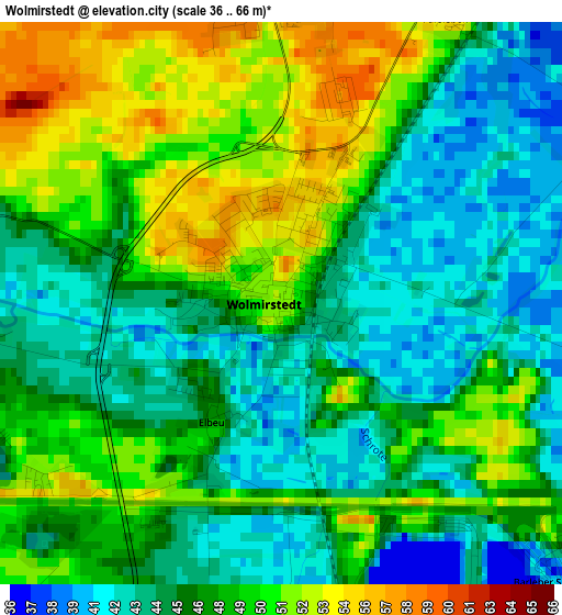
Below is the Elevation map of Wolmirstedt, which displays elevation range with different colors. Scale of the first map is from 36 to 66 m (118 to 217 ft) with average elevation of 46.9 meters (=154 ft) [note 1]
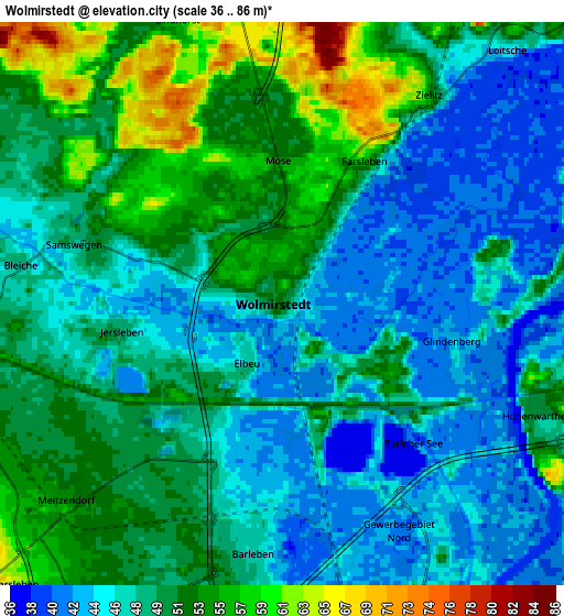
These maps also provides idea of topography and contour of this city, they are displayed at different zoom levels. More info about maps, scale and edge coordinates you can find below images.
| \ | Map #1 | Map #2 | Topo.Map |
| Scale [m] | 36..66 m | 36..86 m | × |
| Scale [ft] | 118..217 ft | 118..282 ft | × |
| Average | 46.9 m = 154 ft | 48.8 m = 160 ft | × |
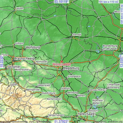
| Width | 5.98 km = 3.7 mi | 11.97 km = 7.4 mi | 191.5 km = 119 mi |
| Height | 5.98 km = 3.7 mi | 11.97 km = 7.4 mi | 191.4 km = 118.9 mi |
| ↑Max Latitude | 52.275457° | 52.302337° | 53.10119° |
| Latitude at center | 52.24856° | 52.24856° | 52.24856° |
| ↓Min Latitude | 52.221647° | 52.194717° | 51.37923° |
| ← Min Longitude | 11.585505° | 11.541559° | 10.2232° |
| Longitude center | 11.62945° | 11.62945° | 11.62945° |
| →Max Longitude | 11.673395° | 11.717341° | 13.0357° |
Nearby cities:
Cities around Wolmirstedt sort by population:
• Barleben elevation 46 m
5.2 km,  188°
188°
• Colbitz 58 m
7.8 km,  347°
347°
• Gerwisch 45 m
11 km,  136°
136°
• Zielitz 53 m
5.5 km,  34°
34°
• Ebendorf 57 m
7.9 km,  207°
207°
• Lostau 47 m
8.6 km,  120°
120°
• Samswegen 50 m
4.8 km,  286°
286°
• Hohenwarthe 53 m
6.2 km,  109°
109°
• Dahlenwarsleben 64 m
8.6 km,  226°
226°
• Groß Ammensleben 62 m
7.5 km,  256°
256°
• Glindenberg 46 m
3.9 km, 106°
• Meitzendorf 53 m
6.1 km, 229°
Multilingual:
 En español:
Wolmirstedt elevación 52 m.
 En France:
Wolmirstedt élévation 52 m.
 Auf Deutsch:
Wolmirstedt höhe über dem Meeresspiegel ist 52 m.

Sources and notes:
- [note 1] Map square and city borders are not equal. Map elevation data is calculated only from area inside that square.
- [src 1] Elevation data from geonames database provided with same terms of usage.
- [src 2] The elevation map of Wolmirstedt is generated using elevation data from NASA's 3 arcsec (90m) resolution SRTM data.
- [src 3] Base (background) map © OpenStreetMap contributors tiles are generated by Geofabrik and OpenTopoMap.
Copyright & License:
This Wolmirstedt Elevation Map is licensed under CC BY-SA. You may reuse any part from this page, if you give a proper credit by linking to this URL:
 More info on terms of use page.