Wunstorf elevation
Wunstorf (Lower Saxony), Germany elevation is 47 meters and Wunstorf elevation in feet is 154 ft above sea level [src 1]. Wunstorf is a populated place (feature code) with elevation that is 211 meters (692 ft) smaller than average city elevation in Germany.
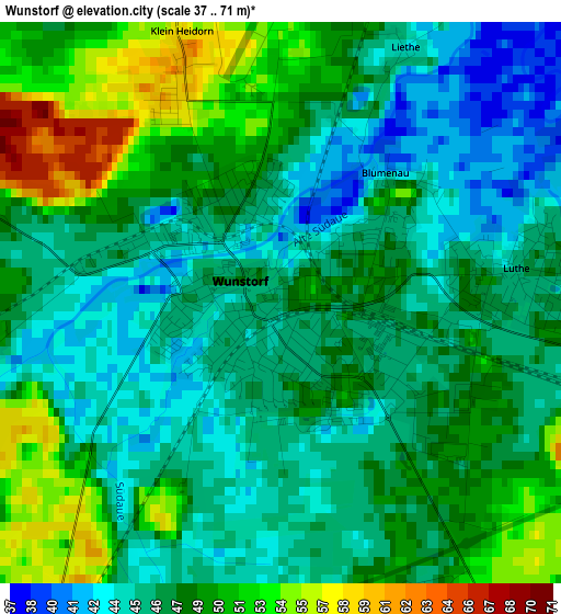
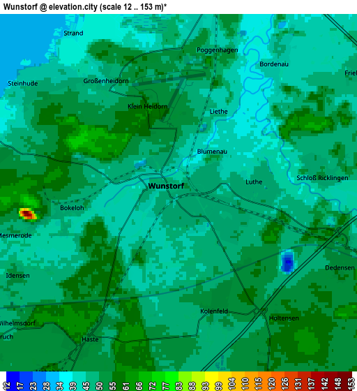
Below is the Elevation map of Wunstorf, which displays elevation range with different colors. Scale of the first map is from 37 to 71 m (121 to 233 ft) with average elevation of 47.5 meters (=156 ft) [note 1]
These maps also provides idea of topography and contour of this city, they are displayed at different zoom levels. More info about maps, scale and edge coordinates you can find below images.
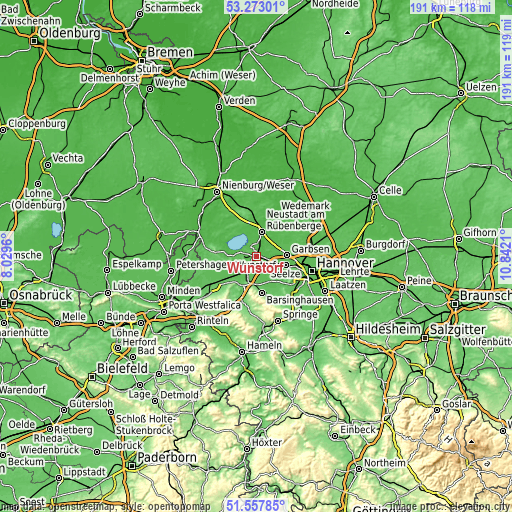
| \ | Map #1 | Map #2 | Topo.Map |
| Scale [m] | 37..71 m | 12..153 m | × |
| Scale [ft] | 121..233 ft | 39..502 ft | × |
| Average | 47.5 m = 156 ft | 48.6 m = 159 ft | × |
| Width | 5.96 km = 3.7 mi | 11.92 km = 7.4 mi | 190.7 km = 118.5 mi |
| Height | 5.96 km = 3.7 mi | 11.92 km = 7.4 mi | 190.7 km = 118.5 mi |
| ↑Max Latitude | 52.45056° | 52.477335° | 53.27301° |
| Latitude at center | 52.42377° | 52.42377° | 52.42377° |
| ↓Min Latitude | 52.396963° | 52.37014° | 51.55785° |
| ← Min Longitude | 9.391905° | 9.347959° | 8.0296° |
| Longitude center | 9.43585° | 9.43585° | 9.43585° |
| →Max Longitude | 9.479795° | 9.523741° | 10.8421° |
Nearby cities:
Cities around Wunstorf sort by population:
• Garbsen elevation 50 m
10.5 km,  96°
96°
• Neustadt am Rübenberge 42 m
9.1 km,  9°
9°
• Seelze 50 m
11.4 km,  105°
105°
• Bad Nenndorf 86 m
10.4 km,  201°
201°
• Garbsen-Mitte 52 m
11.4 km,  88°
88°
• Auf der Horst 52 m
11.3 km, 92°
• Hagenburg 42 m
7.6 km,  278°
278°
• Haste 53 m
5.6 km,  211°
211°
• Hohnhorst 62 m
7.4 km,  215°
215°
• Auhagen 52 m
10.2 km,  253°
253°
• Großgoltern 60 m
11.1 km,  156°
156°
• Groß Munzel 59 m
7.1 km, 156°
Multilingual:
 En español:
Wunstorf elevación 47 m.
 En France:
Wunstorf élévation 47 m.


Sources and notes:
- [note 1] Map square and city borders are not equal. Map elevation data is calculated only from area inside that square.
- [src 1] Elevation data from geonames database provided with same terms of usage.
- [src 2] The elevation map of Wunstorf is generated using elevation data from NASA's 3 arcsec (90m) resolution SRTM data.
- [src 3] Base (background) map © OpenStreetMap contributors tiles are generated by Geofabrik and OpenTopoMap.
Copyright & License:
This Wunstorf Elevation Map is licensed under CC BY-SA. You may reuse any part from this page, if you give a proper credit by linking to this URL:
 More info on terms of use page.