Zahna elevation
Zahna (Saxony-Anhalt), Germany elevation is 91 meters and Zahna elevation in feet is 299 ft above sea level [src 1]. Zahna is a populated place (feature code) with elevation that is 167 meters (548 ft) smaller than average city elevation in Germany.
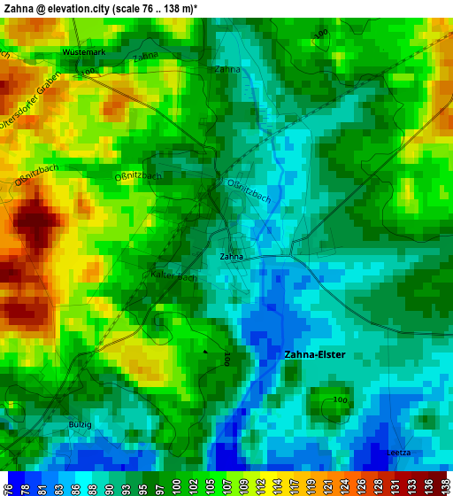
Below is the Elevation map of Zahna, which displays elevation range with different colors. Scale of the first map is from 76 to 138 m (249 to 453 ft) with average elevation of 98.9 meters (=324 ft) [note 1]
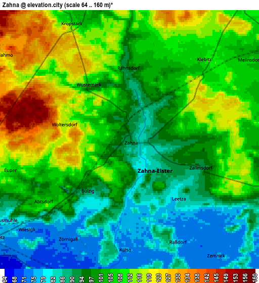
These maps also provides idea of topography and contour of this city, they are displayed at different zoom levels. More info about maps, scale and edge coordinates you can find below images.
| \ | Map #1 | Map #2 | Topo.Map |
| Scale [m] | 76..138 m | 64..160 m | × |
| Scale [ft] | 249..453 ft | 210..525 ft | × |
| Average | 98.9 m = 324 ft | 102.3 m = 336 ft | × |
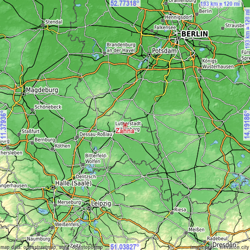
| Width | 6.03 km = 3.7 mi | 12.06 km = 7.5 mi | 192.9 km = 119.9 mi |
| Height | 6.03 km = 3.7 mi | 12.06 km = 7.5 mi | 192.9 km = 119.9 mi |
| ↑Max Latitude | 51.941199° | 51.968282° | 52.77318° |
| Latitude at center | 51.9141° | 51.9141° | 51.9141° |
| ↓Min Latitude | 51.886984° | 51.859853° | 51.03827° |
| ← Min Longitude | 12.741665° | 12.697719° | 11.37936° |
| Longitude center | 12.78561° | 12.78561° | 12.78561° |
| →Max Longitude | 12.829555° | 12.873501° | 14.19186° |
Nearby cities:
Cities around Zahna sort by population:
• Wittenberg elevation 72 m
10.7 km,  240°
240°
• Friedrichstadt 90 m
8.5 km,  249°
249°
• Piesteritz 72 m
13.8 km, 248°
• Elster 72 m
9.7 km,  164°
164°
• Pratau 70 m
12.6 km,  230°
230°
• Mühlanger 70 m
7.5 km,  198°
198°
• Abtsdorf 103 m
4.9 km, 236°
• Kropstädt 108 m
6.1 km,  333°
333°
• Dobien 92 m
12 km,  265°
265°
• Nudersdorf 109 m
13.2 km,  277°
277°
• Seyda 79 m
9.1 km,  113°
113°
• Teuchel 95 m
10 km, 253°
Multilingual:
 En español:
Zahna elevación 91 m.
 En France:
Zahna élévation 91 m.


Sources and notes:
- [note 1] Map square and city borders are not equal. Map elevation data is calculated only from area inside that square.
- [src 1] Elevation data from geonames database provided with same terms of usage.
- [src 2] The elevation map of Zahna is generated using elevation data from NASA's 3 arcsec (90m) resolution SRTM data.
- [src 3] Base (background) map © OpenStreetMap contributors tiles are generated by Geofabrik and OpenTopoMap.
Copyright & License:
This Zahna Elevation Map is licensed under CC BY-SA. You may reuse any part from this page, if you give a proper credit by linking to this URL:
 More info on terms of use page.