Zell elevation
Zell (Rheinland-Pfalz), Germany elevation is 129 meters and Zell elevation in feet is 423 ft above sea level [src 1]. Zell is a populated place (feature code) with elevation that is 129 meters (423 ft) smaller than average city elevation in Germany.
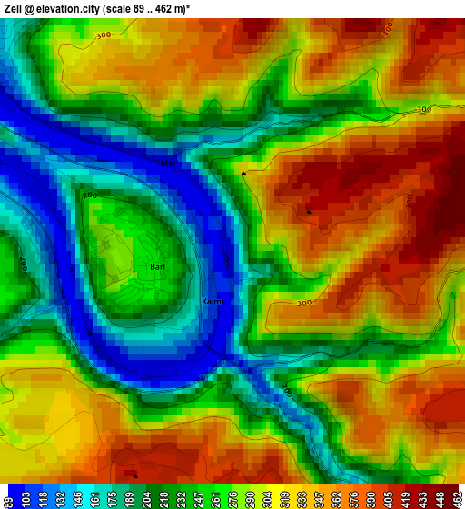
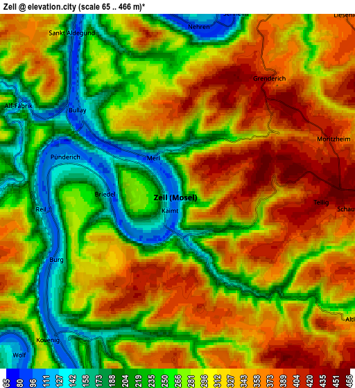
Below is the Elevation map of Zell, which displays elevation range with different colors. Scale of the first map is from 89 to 462 m (292 to 1516 ft) with average elevation of 278.2 meters (=913 ft) [note 1]
These maps also provides idea of topography and contour of this city, they are displayed at different zoom levels. More info about maps, scale and edge coordinates you can find below images.
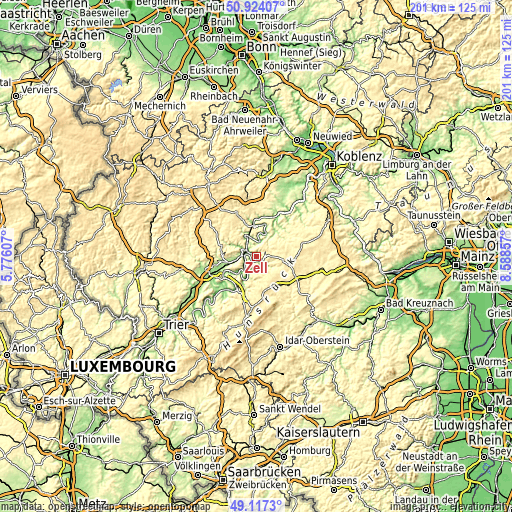
| \ | Map #1 | Map #2 | Topo.Map |
| Scale [m] | 89..462 m | 65..466 m | × |
| Scale [ft] | 292..1516 ft | 213..1529 ft | × |
| Average | 278.2 m = 913 ft | 293.5 m = 963 ft | × |
| Width | 6.28 km = 3.9 mi | 12.56 km = 7.8 mi | 200.9 km = 124.8 mi |
| Height | 6.28 km = 3.9 mi | 12.56 km = 7.8 mi | 200.9 km = 124.8 mi |
| ↑Max Latitude | 50.057402° | 50.085608° | 50.92407° |
| Latitude at center | 50.02918° | 50.02918° | 50.02918° |
| ↓Min Latitude | 50.000941° | 49.972686° | 49.1173° |
| ← Min Longitude | 7.138375° | 7.094429° | 5.77607° |
| Longitude center | 7.18232° | 7.18232° | 7.18232° |
| →Max Longitude | 7.226265° | 7.270211° | 8.58857° |
Nearby cities:
Cities around Zell sort by population:
• Traben-Trarbach elevation 111 m
9.9 km,  208°
208°
• Cochem 110 m
13 km,  354°
354°
• Kröv 177 m
8.7 km,  234°
234°
• Blankenrath 399 m
8.6 km,  82°
82°
• Enkirch 113 m
6.2 km,  216°
216°
• Bullay 134 m
4.3 km,  311°
311°
• Bruttig-Fankel 96 m
12.1 km,  17°
17°
• Mastershausen 413 m
12.7 km,  70°
70°
• Reil 134 m
4.9 km,  253°
253°
• Kinderbeuern 164 m
11.6 km,  258°
258°
• Ediger-Eller 344 m
10 km, 346°
• Briedel 256 m
2.7 km,  238°
238°
Multilingual:
 En español:
Zell elevación 129 m.
 En France:
Zell élévation 129 m.


Sources and notes:
- [note 1] Map square and city borders are not equal. Map elevation data is calculated only from area inside that square.
- [src 1] Elevation data from geonames database provided with same terms of usage.
- [src 2] The elevation map of Zell is generated using elevation data from NASA's 3 arcsec (90m) resolution SRTM data.
- [src 3] Base (background) map © OpenStreetMap contributors tiles are generated by Geofabrik and OpenTopoMap.
Copyright & License:
This Zell Elevation Map is licensed under CC BY-SA. You may reuse any part from this page, if you give a proper credit by linking to this URL:
 More info on terms of use page.