Bor elevation
Bor (Plzeňský kraj, Okres Tachov), Czech Republic elevation is 472 meters and Bor elevation in feet is 1549 ft above sea level [src 1]. Bor is a populated place (feature code) with elevation that is 127 meters (417 ft) bigger than average city elevation in Czech Republic.
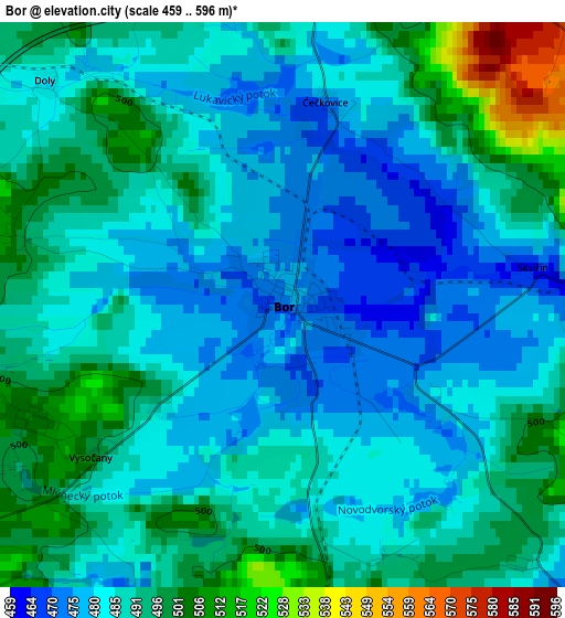
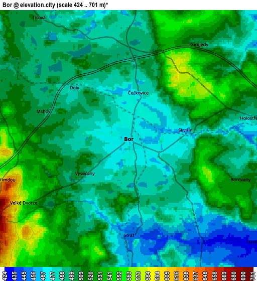
Below is the Elevation map of Bor, which displays elevation range with different colors. Scale of the first map is from 459 to 596 m (1506 to 1955 ft) with average elevation of 488 meters (=1601 ft) [note 1]
These maps also provides idea of topography and contour of this city, they are displayed at different zoom levels. More info about maps, scale and edge coordinates you can find below images.
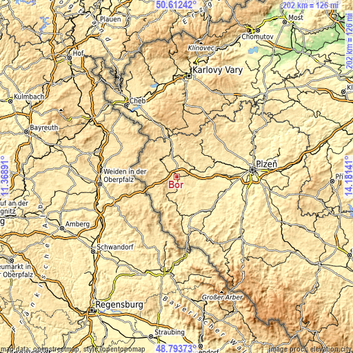
| \ | Map #1 | Map #2 | Topo.Map |
| Scale [m] | 459..596 m | 424..701 m | × |
| Scale [ft] | 1506..1955 ft | 1391..2300 ft | × |
| Average | 488 m = 1601 ft | 504 m = 1654 ft | × |
| Width | 6.32 km = 3.9 mi | 12.64 km = 7.9 mi | 202.2 km = 125.6 mi |
| Height | 6.32 km = 3.9 mi | 12.64 km = 7.9 mi | 202.2 km = 125.6 mi |
| ↑Max Latitude | 49.739998° | 49.76839° | 50.61242° |
| Latitude at center | 49.71159° | 49.71159° | 49.71159° |
| ↓Min Latitude | 49.683165° | 49.654724° | 48.79373° |
| ← Min Longitude | 12.731215° | 12.687269° | 11.36891° |
| Longitude center | 12.77516° | 12.77516° | 12.77516° |
| →Max Longitude | 12.819105° | 12.863051° | 14.18141° |
Nearby cities:
Cities around Bor sort by population:
• Tachov elevation 483 m
13.8 km,  312°
312°
• Stříbro 402 m
16.7 km,  72°
72°
• Planá 514 m
17.6 km,  352°
352°
• Bělá nad Radbuzou 441 m
14 km,  197°
197°
• Heřmanova Huť 367 m
23.4 km,  91°
91°
• Chodová Planá 525 m
20.5 km, 350°
• Poběžovice 430 m
22.5 km,  174°
174°
• Kladruby 411 m
14.9 km, 88°
• Přimda 696 m
8.4 km,  240°
240°
• Hostouň 448 m
16.9 km,  180°
180°
• Černošín 498 m
14 km,  33°
33°
• Stráž 453 m
4.8 km, 179°
Multilingual:
 En español:
Bor elevación 472 m.
 En France:
Bor élévation 472 m.
 Auf Deutsch:
Bor u Tachova höhe über dem Meeresspiegel ist 472 m.

Sources and notes:
- [note 1] Map square and city borders are not equal. Map elevation data is calculated only from area inside that square.
- [src 1] Elevation data from geonames database provided with same terms of usage.
- [src 2] The elevation map of Bor is generated using elevation data from NASA's 3 arcsec (90m) resolution SRTM data.
- [src 3] Base (background) map © OpenStreetMap contributors tiles are generated by Geofabrik and OpenTopoMap.
Copyright & License:
This Bor Elevation Map is licensed under CC BY-SA. You may reuse any part from this page, if you give a proper credit by linking to this URL:
 More info on terms of use page.