Božice elevation
Božice (South Moravian, Okres Znojmo), Czech Republic elevation is 190 meters and Božice elevation in feet is 623 ft above sea level [src 1]. Božice is a populated place (feature code) with elevation that is 155 meters (509 ft) smaller than average city elevation in Czech Republic.
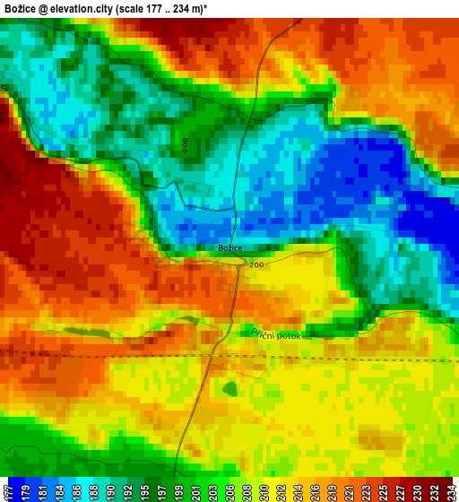
Below is the Elevation map of Božice, which displays elevation range with different colors. Scale of the first map is from 177 to 234 m (581 to 768 ft) with average elevation of 206.9 meters (=679 ft) [note 1]
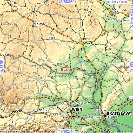
These maps also provides idea of topography and contour of this city, they are displayed at different zoom levels. More info about maps, scale and edge coordinates you can find below images.
| \ | Map #1 | Topo.Map |
| Scale [m] | 177..234 m | × |
| Scale [ft] | 581..768 ft | × |
| Average | 206.9 m = 679 ft | × |
| Width | 6.43 km = 4 mi | 205.8 km = 127.9 mi |
| Height | 6.43 km = 4 mi | 205.8 km = 127.9 mi |
| ↑Max Latitude | 48.865787° | 49.75393° |
| Latitude at center | 48.83687° | 48.83687° |
| ↓Min Latitude | 48.807937° | 47.90271° |
| ← Min Longitude | 16.244805° | 14.8825° |
| Longitude center | 16.28875° | 16.28875° |
| →Max Longitude | 16.332695° | 17.695° |
Nearby cities:
Cities around Božice sort by population:
• Hrušovany nad Jevišovkou elevation 179 m
8.4 km,  95°
95°
• Miroslav 253 m
12.4 km,  8°
8°
• Drnholec 184 m
14.6 km,  80°
80°
• Hodonice 217 m
9.2 km,  269°
269°
• Hostěradice 215 m
12.8 km,  350°
350°
• Hevlín 178 m
11.6 km,  144°
144°
• Šanov 197 m
7.7 km,  121°
121°
• Jaroslavice 191 m
9.8 km,  204°
204°
• Tasovice 210 m
9.7 km, 269°
• Novosedly 176 m
14.9 km,  89°
89°
• Vrbovec 214 m
14.4 km,  253°
253°
• Suchohrdly 308 m
14.6 km,  283°
283°
Multilingual:
 En español:
Božice elevación 190 m.
 En France:
Božice élévation 190 m.


Sources and notes:
- [note 1] Map square and city borders are not equal. Map elevation data is calculated only from area inside that square.
- [src 1] Elevation data from geonames database provided with same terms of usage.
- [src 2] The elevation map of Božice is generated using elevation data from NASA's 3 arcsec (90m) resolution SRTM data.
- [src 3] Base (background) map © OpenStreetMap contributors tiles are generated by Geofabrik and OpenTopoMap.
Copyright & License:
This Božice Elevation Map is licensed under CC BY-SA. You may reuse any part from this page, if you give a proper credit by linking to this URL:
 More info on terms of use page.