Hostěradice elevation
Hostěradice (South Moravian, Okres Znojmo), Czech Republic elevation is 215 meters and Hostěradice elevation in feet is 705 ft above sea level [src 1]. Hostěradice is a populated place (feature code) with elevation that is 130 meters (427 ft) smaller than average city elevation in Czech Republic.
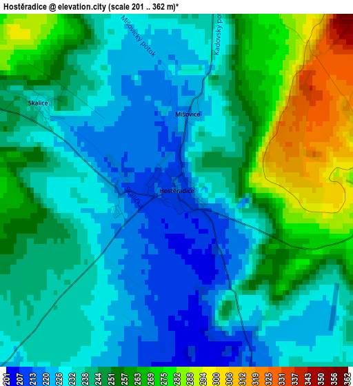
Below is the Elevation map of Hostěradice, which displays elevation range with different colors. Scale of the first map is from 201 to 362 m (659 to 1188 ft) with average elevation of 244 meters (=801 ft) [note 1]
These maps also provides idea of topography and contour of this city, they are displayed at different zoom levels. More info about maps, scale and edge coordinates you can find below images.
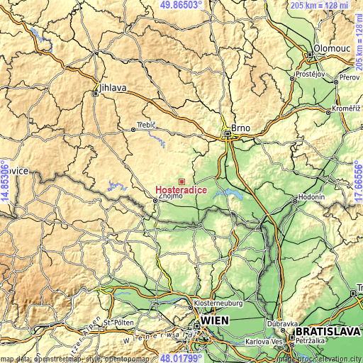
| \ | Map #1 | Topo.Map |
| Scale [m] | 201..362 m | × |
| Scale [ft] | 659..1188 ft | × |
| Average | 244 m = 801 ft | × |
| Width | 6.42 km = 4 mi | 205.4 km = 127.6 mi |
| Height | 6.42 km = 4 mi | 205.4 km = 127.6 mi |
| ↑Max Latitude | 48.978911° | 49.86503° |
| Latitude at center | 48.95006° | 48.95006° |
| ↓Min Latitude | 48.921192° | 48.01799° |
| ← Min Longitude | 16.215365° | 14.85306° |
| Longitude center | 16.25931° | 16.25931° |
| →Max Longitude | 16.303255° | 17.66556° |
Nearby cities:
Cities around Hostěradice sort by population:
• Moravský Krumlov elevation 258 m
11.6 km,  19°
19°
• Hrušovany nad Jevišovkou 179 m
17 km,  141°
141°
• Miroslav 253 m
3.9 km,  93°
93°
• Dobšice 212 m
17.2 km,  228°
228°
• Hodonice 217 m
14.4 km,  209°
209°
• Božice 190 m
12.8 km,  170°
170°
• Tasovice 210 m
14.8 km, 210°
• Višňové 338 m
8.7 km,  294°
294°
• Rouchovany 352 m
17.4 km,  320°
320°
• Únanov 290 m
15.3 km,  249°
249°
• Olbramovice 197 m
11.1 km,  69°
69°
• Suchohrdly 308 m
15.1 km, 232°
Multilingual:
 En español:
Hostěradice elevación 215 m.
 En France:
Hostěradice élévation 215 m.
 Auf Deutsch:
Hostěradice höhe über dem Meeresspiegel ist 215 m.

Sources and notes:
- [note 1] Map square and city borders are not equal. Map elevation data is calculated only from area inside that square.
- [src 1] Elevation data from geonames database provided with same terms of usage.
- [src 2] The elevation map of Hostěradice is generated using elevation data from NASA's 3 arcsec (90m) resolution SRTM data.
- [src 3] Base (background) map © OpenStreetMap contributors tiles are generated by Geofabrik and OpenTopoMap.
Copyright & License:
This Hostěradice Elevation Map is licensed under CC BY-SA. You may reuse any part from this page, if you give a proper credit by linking to this URL:
 More info on terms of use page.