Čáslav elevation
Čáslav (Central Bohemia, Okres Kutná Hora), Czech Republic elevation is 264 meters and Čáslav elevation in feet is 866 ft above sea level [src 1]. Čáslav is a populated place (feature code) with elevation that is 81 meters (266 ft) smaller than average city elevation in Czech Republic.
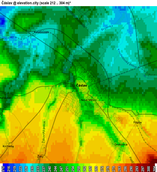
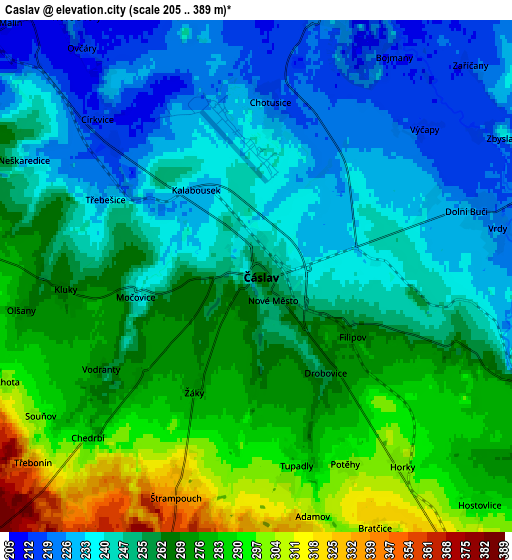
Below is the Elevation map of Čáslav, which displays elevation range with different colors. Scale of the first map is from 212 to 304 m (696 to 997 ft) with average elevation of 251 meters (=823 ft) [note 1]
These maps also provides idea of topography and contour of this city, they are displayed at different zoom levels. More info about maps, scale and edge coordinates you can find below images.
| \ | Map #1 | Map #2 | Topo.Map |
| Scale [m] | 212..304 m | 205..389 m | × |
| Scale [ft] | 696..997 ft | 673..1276 ft | × |
| Average | 251 m = 823 ft | 258 m = 846 ft | × |
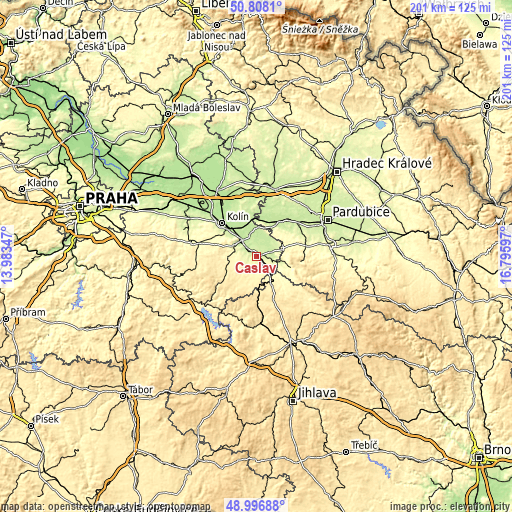
| Width | 6.29 km = 3.9 mi | 12.59 km = 7.8 mi | 201.4 km = 125.1 mi |
| Height | 6.29 km = 3.9 mi | 12.59 km = 7.8 mi | 201.4 km = 125.1 mi |
| ↑Max Latitude | 49.939281° | 49.967556° | 50.8081° |
| Latitude at center | 49.91099° | 49.91099° | 49.91099° |
| ↓Min Latitude | 49.882682° | 49.854357° | 48.99688° |
| ← Min Longitude | 15.345775° | 15.301829° | 13.98347° |
| Longitude center | 15.38972° | 15.38972° | 15.38972° |
| →Max Longitude | 15.433665° | 15.477611° | 16.79597° |
Nearby cities:
Cities around Čáslav sort by population:
• Kutná Hora elevation 255 m
9.6 km,  295°
295°
• Třemošnice 305 m
14.4 km,  108°
108°
• Chvaletice 222 m
13.9 km,  8°
8°
• Vrdy 226 m
6 km,  78°
78°
• Golčův Jeníkov 379 m
12.2 km,  149°
149°
• Týnec nad Labem 240 m
14.7 km,  351°
351°
• Ronov nad Doubravou 259 m
10.5 km,  103°
103°
• Starý Kolín 201 m
12.9 km,  328°
328°
• Žleby 257 m
7.5 km, 108°
• Církvice 214 m
5.5 km,  314°
314°
• Sedlec 232 m
9.3 km, 309°
• Vilémov 356 m
14.9 km,  135°
135°
Multilingual:
 En español:
Čáslav elevación 264 m.
 En France:
Čáslav élévation 264 m.
 Auf Deutsch:
Tschaslau höhe über dem Meeresspiegel ist 264 m.

Sources and notes:
- [note 1] Map square and city borders are not equal. Map elevation data is calculated only from area inside that square.
- [src 1] Elevation data from geonames database provided with same terms of usage.
- [src 2] The elevation map of Čáslav is generated using elevation data from NASA's 3 arcsec (90m) resolution SRTM data.
- [src 3] Base (background) map © OpenStreetMap contributors tiles are generated by Geofabrik and OpenTopoMap.
Copyright & License:
This Čáslav Elevation Map is licensed under CC BY-SA. You may reuse any part from this page, if you give a proper credit by linking to this URL:
 More info on terms of use page.