Vilémov elevation
Vilémov (Vysočina, Okres Havlíčkův Brod), Czech Republic elevation is 356 meters and Vilémov elevation in feet is 1168 ft above sea level [src 1]. Vilémov is a populated place (feature code) with elevation that is 11 meters (36 ft) bigger than average city elevation in Czech Republic.
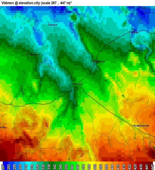
Below is the Elevation map of Vilémov, which displays elevation range with different colors. Scale of the first map is from 287 to 447 m (942 to 1467 ft) with average elevation of 360.1 meters (=1181 ft) [note 1]
These maps also provides idea of topography and contour of this city, they are displayed at different zoom levels. More info about maps, scale and edge coordinates you can find below images.
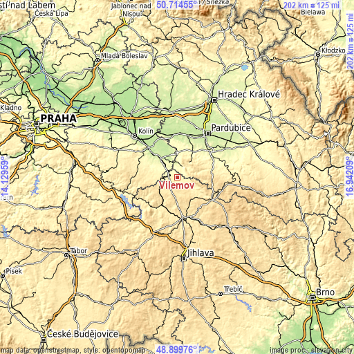
| \ | Map #1 | Topo.Map |
| Scale [m] | 287..447 m | × |
| Scale [ft] | 942..1467 ft | × |
| Average | 360.1 m = 1181 ft | × |
| Width | 6.31 km = 3.9 mi | 201.8 km = 125.4 mi |
| Height | 6.31 km = 3.9 mi | 201.8 km = 125.4 mi |
| ↑Max Latitude | 49.844007° | 50.71455° |
| Latitude at center | 49.81566° | 49.81566° |
| ↓Min Latitude | 49.787296° | 48.89976° |
| ← Min Longitude | 15.491895° | 14.12959° |
| Longitude center | 15.53584° | 15.53584° |
| →Max Longitude | 15.579785° | 16.94209° |
Nearby cities:
Cities around Vilémov sort by population:
• Čáslav elevation 264 m
14.9 km,  315°
315°
• Chotěboř 525 m
14.3 km,  137°
137°
• Světlá nad Sázavou 403 m
19 km,  209°
209°
• Heřmanův Městec 281 m
17.3 km,  32°
32°
• Třemošnice 305 m
6.7 km, 28°
• Vrdy 226 m
12.6 km,  338°
338°
• Golčův Jeníkov 379 m
4.2 km,  270°
270°
• Seč 535 m
9.3 km,  68°
68°
• Ronov nad Doubravou 259 m
8.1 km,  357°
357°
• Prachovice 456 m
10.9 km,  37°
37°
• Habry 471 m
7.6 km, 208°
• Žleby 257 m
8.9 km, 337°
Multilingual:
 En español:
Vilémov elevación 356 m.
 En France:
Vilémov élévation 356 m.


Sources and notes:
- [note 1] Map square and city borders are not equal. Map elevation data is calculated only from area inside that square.
- [src 1] Elevation data from geonames database provided with same terms of usage.
- [src 2] The elevation map of Vilémov is generated using elevation data from NASA's 3 arcsec (90m) resolution SRTM data.
- [src 3] Base (background) map © OpenStreetMap contributors tiles are generated by Geofabrik and OpenTopoMap.
Copyright & License:
This Vilémov Elevation Map is licensed under CC BY-SA. You may reuse any part from this page, if you give a proper credit by linking to this URL:
 More info on terms of use page.