Chlumec elevation
Chlumec (Ústecký kraj, Okres Ústí nad Labem), Czech Republic elevation is 243 meters and Chlumec elevation in feet is 797 ft above sea level [src 1]. Chlumec is a populated place (feature code) with elevation that is 102 meters (335 ft) smaller than average city elevation in Czech Republic.
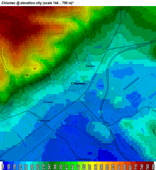
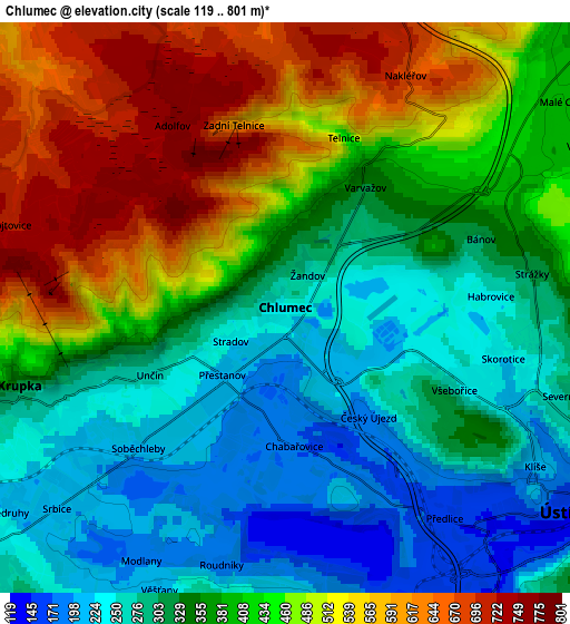
Below is the Elevation map of Chlumec, which displays elevation range with different colors. Scale of the first map is from 144 to 790 m (472 to 2592 ft) with average elevation of 331 meters (=1086 ft) [note 1]
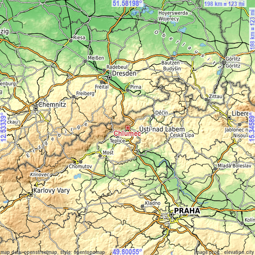
These maps also provides idea of topography and contour of this city, they are displayed at different zoom levels. More info about maps, scale and edge coordinates you can find below images.
| \ | Map #1 | Map #2 | Topo.Map |
| Scale [m] | 144..790 m | 119..801 m | × |
| Scale [ft] | 472..2592 ft | 390..2628 ft | × |
| Average | 331 m = 1086 ft | 389.7 m = 1279 ft | × |
| Width | 6.19 km = 3.8 mi | 12.38 km = 7.7 mi | 198.1 km = 123.1 mi |
| Height | 6.19 km = 3.8 mi | 12.38 km = 7.7 mi | 198.1 km = 123.1 mi |
| ↑Max Latitude | 50.727546° | 50.755356° | 51.58198° |
| Latitude at center | 50.69972° | 50.69972° | 50.69972° |
| ↓Min Latitude | 50.671877° | 50.644018° | 49.80055° |
| ← Min Longitude | 13.895695° | 13.851749° | 12.53339° |
| Longitude center | 13.93964° | 13.93964° | 13.93964° |
| →Max Longitude | 13.983585° | 14.027531° | 15.34589° |
Nearby cities:
Cities around Chlumec sort by population:
• Ústí nad Labem elevation 150 m
7.8 km,  123°
123°
• Teplice 229 m
10.5 km,  230°
230°
• Krupka 325 m
6 km,  253°
253°
• Dubí 407 m
11 km,  261°
261°
• Jílové 265 m
13.4 km,  59°
59°
• Trmice 150 m
7.4 km,  148°
148°
• Proboštov 243 m
8.1 km,  244°
244°
• Chabařovice 175 m
3 km,  176°
176°
• Novosedlice 261 m
9.5 km, 239°
• Bystřany 193 m
9.5 km,  213°
213°
• Libouchec 338 m
9.7 km,  47°
47°
• Řehlovice 167 m
10.3 km,  174°
174°
Multilingual:
 En español:
Chlumec elevación 243 m.
 En France:
Chlumec élévation 243 m.


Sources and notes:
- [note 1] Map square and city borders are not equal. Map elevation data is calculated only from area inside that square.
- [src 1] Elevation data from geonames database provided with same terms of usage.
- [src 2] The elevation map of Chlumec is generated using elevation data from NASA's 3 arcsec (90m) resolution SRTM data.
- [src 3] Base (background) map © OpenStreetMap contributors tiles are generated by Geofabrik and OpenTopoMap.
Copyright & License:
This Chlumec Elevation Map is licensed under CC BY-SA. You may reuse any part from this page, if you give a proper credit by linking to this URL:
 More info on terms of use page.