Teplice elevation
Teplice (Ústecký kraj, Okres Teplice), Czech Republic elevation is 229 meters and Teplice elevation in feet is 751 ft above sea level [src 1]. Teplice is a populated place (feature code) with elevation that is 116 meters (381 ft) smaller than average city elevation in Czech Republic.
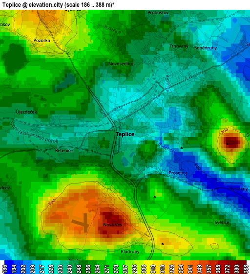
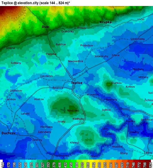
Below is the Elevation map of Teplice, which displays elevation range with different colors. Scale of the first map is from 186 to 388 m (610 to 1273 ft) with average elevation of 260 meters (=853 ft) [note 1]
These maps also provides idea of topography and contour of this city, they are displayed at different zoom levels. More info about maps, scale and edge coordinates you can find below images.
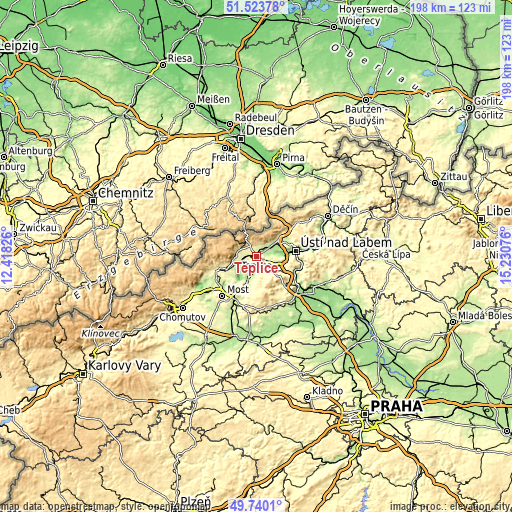
| \ | Map #1 | Map #2 | Topo.Map |
| Scale [m] | 186..388 m | 144..824 m | × |
| Scale [ft] | 610..1273 ft | 472..2703 ft | × |
| Average | 260 m = 853 ft | 278 m = 912 ft | × |
| Width | 6.2 km = 3.9 mi | 12.4 km = 7.7 mi | 198.3 km = 123.2 mi |
| Height | 6.2 km = 3.9 mi | 12.4 km = 7.7 mi | 198.3 km = 123.2 mi |
| ↑Max Latitude | 50.668261° | 50.696106° | 51.52378° |
| Latitude at center | 50.6404° | 50.6404° | 50.6404° |
| ↓Min Latitude | 50.612522° | 50.584628° | 49.7401° |
| ← Min Longitude | 13.780565° | 13.736619° | 12.41826° |
| Longitude center | 13.82451° | 13.82451° | 13.82451° |
| →Max Longitude | 13.868455° | 13.912401° | 15.23076° |
Nearby cities:
Cities around Teplice sort by population:
• Krupka elevation 325 m
5.4 km,  25°
25°
• Duchcov 217 m
6.9 km,  233°
233°
• Dubí 407 m
5.7 km,  331°
331°
• Osek 315 m
9.5 km,  257°
257°
• Košťany 277 m
5.1 km,  288°
288°
• Proboštov 243 m
3.1 km,  14°
14°
• Chabařovice 175 m
9 km,  66°
66°
• Novosedlice 261 m
1.8 km,  356°
356°
• Hrob 362 m
7.2 km, 286°
• Bystřany 193 m
3.1 km,  114°
114°
• Hostomice 192 m
6 km,  191°
191°
• Zabrušany 211 m
4.7 km,  213°
213°
Multilingual:
 En español:
Teplice elevación 229 m.
 En France:
Teplice élévation 229 m.


Sources and notes:
- [note 1] Map square and city borders are not equal. Map elevation data is calculated only from area inside that square.
- [src 1] Elevation data from geonames database provided with same terms of usage.
- [src 2] The elevation map of Teplice is generated using elevation data from NASA's 3 arcsec (90m) resolution SRTM data.
- [src 3] Base (background) map © OpenStreetMap contributors tiles are generated by Geofabrik and OpenTopoMap.
Copyright & License:
This Teplice Elevation Map is licensed under CC BY-SA. You may reuse any part from this page, if you give a proper credit by linking to this URL:
 More info on terms of use page.