Dubá elevation
Dubá (Liberecký kraj, Okres Česká Lípa), Czech Republic elevation is 270 meters and Dubá elevation in feet is 886 ft above sea level [src 1]. Dubá is a populated place (feature code) with elevation that is 75 meters (246 ft) smaller than average city elevation in Czech Republic.
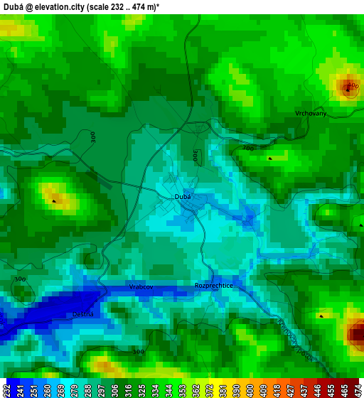
Below is the Elevation map of Dubá, which displays elevation range with different colors. Scale of the first map is from 232 to 474 m (761 to 1555 ft) with average elevation of 310.2 meters (=1018 ft) [note 1]
These maps also provides idea of topography and contour of this city, they are displayed at different zoom levels. More info about maps, scale and edge coordinates you can find below images.
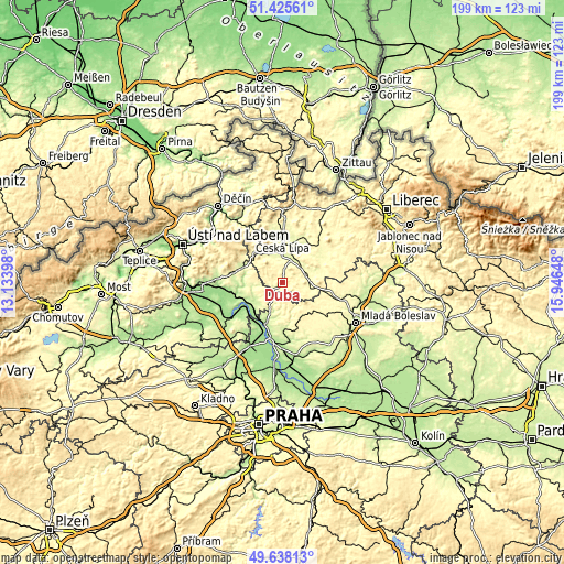
| \ | Map #1 | Topo.Map |
| Scale [m] | 232..474 m | × |
| Scale [ft] | 761..1555 ft | × |
| Average | 310.2 m = 1018 ft | × |
| Width | 6.21 km = 3.9 mi | 198.7 km = 123.5 mi |
| Height | 6.21 km = 3.9 mi | 198.7 km = 123.5 mi |
| ↑Max Latitude | 50.568261° | 51.42561° |
| Latitude at center | 50.54034° | 50.54034° |
| ↓Min Latitude | 50.512403° | 49.63813° |
| ← Min Longitude | 14.496285° | 13.13398° |
| Longitude center | 14.54023° | 14.54023° |
| →Max Longitude | 14.584175° | 15.94648° |
Nearby cities:
Cities around Dubá sort by population:
• Česká Lípa elevation 263 m
16.1 km,  359°
359°
• Štětí 160 m
15.2 km,  230°
230°
• Mimoň 281 m
18.5 km,  44°
44°
• Doksy 279 m
8.6 km,  71°
71°
• Bělá pod Bezdězem 297 m
19.2 km,  103°
103°
• Zákupy 272 m
17.7 km,  24°
24°
• Úštěk 247 m
14.8 km,  289°
289°
• Hošťka 181 m
15.6 km,  248°
248°
• Mšeno 359 m
13.1 km,  150°
150°
• Liběšice 253 m
18 km,  280°
280°
• Dolní Beřkovice 163 m
17.6 km,  201°
201°
• Horní Počaply 163 m
16.7 km,  219°
219°
Multilingual:
 En español:
Dubá elevación 270 m.
 En France:
Dubá élévation 270 m.


Sources and notes:
- [note 1] Map square and city borders are not equal. Map elevation data is calculated only from area inside that square.
- [src 1] Elevation data from geonames database provided with same terms of usage.
- [src 2] The elevation map of Dubá is generated using elevation data from NASA's 3 arcsec (90m) resolution SRTM data.
- [src 3] Base (background) map © OpenStreetMap contributors tiles are generated by Geofabrik and OpenTopoMap.
Copyright & License:
This Dubá Elevation Map is licensed under CC BY-SA. You may reuse any part from this page, if you give a proper credit by linking to this URL:
 More info on terms of use page.