Halenkov elevation
Halenkov (Zlín, Okres Vsetín), Czech Republic elevation is 425 meters and Halenkov elevation in feet is 1394 ft above sea level [src 1]. Halenkov is a populated place (feature code) with elevation that is 80 meters (262 ft) bigger than average city elevation in Czech Republic.
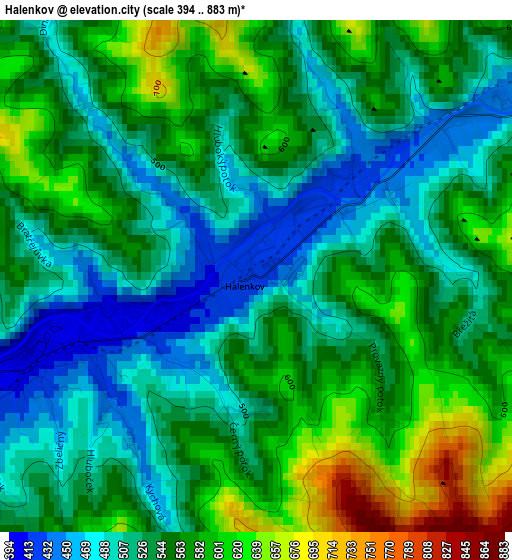
Below is the Elevation map of Halenkov, which displays elevation range with different colors. Scale of the first map is from 394 to 883 m (1293 to 2897 ft) with average elevation of 545.6 meters (=1790 ft) [note 1]
These maps also provides idea of topography and contour of this city, they are displayed at different zoom levels. More info about maps, scale and edge coordinates you can find below images.
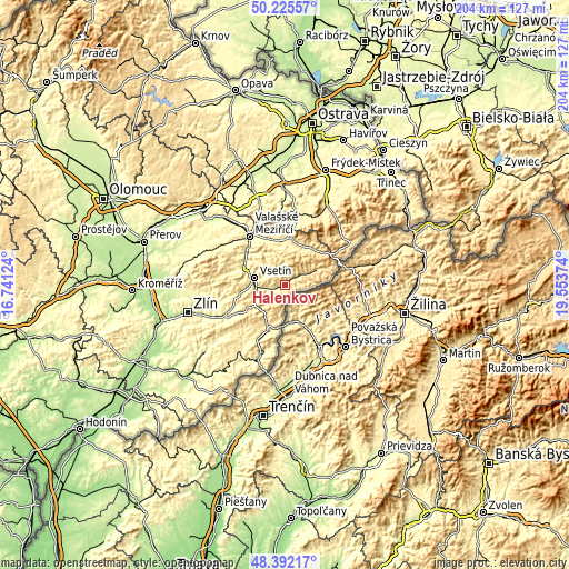
| \ | Map #1 | Topo.Map |
| Scale [m] | 394..883 m | × |
| Scale [ft] | 1293..2897 ft | × |
| Average | 545.6 m = 1790 ft | × |
| Width | 6.37 km = 4 mi | 203.9 km = 126.7 mi |
| Height | 6.37 km = 4 mi | 203.8 km = 126.6 mi |
| ↑Max Latitude | 49.346038° | 50.22557° |
| Latitude at center | 49.3174° | 49.3174° |
| ↓Min Latitude | 49.288745° | 48.39217° |
| ← Min Longitude | 18.103545° | 16.74124° |
| Longitude center | 18.14749° | 18.14749° |
| →Max Longitude | 18.191435° | 19.55374° |
Nearby cities:
Cities around Halenkov sort by population:
• Vsetín elevation 346 m
11.2 km,  282°
282°
• Karolinka 479 m
7.7 km,  60°
60°
• Nový Hrozenkov 449 m
4.3 km, 59°
• Velké Karlovice 510 m
11 km, 63°
• Hovězí 384 m
6.5 km,  256°
256°
• Valašská Bystřice 463 m
11.2 km,  345°
345°
• Lidečko 445 m
14.5 km,  208°
208°
• Dolní Bečva 433 m
15.7 km,  12°
12°
• Prostřední Bečva 465 m
15.2 km,  29°
29°
• Francova Lhota 498 m
13.1 km,  191°
191°
• Vidče 380 m
14.3 km,  344°
344°
• Valašská Polanka 388 m
12.5 km,  240°
240°
Multilingual:
 En español:
Halenkov elevación 425 m.
 En France:
Halenkov élévation 425 m.
 Auf Deutsch:
Halenkov höhe über dem Meeresspiegel ist 425 m.

Sources and notes:
- [note 1] Map square and city borders are not equal. Map elevation data is calculated only from area inside that square.
- [src 1] Elevation data from geonames database provided with same terms of usage.
- [src 2] The elevation map of Halenkov is generated using elevation data from NASA's 3 arcsec (90m) resolution SRTM data.
- [src 3] Base (background) map © OpenStreetMap contributors tiles are generated by Geofabrik and OpenTopoMap.
Copyright & License:
This Halenkov Elevation Map is licensed under CC BY-SA. You may reuse any part from this page, if you give a proper credit by linking to this URL:
 More info on terms of use page.