Hodonín elevation
Hodonín (South Moravian, Okres Hodonín), Czech Republic elevation is 163 meters and Hodonín elevation in feet is 535 ft above sea level [src 1]. Hodonín is a populated place (feature code) with elevation that is 182 meters (597 ft) smaller than average city elevation in Czech Republic.
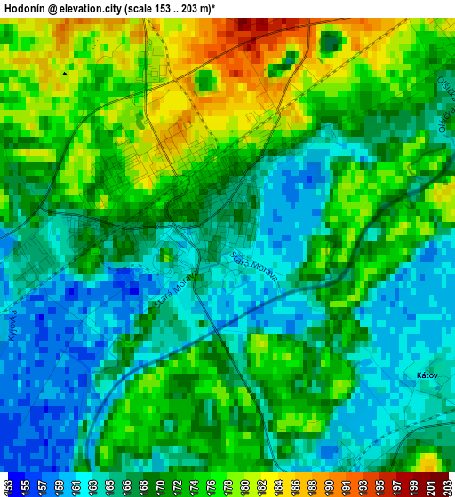
Below is the Elevation map of Hodonín, which displays elevation range with different colors. Scale of the first map is from 153 to 203 m (502 to 666 ft) with average elevation of 170.3 meters (=559 ft) [note 1]
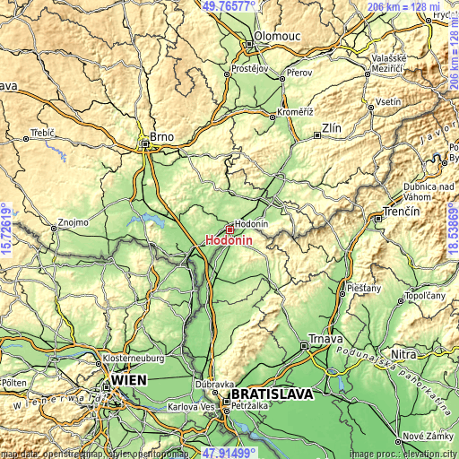
These maps also provides idea of topography and contour of this city, they are displayed at different zoom levels. More info about maps, scale and edge coordinates you can find below images.
| \ | Map #1 | Map #2 | Topo.Map |
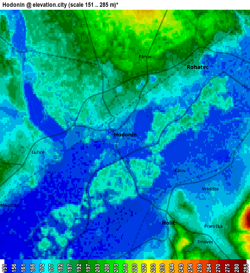
| Scale [m] | 153..203 m | 151..285 m | × |
| Scale [ft] | 502..666 ft | 495..935 ft | × |
| Average | 170.3 m = 559 ft | 176 m = 577 ft | × |
| Width | 6.43 km = 4 mi | 12.86 km = 8 mi | 205.8 km = 127.9 mi |
| Height | 6.43 km = 4 mi | 12.86 km = 8 mi | 205.8 km = 127.9 mi |
| ↑Max Latitude | 48.87784° | 48.906733° | 49.76577° |
| Latitude at center | 48.84893° | 48.84893° | 48.84893° |
| ↓Min Latitude | 48.820004° | 48.79106° | 47.91499° |
| ← Min Longitude | 17.088495° | 17.044549° | 15.72619° |
| Longitude center | 17.13244° | 17.13244° | 17.13244° |
| →Max Longitude | 17.176385° | 17.220331° | 18.53869° |
Nearby cities:
Cities around Hodonín sort by population:
• Dubňany elevation 191 m
8.2 km,  337°
337°
• Ratíškovice 202 m
8.3 km,  17°
17°
• Mutěnice 182 m
9.7 km,  309°
309°
• Rohatec 179 m
5.1 km,  46°
46°
• Dolní Bojanovice 174 m
7.7 km,  278°
278°
• Lužice 174 m
4.6 km,  258°
258°
• Moravská Nová Ves 190 m
10.1 km,  239°
239°
• Vacenovice 202 m
11.1 km, 15°
• Prušánky 183 m
11.3 km, 258°
• Mikulčice 163 m
7 km, 238°
• Petrov 169 m
11.3 km,  70°
70°
• Sudoměřice 182 m
9.3 km,  77°
77°
Multilingual:
 En español:
Hodonín elevación 163 m.
 En France:
Hodonín élévation 163 m.


Sources and notes:
- [note 1] Map square and city borders are not equal. Map elevation data is calculated only from area inside that square.
- [src 1] Elevation data from geonames database provided with same terms of usage.
- [src 2] The elevation map of Hodonín is generated using elevation data from NASA's 3 arcsec (90m) resolution SRTM data.
- [src 3] Base (background) map © OpenStreetMap contributors tiles are generated by Geofabrik and OpenTopoMap.
Copyright & License:
This Hodonín Elevation Map is licensed under CC BY-SA. You may reuse any part from this page, if you give a proper credit by linking to this URL:
 More info on terms of use page.