Holýšov elevation
Holýšov (Plzeňský kraj, Okres Domažlice), Czech Republic elevation is 367 meters and Holýšov elevation in feet is 1204 ft above sea level [src 1]. Holýšov is a populated place (feature code) with elevation that is 22 meters (72 ft) bigger than average city elevation in Czech Republic.
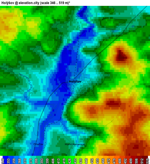
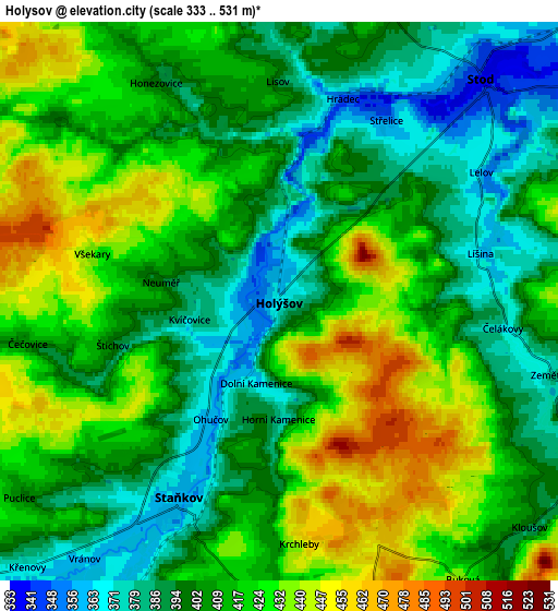
Below is the Elevation map of Holýšov, which displays elevation range with different colors. Scale of the first map is from 346 to 519 m (1135 to 1703 ft) with average elevation of 411.3 meters (=1349 ft) [note 1]
These maps also provides idea of topography and contour of this city, they are displayed at different zoom levels. More info about maps, scale and edge coordinates you can find below images.
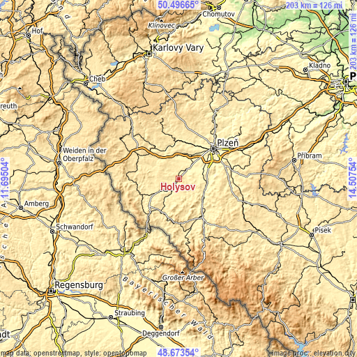
| \ | Map #1 | Map #2 | Topo.Map |
| Scale [m] | 346..519 m | 333..531 m | × |
| Scale [ft] | 1135..1703 ft | 1093..1742 ft | × |
| Average | 411.3 m = 1349 ft | 410.5 m = 1347 ft | × |
| Width | 6.33 km = 3.9 mi | 12.67 km = 7.9 mi | 202.7 km = 126 mi |
| Height | 6.33 km = 3.9 mi | 12.67 km = 7.9 mi | 202.7 km = 126 mi |
| ↑Max Latitude | 49.622087° | 49.650548° | 50.49665° |
| Latitude at center | 49.59361° | 49.59361° | 49.59361° |
| ↓Min Latitude | 49.565116° | 49.536606° | 48.67354° |
| ← Min Longitude | 13.057345° | 13.013399° | 11.69504° |
| Longitude center | 13.10129° | 13.10129° | 13.10129° |
| →Max Longitude | 13.145235° | 13.189181° | 14.50754° |
Nearby cities:
Cities around Holýšov sort by population:
• Nýřany elevation 335 m
15.3 km,  31°
31°
• Dobřany 327 m
15.4 km,  63°
63°
• Horšovský Týn 383 m
13.4 km,  237°
237°
• Stod 340 m
6.8 km,  42°
42°
• Staňkov 359 m
5 km,  206°
206°
• Chotěšov 332 m
9.9 km,  47°
47°
• Chlumčany 392 m
15.9 km,  74°
74°
• Líně 337 m
15.9 km, 44°
• Zbůch 358 m
13 km, 43°
• Heřmanova Huť 367 m
12.6 km,  359°
359°
• Merklín 381 m
7.9 km,  117°
117°
• Blížejov 384 m
13.2 km,  217°
217°
Multilingual:
 En español:
Holýšov elevación 367 m.
 En France:
Holýšov élévation 367 m.


Sources and notes:
- [note 1] Map square and city borders are not equal. Map elevation data is calculated only from area inside that square.
- [src 1] Elevation data from geonames database provided with same terms of usage.
- [src 2] The elevation map of Holýšov is generated using elevation data from NASA's 3 arcsec (90m) resolution SRTM data.
- [src 3] Base (background) map © OpenStreetMap contributors tiles are generated by Geofabrik and OpenTopoMap.
Copyright & License:
This Holýšov Elevation Map is licensed under CC BY-SA. You may reuse any part from this page, if you give a proper credit by linking to this URL:
 More info on terms of use page.