Kněždub elevation
Kněždub (South Moravian, Okres Hodonín), Czech Republic elevation is 185 meters and Kněždub elevation in feet is 607 ft above sea level [src 1]. Kněždub is a populated place (feature code) with elevation that is 160 meters (525 ft) smaller than average city elevation in Czech Republic.
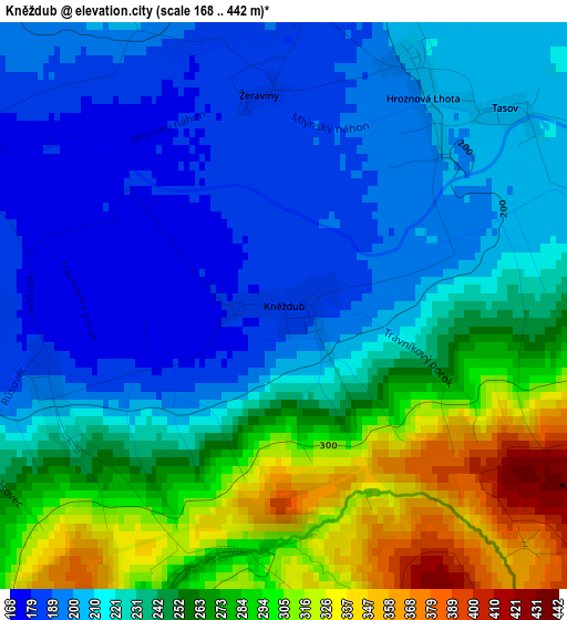
Below is the Elevation map of Kněždub, which displays elevation range with different colors. Scale of the first map is from 168 to 442 m (551 to 1450 ft) with average elevation of 237.9 meters (=781 ft) [note 1]
These maps also provides idea of topography and contour of this city, they are displayed at different zoom levels. More info about maps, scale and edge coordinates you can find below images.
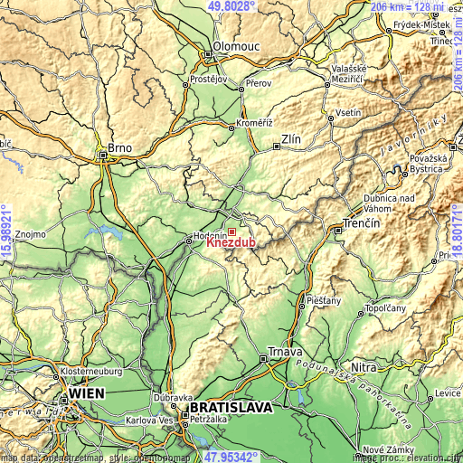
| \ | Map #1 | Topo.Map |
| Scale [m] | 168..442 m | × |
| Scale [ft] | 551..1450 ft | × |
| Average | 237.9 m = 781 ft | × |
| Width | 6.43 km = 4 mi | 205.6 km = 127.8 mi |
| Height | 6.43 km = 4 mi | 205.6 km = 127.8 mi |
| ↑Max Latitude | 48.915548° | 49.8028° |
| Latitude at center | 48.88666° | 48.88666° |
| ↓Min Latitude | 48.857755° | 47.95342° |
| ← Min Longitude | 17.351515° | 15.98921° |
| Longitude center | 17.39546° | 17.39546° |
| →Max Longitude | 17.439405° | 18.80171° |
Nearby cities:
Cities around Kněždub sort by population:
• Veselí nad Moravou elevation 170 m
7.6 km,  349°
349°
• Strážnice 180 m
6 km,  285°
285°
• Uherský Ostroh 178 m
11 km,  357°
357°
• Velká nad Veličkou 286 m
9.2 km,  92°
92°
• Vnorovy 186 m
5.9 km,  326°
326°
• Moravský Písek 178 m
12.4 km,  338°
338°
• Ostrožská Lhota 200 m
11.2 km,  28°
28°
• Lipov 228 m
5.3 km,  67°
67°
• Petrov 169 m
8.6 km,  266°
266°
• Hroznová Lhota 200 m
2.8 km, 33°
• Sudoměřice 182 m
10.4 km,  257°
257°
• Louka 246 m
7.6 km, 65°
Multilingual:
 En español:
Kněždub elevación 185 m.
 En France:
Kněždub élévation 185 m.


Sources and notes:
- [note 1] Map square and city borders are not equal. Map elevation data is calculated only from area inside that square.
- [src 1] Elevation data from geonames database provided with same terms of usage.
- [src 2] The elevation map of Kněždub is generated using elevation data from NASA's 3 arcsec (90m) resolution SRTM data.
- [src 3] Base (background) map © OpenStreetMap contributors tiles are generated by Geofabrik and OpenTopoMap.
Copyright & License:
This Kněždub Elevation Map is licensed under CC BY-SA. You may reuse any part from this page, if you give a proper credit by linking to this URL:
 More info on terms of use page.