Kroměříž elevation
Kroměříž (Zlín, Okres Kroměříž), Czech Republic elevation is 208 meters and Kroměříž elevation in feet is 682 ft above sea level [src 1]. Kroměříž is a populated place (feature code) with elevation that is 137 meters (449 ft) smaller than average city elevation in Czech Republic.
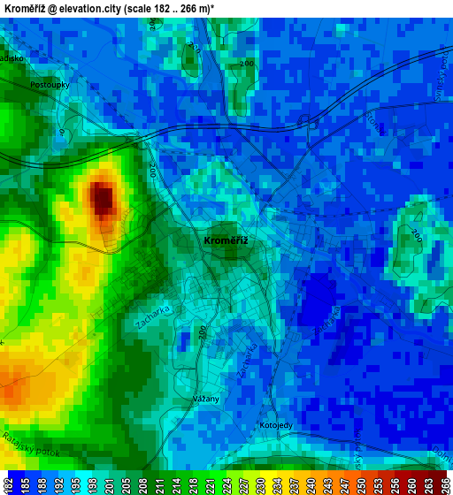
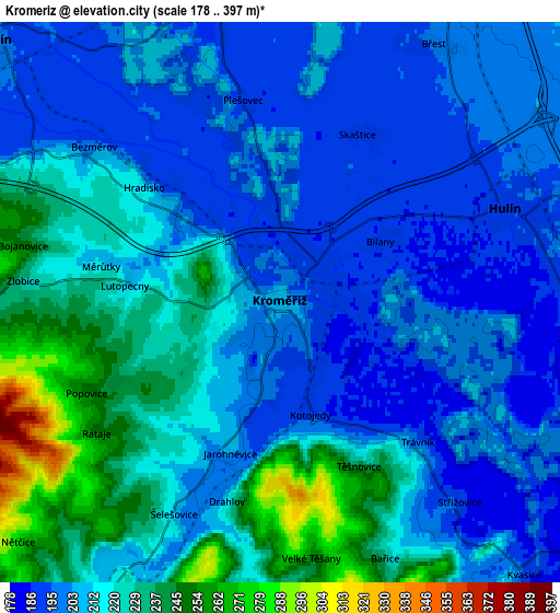
Below is the Elevation map of Kroměříž, which displays elevation range with different colors. Scale of the first map is from 182 to 266 m (597 to 873 ft) with average elevation of 199.6 meters (=655 ft) [note 1]
These maps also provides idea of topography and contour of this city, they are displayed at different zoom levels. More info about maps, scale and edge coordinates you can find below images.
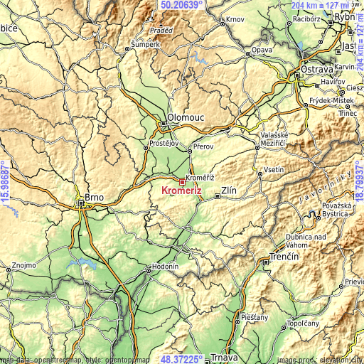
| \ | Map #1 | Map #2 | Topo.Map |
| Scale [m] | 182..266 m | 178..397 m | × |
| Scale [ft] | 597..873 ft | 584..1302 ft | × |
| Average | 199.6 m = 655 ft | 212.9 m = 698 ft | × |
| Width | 6.37 km = 4 mi | 12.75 km = 7.9 mi | 203.9 km = 126.7 mi |
| Height | 6.37 km = 4 mi | 12.75 km = 7.9 mi | 203.9 km = 126.7 mi |
| ↑Max Latitude | 49.3265° | 49.355133° | 50.20639° |
| Latitude at center | 49.29785° | 49.29785° | 49.29785° |
| ↓Min Latitude | 49.269184° | 49.240501° | 48.37225° |
| ← Min Longitude | 17.349175° | 17.305229° | 15.98687° |
| Longitude center | 17.39312° | 17.39312° | 17.39312° |
| →Max Longitude | 17.437065° | 17.481011° | 18.79937° |
Nearby cities:
Cities around Kroměříž sort by population:
• Holešov elevation 231 m
14 km,  73°
73°
• Hulín 191 m
5.5 km, 67°
• Kojetín 203 m
8.9 km,  312°
312°
• Chropyně 197 m
6.8 km,  342°
342°
• Tlumačov 188 m
8.9 km,  123°
123°
• Kvasice 194 m
8.3 km,  138°
138°
• Němčice nad Hanou 204 m
14.4 km,  289°
289°
• Zdounky 232 m
9.5 km,  214°
214°
• Zborovice 252 m
9.6 km,  235°
235°
• Horní Moštěnice 206 m
13.6 km,  20°
20°
• Rataje 249 m
5.1 km,  234°
234°
• Žlutava 281 m
13 km,  147°
147°
Multilingual:
 En español:
Kroměříž elevación 208 m.
 En France:
Kroměříž élévation 208 m.
 Auf Deutsch:
Kremsier höhe über dem Meeresspiegel ist 208 m.
 На русском:
Кромнержиж, Кромержиж высота над уровнем моря 208 м
Sources and notes:
- [note 1] Map square and city borders are not equal. Map elevation data is calculated only from area inside that square.
- [src 1] Elevation data from geonames database provided with same terms of usage.
- [src 2] The elevation map of Kroměříž is generated using elevation data from NASA's 3 arcsec (90m) resolution SRTM data.
- [src 3] Base (background) map © OpenStreetMap contributors tiles are generated by Geofabrik and OpenTopoMap.
Copyright & License:
This Kroměříž Elevation Map is licensed under CC BY-SA. You may reuse any part from this page, if you give a proper credit by linking to this URL:
 More info on terms of use page.