Náchod elevation
Náchod (Královéhradecký kraj, Okres Náchod), Czech Republic elevation is 350 meters and Náchod elevation in feet is 1148 ft above sea level [src 1]. Náchod is a populated place (feature code) with elevation that is 5 meters (16 ft) bigger than average city elevation in Czech Republic.
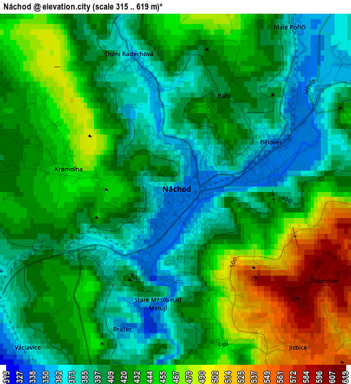
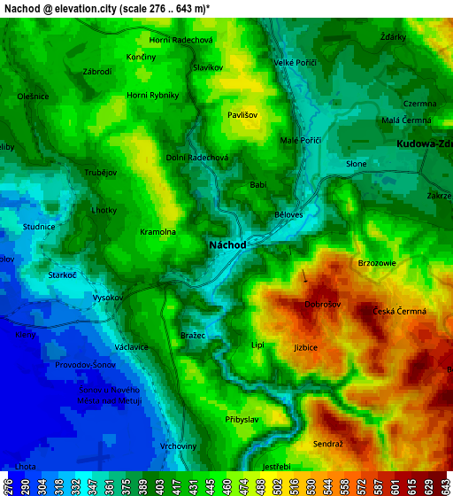
Below is the Elevation map of Náchod, which displays elevation range with different colors. Scale of the first map is from 315 to 619 m (1033 to 2031 ft) with average elevation of 424.6 meters (=1393 ft) [note 1]
These maps also provides idea of topography and contour of this city, they are displayed at different zoom levels. More info about maps, scale and edge coordinates you can find below images.
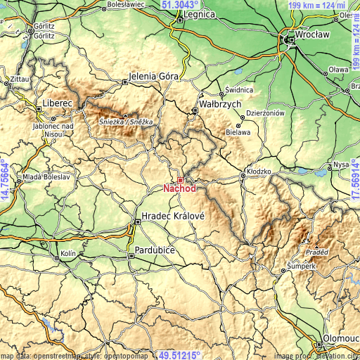
| \ | Map #1 | Map #2 | Topo.Map |
| Scale [m] | 315..619 m | 276..643 m | × |
| Scale [ft] | 1033..2031 ft | 906..2110 ft | × |
| Average | 424.6 m = 1393 ft | 416.3 m = 1366 ft | × |
| Width | 6.23 km = 3.9 mi | 12.45 km = 7.7 mi | 199.3 km = 123.8 mi |
| Height | 6.23 km = 3.9 mi | 12.45 km = 7.7 mi | 199.3 km = 123.8 mi |
| ↑Max Latitude | 50.444694° | 50.472671° | 51.3043° |
| Latitude at center | 50.4167° | 50.4167° | 50.4167° |
| ↓Min Latitude | 50.38869° | 50.360663° | 49.51215° |
| ← Min Longitude | 16.118945° | 16.074999° | 14.75664° |
| Longitude center | 16.16289° | 16.16289° | 16.16289° |
| →Max Longitude | 16.206835° | 16.250781° | 17.56914° |
Nearby cities:
Cities around Náchod sort by population:
• Nové Město nad Metují elevation 334 m
8.1 km,  185°
185°
• Červený Kostelec 419 m
8.3 km,  323°
323°
• Dobruška 297 m
13.9 km,  180°
180°
• Hronov 372 m
7.1 km,  11°
11°
• Úpice 357 m
14.9 km, 315°
• Česká Skalice 291 m
8.9 km,  253°
253°
• Police nad Metují 439 m
14.3 km,  20°
20°
• Rtyně v Podkrkonoší 391 m
11.8 km,  326°
326°
• Velké Poříčí 360 m
5.3 km, 20°
• Malé Svatoňovice 439 m
15.3 km, 328°
• Provodov-Šonov 294 m
5.1 km,  229°
229°
• Machov 478 m
12.2 km,  41°
41°
Multilingual:
 En español:
Náchod elevación 350 m.
 En France:
Náchod élévation 350 m.


Sources and notes:
- [note 1] Map square and city borders are not equal. Map elevation data is calculated only from area inside that square.
- [src 1] Elevation data from geonames database provided with same terms of usage.
- [src 2] The elevation map of Náchod is generated using elevation data from NASA's 3 arcsec (90m) resolution SRTM data.
- [src 3] Base (background) map © OpenStreetMap contributors tiles are generated by Geofabrik and OpenTopoMap.
Copyright & License:
This Náchod Elevation Map is licensed under CC BY-SA. You may reuse any part from this page, if you give a proper credit by linking to this URL:
 More info on terms of use page.