Oloví elevation
Oloví (Karlovarský kraj, Okres Sokolov), Czech Republic elevation is 476 meters and Oloví elevation in feet is 1562 ft above sea level [src 1]. Oloví is a populated place (feature code) with elevation that is 131 meters (430 ft) bigger than average city elevation in Czech Republic.
Below is the Elevation map of Oloví, which displays elevation range with different colors. Scale of the first map is from 440 to 716 m (1444 to 2349 ft) with average elevation of 602.9 meters (=1978 ft) [note 1]
These maps also provides idea of topography and contour of this city, they are displayed at different zoom levels. More info about maps, scale and edge coordinates you can find below images.
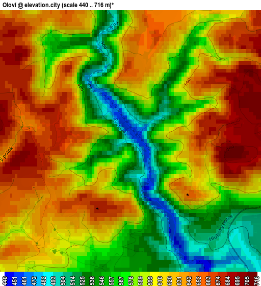
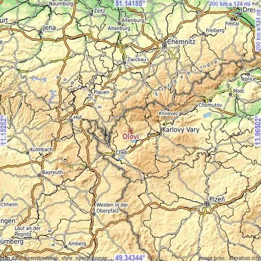
| \ | Map #1 | Topo.Map |
| Scale [m] | 440..716 m | × |
| Scale [ft] | 1444..2349 ft | × |
| Average | 602.9 m = 1978 ft | × |
| Width | 6.25 km = 3.9 mi | 200 km = 124.3 mi |
| Height | 6.25 km = 3.9 mi | 199.9 km = 124.2 mi |
| ↑Max Latitude | 50.279221° | 51.14185° |
| Latitude at center | 50.25113° | 50.25113° |
| ↓Min Latitude | 50.223022° | 49.34344° |
| ← Min Longitude | 12.514825° | 11.15252° |
| Longitude center | 12.55877° | 12.55877° |
| →Max Longitude | 12.602715° | 13.96502° |
Nearby cities:
Cities around Oloví sort by population:
• Sokolov elevation 402 m
9.7 km,  143°
143°
• Chodov 414 m
13.3 km,  95°
95°
• Kraslice 515 m
8.6 km,  340°
340°
• Habartov 504 m
7.6 km,  184°
184°
• Rotava 515 m
5.1 km,  11°
11°
• Březová 509 m
13.4 km,  151°
151°
• Luby 524 m
10.9 km,  270°
270°
• Bukovany 455 m
9.5 km,  174°
174°
• Svatava 406 m
8.1 km, 144°
• Dolní Rychnov 426 m
11.4 km, 147°
• Lomnice 432 m
6.8 km,  129°
129°
• Vintířov 455 m
11.4 km, 99°
Multilingual:
 En español:
Oloví elevación 476 m.
 En France:
Oloví élévation 476 m.


Sources and notes:
- [note 1] Map square and city borders are not equal. Map elevation data is calculated only from area inside that square.
- [src 1] Elevation data from geonames database provided with same terms of usage.
- [src 2] The elevation map of Oloví is generated using elevation data from NASA's 3 arcsec (90m) resolution SRTM data.
- [src 3] Base (background) map © OpenStreetMap contributors tiles are generated by Geofabrik and OpenTopoMap.
Copyright & License:
This Oloví Elevation Map is licensed under CC BY-SA. You may reuse any part from this page, if you give a proper credit by linking to this URL:
 More info on terms of use page.