Ostopovice elevation
Ostopovice (South Moravian, Okres Brno-venkov), Czech Republic elevation is 238 meters and Ostopovice elevation in feet is 781 ft above sea level [src 1]. Ostopovice is a populated place (feature code) with elevation that is 107 meters (351 ft) smaller than average city elevation in Czech Republic.
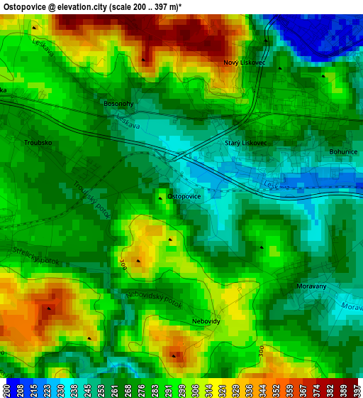
Below is the Elevation map of Ostopovice, which displays elevation range with different colors. Scale of the first map is from 200 to 397 m (656 to 1302 ft) with average elevation of 280.3 meters (=920 ft) [note 1]
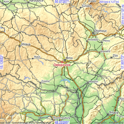
These maps also provides idea of topography and contour of this city, they are displayed at different zoom levels. More info about maps, scale and edge coordinates you can find below images.
| \ | Map #1 | Topo.Map |
| Scale [m] | 200..397 m | × |
| Scale [ft] | 656..1302 ft | × |
| Average | 280.3 m = 920 ft | × |
| Width | 6.39 km = 4 mi | 204.5 km = 127.1 mi |
| Height | 6.39 km = 4 mi | 204.5 km = 127.1 mi |
| ↑Max Latitude | 49.189729° | 50.07207° |
| Latitude at center | 49.161° | 49.161° |
| ↓Min Latitude | 49.132254° | 48.23285° |
| ← Min Longitude | 16.501535° | 15.13923° |
| Longitude center | 16.54548° | 16.54548° |
| →Max Longitude | 16.589425° | 17.95173° |
Nearby cities:
Cities around Ostopovice sort by population:
• Brno elevation 226 m
5.9 km,  50°
50°
• Rosice 339 m
11.7 km,  281°
281°
• Modřice 204 m
6.3 km,  137°
137°
• Rajhrad 196 m
8.9 km,  151°
151°
• Mokrá Hora 286 m
11.7 km,  16°
16°
• Střelice 273 m
3.2 km,  252°
252°
• Dolní Kounice 199 m
11.7 km,  210°
210°
• Ořechov 296 m
5.8 km,  196°
196°
• Troubsko 267 m
2.7 km,  290°
290°
• Moravany 248 m
2.9 km,  120°
120°
• Želešice 206 m
5.6 km, 151°
• Rajhradice 185 m
9.8 km, 141°
Multilingual:
 En español:
Ostopovice elevación 238 m.
 En France:
Ostopovice élévation 238 m.
 Auf Deutsch:
Ostopovice höhe über dem Meeresspiegel ist 238 m.

Sources and notes:
- [note 1] Map square and city borders are not equal. Map elevation data is calculated only from area inside that square.
- [src 1] Elevation data from geonames database provided with same terms of usage.
- [src 2] The elevation map of Ostopovice is generated using elevation data from NASA's 3 arcsec (90m) resolution SRTM data.
- [src 3] Base (background) map © OpenStreetMap contributors tiles are generated by Geofabrik and OpenTopoMap.
Copyright & License:
This Ostopovice Elevation Map is licensed under CC BY-SA. You may reuse any part from this page, if you give a proper credit by linking to this URL:
 More info on terms of use page.