Ostrava elevation
Ostrava (Moravskoslezský, Okres Ostrava-město), Czech Republic elevation is 211 meters and Ostrava elevation in feet is 692 ft above sea level [src 1]. Ostrava is a seat of a first-order administrative division (feature code) with elevation that is 134 meters (440 ft) smaller than average city elevation in Czech Republic.
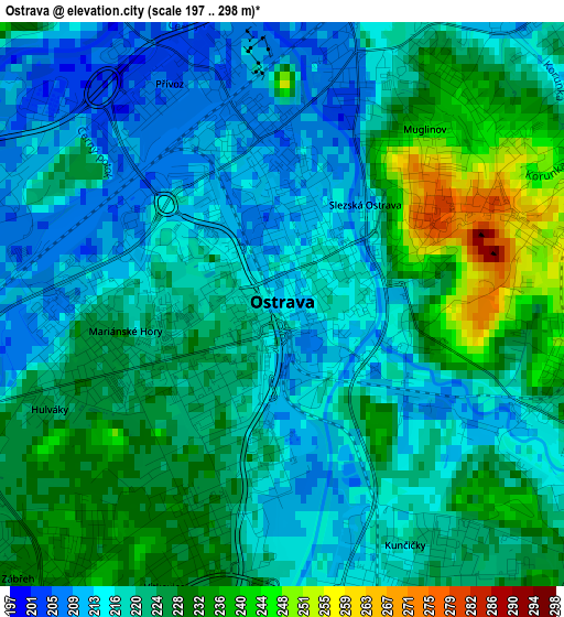
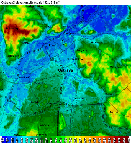
Below is the Elevation map of Ostrava, which displays elevation range with different colors. Scale of the first map is from 197 to 298 m (646 to 978 ft) with average elevation of 221.8 meters (=728 ft) [note 1]
These maps also provides idea of topography and contour of this city, they are displayed at different zoom levels. More info about maps, scale and edge coordinates you can find below images.
| \ | Map #1 | Map #2 | Topo.Map |
| Scale [m] | 197..298 m | 192..319 m | × |
| Scale [ft] | 646..978 ft | 630..1047 ft | × |
| Average | 221.8 m = 728 ft | 229.2 m = 752 ft | × |
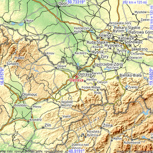
| Width | 6.3 km = 3.9 mi | 12.61 km = 7.8 mi | 201.7 km = 125.3 mi |
| Height | 6.3 km = 3.9 mi | 12.61 km = 7.8 mi | 201.7 km = 125.3 mi |
| ↑Max Latitude | 49.862986° | 49.891306° | 50.73319° |
| Latitude at center | 49.83465° | 49.83465° | 49.83465° |
| ↓Min Latitude | 49.806297° | 49.777928° | 48.9191° |
| ← Min Longitude | 18.238095° | 18.194149° | 16.87579° |
| Longitude center | 18.28204° | 18.28204° | 18.28204° |
| →Max Longitude | 18.325985° | 18.369931° | 19.68829° |
Nearby cities:
Cities around Ostrava sort by population:
• Orlová elevation 226 m
10.7 km,  83°
83°
• Bohumín 203 m
9.4 km,  35°
35°
• Starý Bohumín 200 m
9.9 km,  22°
22°
• Hlučín 247 m
9.6 km,  317°
317°
• Petřvald 248 m
7.7 km,  93°
93°
• Rychvald 228 m
7.6 km,  62°
62°
• Vratimov 246 m
7.5 km,  164°
164°
• Šenov 275 m
8.2 km,  124°
124°
• Ludgeřovice 231 m
6.9 km,  334°
334°
• Markvartovice 241 m
8.6 km,  337°
337°
• Šilheřovice 220 m
10.2 km,  355°
355°
• Vrbice 201 m
6 km, 24°
Multilingual:
 En español:
Ostrava elevación 211 m.
 En France:
Ostrava élévation 211 m.


Sources and notes:
- [note 1] Map square and city borders are not equal. Map elevation data is calculated only from area inside that square.
- [src 1] Elevation data from geonames database provided with same terms of usage.
- [src 2] The elevation map of Ostrava is generated using elevation data from NASA's 3 arcsec (90m) resolution SRTM data.
- [src 3] Base (background) map © OpenStreetMap contributors tiles are generated by Geofabrik and OpenTopoMap.
Copyright & License:
This Ostrava Elevation Map is licensed under CC BY-SA. You may reuse any part from this page, if you give a proper credit by linking to this URL:
 More info on terms of use page.