Rychvald elevation
Rychvald (Moravskoslezský, Okres Karviná), Czech Republic elevation is 228 meters and Rychvald elevation in feet is 748 ft above sea level [src 1]. Rychvald is a populated place (feature code) with elevation that is 117 meters (384 ft) smaller than average city elevation in Czech Republic.
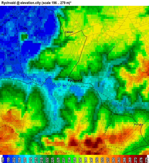
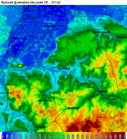
Below is the Elevation map of Rychvald, which displays elevation range with different colors. Scale of the first map is from 196 to 279 m (643 to 915 ft) with average elevation of 229.3 meters (=752 ft) [note 1]
These maps also provides idea of topography and contour of this city, they are displayed at different zoom levels. More info about maps, scale and edge coordinates you can find below images.
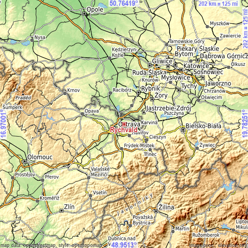
| \ | Map #1 | Map #2 | Topo.Map |
| Scale [m] | 196..279 m | 191..311 m | × |
| Scale [ft] | 643..915 ft | 627..1020 ft | × |
| Average | 229.3 m = 752 ft | 231.2 m = 759 ft | × |
| Width | 6.3 km = 3.9 mi | 12.6 km = 7.8 mi | 201.6 km = 125.3 mi |
| Height | 6.3 km = 3.9 mi | 12.6 km = 7.8 mi | 201.6 km = 125.3 mi |
| ↑Max Latitude | 49.894568° | 49.922869° | 50.76419° |
| Latitude at center | 49.86625° | 49.86625° | 49.86625° |
| ↓Min Latitude | 49.837916° | 49.809565° | 48.9513° |
| ← Min Longitude | 18.332315° | 18.288369° | 16.97001° |
| Longitude center | 18.37626° | 18.37626° | 18.37626° |
| →Max Longitude | 18.420205° | 18.464151° | 19.78251° |
Nearby cities:
Cities around Rychvald sort by population:
• Ostrava elevation 211 m
7.6 km,  242°
242°
• Orlová 226 m
4.5 km,  121°
121°
• Bohumín 203 m
4.4 km,  342°
342°
• Starý Bohumín 200 m
6.3 km,  332°
332°
• Petřvald 248 m
4 km,  166°
166°
• Šenov 275 m
8.1 km,  180°
180°
• Dolní Lutyně 211 m
5.2 km,  45°
45°
• Ludgeřovice 231 m
10.1 km,  285°
285°
• Dětmarovice 230 m
6.8 km,  62°
62°
• Doubrava 229 m
7.5 km,  96°
96°
• Šilheřovice 220 m
10.1 km,  311°
311°
• Vrbice 201 m
4.7 km, 293°
Multilingual:
 En español:
Rychvald elevación 228 m.
 En France:
Rychvald élévation 228 m.
 Auf Deutsch:
Rychvald höhe über dem Meeresspiegel ist 228 m.

Sources and notes:
- [note 1] Map square and city borders are not equal. Map elevation data is calculated only from area inside that square.
- [src 1] Elevation data from geonames database provided with same terms of usage.
- [src 2] The elevation map of Rychvald is generated using elevation data from NASA's 3 arcsec (90m) resolution SRTM data.
- [src 3] Base (background) map © OpenStreetMap contributors tiles are generated by Geofabrik and OpenTopoMap.
Copyright & License:
This Rychvald Elevation Map is licensed under CC BY-SA. You may reuse any part from this page, if you give a proper credit by linking to this URL:
 More info on terms of use page.