Ostravice elevation
Ostravice (Moravskoslezský, Okres Frýdek-Místek), Czech Republic elevation is 436 meters and Ostravice elevation in feet is 1430 ft above sea level [src 1]. Ostravice is a populated place (feature code) with elevation that is 91 meters (299 ft) bigger than average city elevation in Czech Republic.
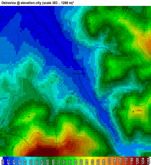
Below is the Elevation map of Ostravice, which displays elevation range with different colors. Scale of the first map is from 383 to 1268 m (1257 to 4160 ft) with average elevation of 632.8 meters (=2076 ft) [note 1]
These maps also provides idea of topography and contour of this city, they are displayed at different zoom levels. More info about maps, scale and edge coordinates you can find below images.
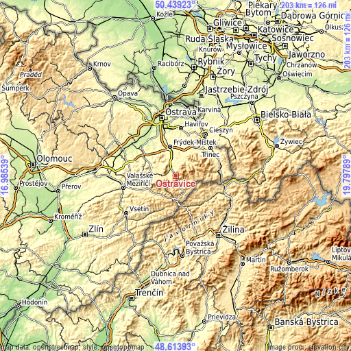
| \ | Map #1 | Topo.Map |
| Scale [m] | 383..1268 m | × |
| Scale [ft] | 1257..4160 ft | × |
| Average | 632.8 m = 2076 ft | × |
| Width | 6.34 km = 3.9 mi | 203 km = 126.1 mi |
| Height | 6.34 km = 3.9 mi | 202.9 km = 126.1 mi |
| ↑Max Latitude | 49.563611° | 50.43923° |
| Latitude at center | 49.5351° | 49.5351° |
| ↓Min Latitude | 49.506572° | 48.61393° |
| ← Min Longitude | 18.347695° | 16.98539° |
| Longitude center | 18.39164° | 18.39164° |
| →Max Longitude | 18.435585° | 19.79789° |
Nearby cities:
Cities around Ostravice sort by population:
• Frýdlant nad Ostravicí elevation 355 m
6.8 km,  340°
340°
• Baška 312 m
12.4 km,  353°
353°
• Kozlovice 373 m
11.5 km,  302°
302°
• Palkovice 322 m
12.4 km,  333°
333°
• Čeladná 427 m
4.2 km,  291°
291°
• Trojanovice 505 m
11.2 km,  261°
261°
• Kunčice pod Ondřejníkem 394 m
9.6 km,  280°
280°
• Raškovice 405 m
11.1 km,  31°
31°
• Janovice 362 m
9.7 km,  6°
6°
• Metylovice 370 m
8.8 km, 334°
• Morávka 462 m
11.7 km,  54°
54°
• Pražmo 435 m
10.7 km,  39°
39°
Multilingual:
 En español:
Ostravice elevación 436 m.
 En France:
Ostravice élévation 436 m.
 Auf Deutsch:
Ostravice höhe über dem Meeresspiegel ist 436 m.

Sources and notes:
- [note 1] Map square and city borders are not equal. Map elevation data is calculated only from area inside that square.
- [src 1] Elevation data from geonames database provided with same terms of usage.
- [src 2] The elevation map of Ostravice is generated using elevation data from NASA's 3 arcsec (90m) resolution SRTM data.
- [src 3] Base (background) map © OpenStreetMap contributors tiles are generated by Geofabrik and OpenTopoMap.
Copyright & License:
This Ostravice Elevation Map is licensed under CC BY-SA. You may reuse any part from this page, if you give a proper credit by linking to this URL:
 More info on terms of use page.