Pardubice elevation
Pardubice (Pardubický, Okres Pardubice), Czech Republic elevation is 227 meters and Pardubice elevation in feet is 745 ft above sea level [src 1]. Pardubice is a seat of a first-order administrative division (feature code) with elevation that is 118 meters (387 ft) smaller than average city elevation in Czech Republic.
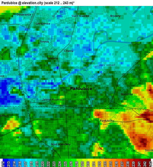
Below is the Elevation map of Pardubice, which displays elevation range with different colors. Scale of the first map is from 212 to 243 m (696 to 797 ft) with average elevation of 221.5 meters (=727 ft) [note 1]
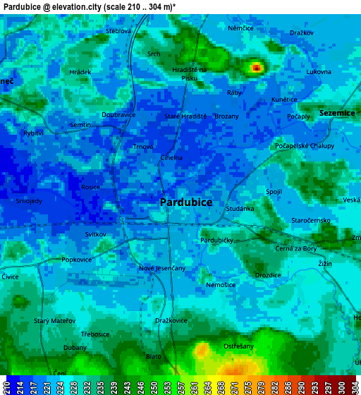
These maps also provides idea of topography and contour of this city, they are displayed at different zoom levels. More info about maps, scale and edge coordinates you can find below images.
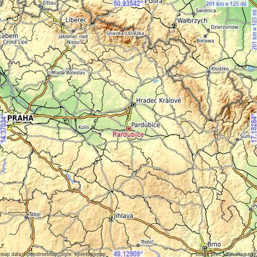
| \ | Map #1 | Map #2 | Topo.Map |
| Scale [m] | 212..243 m | 210..304 m | × |
| Scale [ft] | 696..797 ft | 689..997 ft | × |
| Average | 221.5 m = 727 ft | 227 m = 745 ft | × |
| Width | 6.28 km = 3.9 mi | 12.55 km = 7.8 mi | 200.8 km = 124.8 mi |
| Height | 6.28 km = 3.9 mi | 12.55 km = 7.8 mi | 200.8 km = 124.8 mi |
| ↑Max Latitude | 50.068965° | 50.097164° | 50.93542° |
| Latitude at center | 50.04075° | 50.04075° | 50.04075° |
| ↓Min Latitude | 50.012518° | 49.98427° | 49.12909° |
| ← Min Longitude | 15.732645° | 15.688699° | 14.37034° |
| Longitude center | 15.77659° | 15.77659° | 15.77659° |
| →Max Longitude | 15.820535° | 15.864481° | 17.18284° |
Nearby cities:
Cities around Pardubice sort by population:
• Chrudim elevation 274 m
10.1 km,  172°
172°
• Heřmanův Městec 281 m
13.1 km,  217°
217°
• Slatiňany 267 m
13.6 km, 168°
• Lázně Bohdaneč 222 m
7.9 km,  299°
299°
• Sezemice 233 m
6.1 km,  62°
62°
• Opatovice nad Labem 227 m
11.7 km,  4°
4°
• Dolní Roveň 232 m
13.7 km,  95°
95°
• Hrochův Týnec 243 m
13.2 km,  133°
133°
• Dašice 229 m
9.8 km, 98°
• Moravany 248 m
12.5 km,  110°
110°
• Rybitví 221 m
5.6 km,  292°
292°
• Staré Hradiště 219 m
2.7 km, 3°
Multilingual:
 En español:
Pardubice elevación 227 m.
 En France:
Pardubice élévation 227 m.
 Auf Deutsch:
Pardubice höhe über dem Meeresspiegel ist 227 m.

Sources and notes:
- [note 1] Map square and city borders are not equal. Map elevation data is calculated only from area inside that square.
- [src 1] Elevation data from geonames database provided with same terms of usage.
- [src 2] The elevation map of Pardubice is generated using elevation data from NASA's 3 arcsec (90m) resolution SRTM data.
- [src 3] Base (background) map © OpenStreetMap contributors tiles are generated by Geofabrik and OpenTopoMap.
Copyright & License:
This Pardubice Elevation Map is licensed under CC BY-SA. You may reuse any part from this page, if you give a proper credit by linking to this URL:
 More info on terms of use page.