Pavlíkov elevation
Pavlíkov (Central Bohemia, Okres Rakovník), Czech Republic elevation is 462 meters and Pavlíkov elevation in feet is 1516 ft above sea level [src 1]. Pavlíkov is a populated place (feature code) with elevation that is 117 meters (384 ft) bigger than average city elevation in Czech Republic.
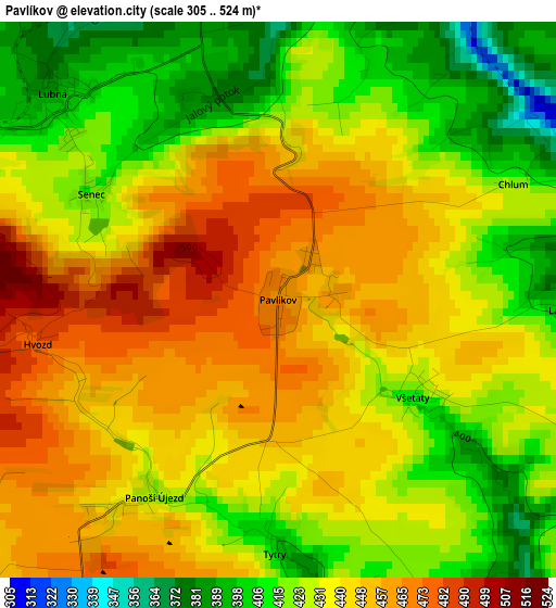
Below is the Elevation map of Pavlíkov, which displays elevation range with different colors. Scale of the first map is from 305 to 524 m (1001 to 1719 ft) with average elevation of 434.6 meters (=1426 ft) [note 1]
These maps also provides idea of topography and contour of this city, they are displayed at different zoom levels. More info about maps, scale and edge coordinates you can find below images.
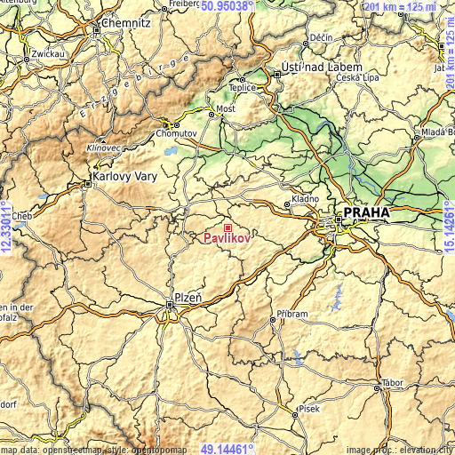
| \ | Map #1 | Topo.Map |
| Scale [m] | 305..524 m | × |
| Scale [ft] | 1001..1719 ft | × |
| Average | 434.6 m = 1426 ft | × |
| Width | 6.27 km = 3.9 mi | 200.8 km = 124.8 mi |
| Height | 6.27 km = 3.9 mi | 200.8 km = 124.8 mi |
| ↑Max Latitude | 50.084196° | 50.95038° |
| Latitude at center | 50.05599° | 50.05599° |
| ↓Min Latitude | 50.027767° | 49.14461° |
| ← Min Longitude | 13.692415° | 12.33011° |
| Longitude center | 13.73636° | 13.73636° |
| →Max Longitude | 13.780305° | 15.14261° |
Nearby cities:
Cities around Pavlíkov sort by population:
• Rakovník elevation 322 m
5.3 km,  357°
357°
• Stochov 439 m
19.1 km,  58°
58°
• Nové Strašecí 481 m
15.9 km,  47°
47°
• Kralovice 450 m
19.6 km,  245°
245°
• Lužná 349 m
7.9 km,  17°
17°
• Jesenice 464 m
19.6 km,  283°
283°
• Lány 426 m
17.1 km, 63°
• Nižbor 236 m
20 km,  108°
108°
• Řevničov 463 m
15.2 km, 19°
• Kožlany 438 m
15.6 km,  243°
243°
• Hudlice 412 m
19.8 km,  122°
122°
• Roztoky 278 m
9.9 km, 109°
Multilingual:
 En español:
Pavlíkov elevación 462 m.
 En France:
Pavlíkov élévation 462 m.
 Auf Deutsch:
Pavlíkov höhe über dem Meeresspiegel ist 462 m.

Sources and notes:
- [note 1] Map square and city borders are not equal. Map elevation data is calculated only from area inside that square.
- [src 1] Elevation data from geonames database provided with same terms of usage.
- [src 2] The elevation map of Pavlíkov is generated using elevation data from NASA's 3 arcsec (90m) resolution SRTM data.
- [src 3] Base (background) map © OpenStreetMap contributors tiles are generated by Geofabrik and OpenTopoMap.
Copyright & License:
This Pavlíkov Elevation Map is licensed under CC BY-SA. You may reuse any part from this page, if you give a proper credit by linking to this URL:
 More info on terms of use page.