Stochov elevation
Stochov (Central Bohemia, Okres Kladno), Czech Republic elevation is 439 meters and Stochov elevation in feet is 1440 ft above sea level [src 1]. Stochov is a populated place (feature code) with elevation that is 94 meters (308 ft) bigger than average city elevation in Czech Republic.
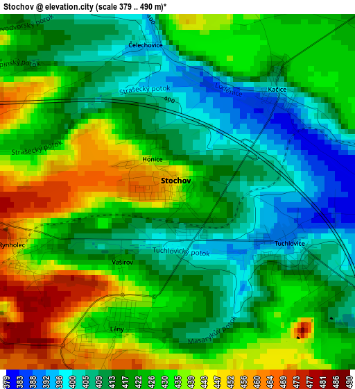
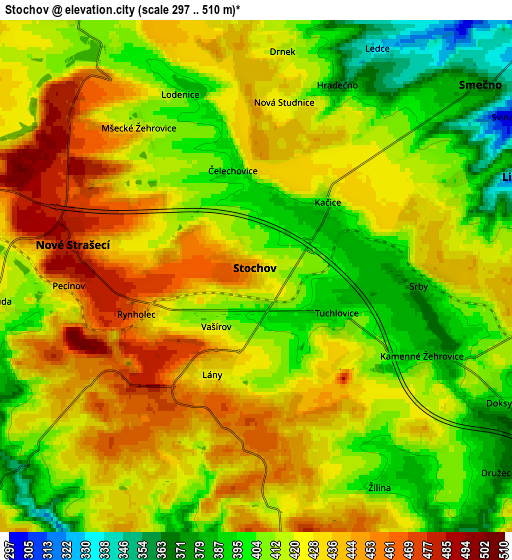
Below is the Elevation map of Stochov, which displays elevation range with different colors. Scale of the first map is from 379 to 490 m (1243 to 1608 ft) with average elevation of 423.4 meters (=1389 ft) [note 1]
These maps also provides idea of topography and contour of this city, they are displayed at different zoom levels. More info about maps, scale and edge coordinates you can find below images.
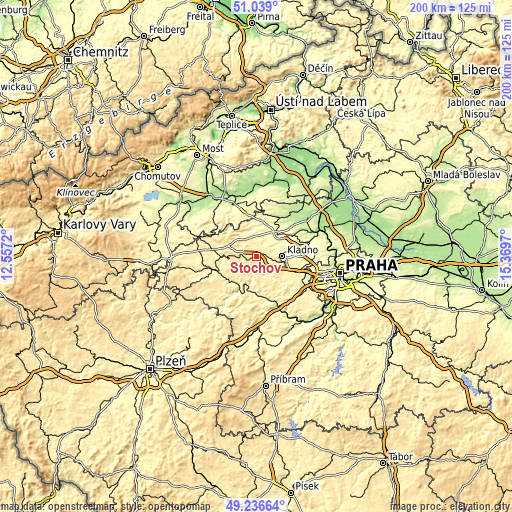
| \ | Map #1 | Map #2 | Topo.Map |
| Scale [m] | 379..490 m | 297..510 m | × |
| Scale [ft] | 1243..1608 ft | 974..1673 ft | × |
| Average | 423.4 m = 1389 ft | 419.7 m = 1377 ft | × |
| Width | 6.26 km = 3.9 mi | 12.53 km = 7.8 mi | 200.4 km = 124.5 mi |
| Height | 6.26 km = 3.9 mi | 12.53 km = 7.8 mi | 200.4 km = 124.5 mi |
| ↑Max Latitude | 50.174463° | 50.2026° | 51.039° |
| Latitude at center | 50.14631° | 50.14631° | 50.14631° |
| ↓Min Latitude | 50.11814° | 50.089954° | 49.23664° |
| ← Min Longitude | 13.919505° | 13.875559° | 12.5572° |
| Longitude center | 13.96345° | 13.96345° | 13.96345° |
| →Max Longitude | 14.007395° | 14.051341° | 15.3697° |
Nearby cities:
Cities around Stochov sort by population:
• Kladno elevation 390 m
9.9 km,  89°
89°
• Nové Strašecí 481 m
4.5 km,  279°
279°
• Libušín 318 m
6.9 km,  69°
69°
• Tuchlovice 390 m
2.2 km,  115°
115°
• Smečno 374 m
7.2 km,  49°
49°
• Vinařice 353 m
9.7 km, 70°
• Lány 426 m
2.6 km,  201°
201°
• Kamenné Žehrovice 403 m
4.4 km, 118°
• Řevničov 463 m
11.9 km,  291°
291°
• Velká Dobrá 405 m
8.6 km, 118°
• Kačice 401 m
2.5 km,  44°
44°
• Doksy 399 m
6.7 km, 116°
Multilingual:
 En español:
Stochov elevación 439 m.
 En France:
Stochov élévation 439 m.


Sources and notes:
- [note 1] Map square and city borders are not equal. Map elevation data is calculated only from area inside that square.
- [src 1] Elevation data from geonames database provided with same terms of usage.
- [src 2] The elevation map of Stochov is generated using elevation data from NASA's 3 arcsec (90m) resolution SRTM data.
- [src 3] Base (background) map © OpenStreetMap contributors tiles are generated by Geofabrik and OpenTopoMap.
Copyright & License:
This Stochov Elevation Map is licensed under CC BY-SA. You may reuse any part from this page, if you give a proper credit by linking to this URL:
 More info on terms of use page.