Roudnice nad Labem elevation
Roudnice nad Labem (Ústecký kraj, Okres Litoměřice), Czech Republic elevation is 180 meters and Roudnice nad Labem elevation in feet is 591 ft above sea level [src 1]. Roudnice nad Labem is a populated place (feature code) with elevation that is 165 meters (541 ft) smaller than average city elevation in Czech Republic.
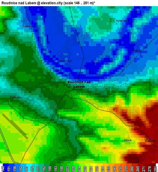
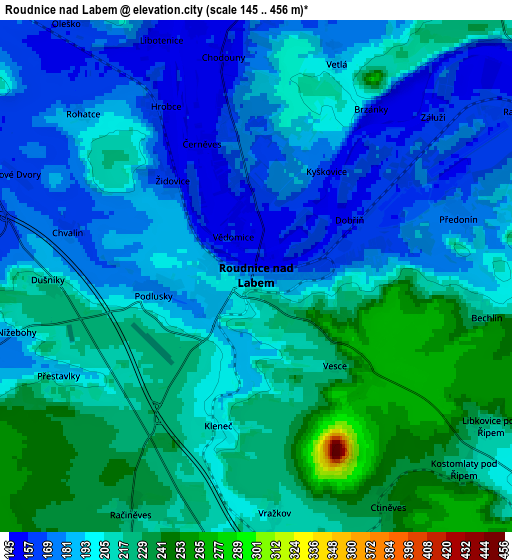
Below is the Elevation map of Roudnice nad Labem, which displays elevation range with different colors. Scale of the first map is from 146 to 281 m (479 to 922 ft) with average elevation of 189.7 meters (=622 ft) [note 1]
These maps also provides idea of topography and contour of this city, they are displayed at different zoom levels. More info about maps, scale and edge coordinates you can find below images.
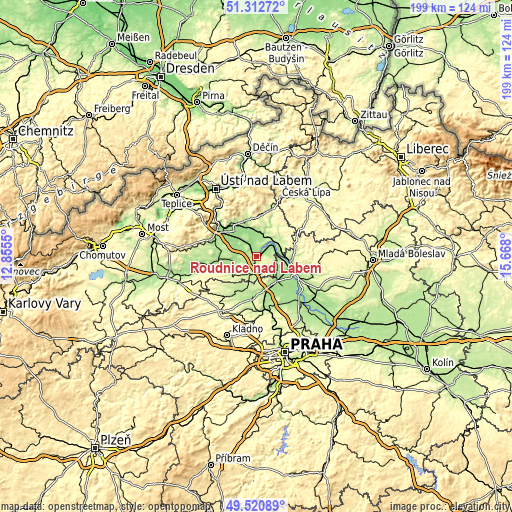
| \ | Map #1 | Map #2 | Topo.Map |
| Scale [m] | 146..281 m | 145..456 m | × |
| Scale [ft] | 479..922 ft | 476..1496 ft | × |
| Average | 189.7 m = 622 ft | 200.7 m = 658 ft | × |
| Width | 6.23 km = 3.9 mi | 12.45 km = 7.7 mi | 199.2 km = 123.8 mi |
| Height | 6.23 km = 3.9 mi | 12.45 km = 7.7 mi | 199.2 km = 123.8 mi |
| ↑Max Latitude | 50.453269° | 50.481241° | 51.31272° |
| Latitude at center | 50.42528° | 50.42528° | 50.42528° |
| ↓Min Latitude | 50.397275° | 50.369253° | 49.52089° |
| ← Min Longitude | 14.217805° | 14.173859° | 12.8555° |
| Longitude center | 14.26175° | 14.26175° | 14.26175° |
| →Max Longitude | 14.305695° | 14.349641° | 15.668° |
Nearby cities:
Cities around Roudnice nad Labem sort by population:
• Litoměřice elevation 167 m
15.1 km,  322°
322°
• Štětí 160 m
8.5 km,  68°
68°
• Terezín 152 m
12.4 km, 320°
• Bohušovice nad Ohří 153 m
10.9 km,  313°
313°
• Budyně nad Ohří 166 m
9.9 km,  256°
256°
• Hošťka 181 m
8.7 km,  36°
36°
• Křešice 150 m
11.3 km,  342°
342°
• Dolní Beřkovice 163 m
13.8 km,  104°
104°
• Polepy 160 m
8.9 km,  1°
1°
• Bechlín 218 m
5.7 km, 100°
• Horní Počaply 163 m
9.1 km,  90°
90°
• Cítov 182 m
11.3 km,  121°
121°
Multilingual:
 En español:
Roudnice nad Labem elevación 180 m.
 En France:
Roudnice nad Labem élévation 180 m.
 Auf Deutsch:
Raudnitz a.d. Elbe höhe über dem Meeresspiegel ist 180 m.
 На русском:
Роуднице-над-Лабем высота над уровнем моря 180 м
Sources and notes:
- [note 1] Map square and city borders are not equal. Map elevation data is calculated only from area inside that square.
- [src 1] Elevation data from geonames database provided with same terms of usage.
- [src 2] The elevation map of Roudnice nad Labem is generated using elevation data from NASA's 3 arcsec (90m) resolution SRTM data.
- [src 3] Base (background) map © OpenStreetMap contributors tiles are generated by Geofabrik and OpenTopoMap.
Copyright & License:
This Roudnice nad Labem Elevation Map is licensed under CC BY-SA. You may reuse any part from this page, if you give a proper credit by linking to this URL:
 More info on terms of use page.