Solnice elevation
Solnice (Královéhradecký kraj, Okres Rychnov nad Kněžnou), Czech Republic elevation is 333 meters and Solnice elevation in feet is 1093 ft above sea level [src 1]. Solnice is a populated place (feature code) with elevation that is 12 meters (39 ft) smaller than average city elevation in Czech Republic.
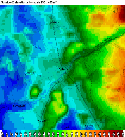
Below is the Elevation map of Solnice, which displays elevation range with different colors. Scale of the first map is from 296 to 435 m (971 to 1427 ft) with average elevation of 338.5 meters (=1111 ft) [note 1]
These maps also provides idea of topography and contour of this city, they are displayed at different zoom levels. More info about maps, scale and edge coordinates you can find below images.
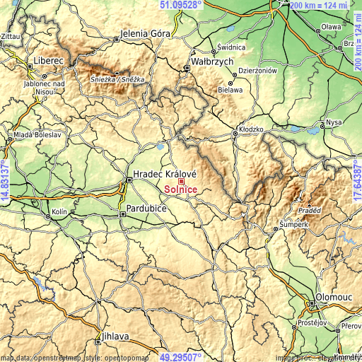
| \ | Map #1 | Topo.Map |
| Scale [m] | 296..435 m | × |
| Scale [ft] | 971..1427 ft | × |
| Average | 338.5 m = 1111 ft | × |
| Width | 6.25 km = 3.9 mi | 200.2 km = 124.4 mi |
| Height | 6.25 km = 3.9 mi | 200.1 km = 124.3 mi |
| ↑Max Latitude | 50.231779° | 51.09528° |
| Latitude at center | 50.20366° | 50.20366° |
| ↓Min Latitude | 50.175524° | 49.29507° |
| ← Min Longitude | 16.193675° | 14.83137° |
| Longitude center | 16.23762° | 16.23762° |
| →Max Longitude | 16.281565° | 17.64387° |
Nearby cities:
Cities around Solnice sort by population:
• Rychnov nad Kněžnou elevation 325 m
5.3 km,  149°
149°
• Dobruška 297 m
11.3 km,  330°
330°
• Týniště nad Orlicí 254 m
12.8 km,  242°
242°
• Kostelec nad Orlicí 294 m
9.2 km,  190°
190°
• Vamberk 319 m
10.3 km,  158°
158°
• Opočno 308 m
11.2 km,  309°
309°
• Borohrádek 262 m
15.6 km,  221°
221°
• Doudleby nad Orlicí 284 m
10.8 km,  171°
171°
• Častolovice 266 m
9.2 km,  205°
205°
• Kvasiny 349 m
2.1 km,  61°
61°
• Albrechtice nad Orlicí 251 m
14.2 km, 240°
• Skuhrov nad Bělou 383 m
4.8 km,  53°
53°
Multilingual:
 En español:
Solnice elevación 333 m.
 En France:
Solnice élévation 333 m.
 Auf Deutsch:
Sollnitz höhe über dem Meeresspiegel ist 333 m.

Sources and notes:
- [note 1] Map square and city borders are not equal. Map elevation data is calculated only from area inside that square.
- [src 1] Elevation data from geonames database provided with same terms of usage.
- [src 2] The elevation map of Solnice is generated using elevation data from NASA's 3 arcsec (90m) resolution SRTM data.
- [src 3] Base (background) map © OpenStreetMap contributors tiles are generated by Geofabrik and OpenTopoMap.
Copyright & License:
This Solnice Elevation Map is licensed under CC BY-SA. You may reuse any part from this page, if you give a proper credit by linking to this URL:
 More info on terms of use page.