Tábor elevation
Tábor (Jihočeský kraj, Okres Tábor), Czech Republic elevation is 456 meters and Tábor elevation in feet is 1496 ft above sea level [src 1]. Tábor is a populated place (feature code) with elevation that is 111 meters (364 ft) bigger than average city elevation in Czech Republic.
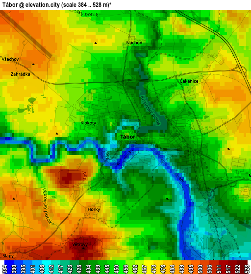
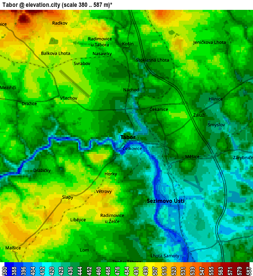
Below is the Elevation map of Tábor, which displays elevation range with different colors. Scale of the first map is from 384 to 528 m (1260 to 1732 ft) with average elevation of 455.8 meters (=1495 ft) [note 1]
These maps also provides idea of topography and contour of this city, they are displayed at different zoom levels. More info about maps, scale and edge coordinates you can find below images.
| \ | Map #1 | Map #2 | Topo.Map |
| Scale [m] | 384..528 m | 380..587 m | × |
| Scale [ft] | 1260..1732 ft | 1247..1926 ft | × |
| Average | 455.8 m = 1495 ft | 463.3 m = 1520 ft | × |
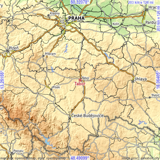
| Width | 6.36 km = 4 mi | 12.72 km = 7.9 mi | 203.5 km = 126.4 mi |
| Height | 6.36 km = 4 mi | 12.72 km = 7.9 mi | 203.4 km = 126.4 mi |
| ↑Max Latitude | 49.442992° | 49.471557° | 50.32078° |
| Latitude at center | 49.41441° | 49.41441° | 49.41441° |
| ↓Min Latitude | 49.385812° | 49.357197° | 48.49099° |
| ← Min Longitude | 14.613855° | 14.569909° | 13.25155° |
| Longitude center | 14.6578° | 14.6578° | 14.6578° |
| →Max Longitude | 14.701745° | 14.745691° | 16.06405° |
Nearby cities:
Cities around Tábor sort by population:
• Sezimovo Ústí elevation 400 m
3.8 km,  148°
148°
• Soběslav 408 m
17.7 km,  165°
165°
• Bechyně 407 m
19.1 km,  226°
226°
• Planá nad Lužnicí 396 m
7.4 km, 154°
• Mladá Vožice 450 m
17.1 km,  39°
39°
• Chýnov 484 m
11.1 km,  94°
94°
• Jistebnice 579 m
12.3 km,  310°
310°
• Malšice 498 m
8 km, 225°
• Chotoviny 553 m
7.2 km,  11°
11°
• Opařany 469 m
12.9 km,  261°
261°
• Sepekov 450 m
17.4 km,  275°
275°
• Chyšky 667 m
20.6 km, 306°
Multilingual:
 En español:
Tábor elevación 456 m.
 En France:
Tábor élévation 456 m.


Sources and notes:
- [note 1] Map square and city borders are not equal. Map elevation data is calculated only from area inside that square.
- [src 1] Elevation data from geonames database provided with same terms of usage.
- [src 2] The elevation map of Tábor is generated using elevation data from NASA's 3 arcsec (90m) resolution SRTM data.
- [src 3] Base (background) map © OpenStreetMap contributors tiles are generated by Geofabrik and OpenTopoMap.
Copyright & License:
This Tábor Elevation Map is licensed under CC BY-SA. You may reuse any part from this page, if you give a proper credit by linking to this URL:
 More info on terms of use page.