Třebíč elevation
Třebíč (Vysočina, Okres Třebíč), Czech Republic elevation is 405 meters and Třebíč elevation in feet is 1329 ft above sea level [src 1]. Třebíč is a populated place (feature code) with elevation that is 60 meters (197 ft) bigger than average city elevation in Czech Republic.
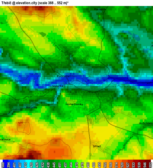
Below is the Elevation map of Třebíč, which displays elevation range with different colors. Scale of the first map is from 388 to 552 m (1273 to 1811 ft) with average elevation of 460.7 meters (=1511 ft) [note 1]
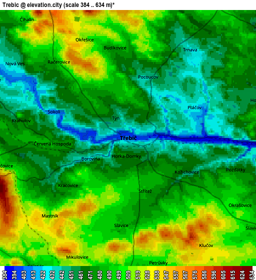
These maps also provides idea of topography and contour of this city, they are displayed at different zoom levels. More info about maps, scale and edge coordinates you can find below images.
| \ | Map #1 | Map #2 | Topo.Map |
| Scale [m] | 388..552 m | 384..634 m | × |
| Scale [ft] | 1273..1811 ft | 1260..2080 ft | × |
| Average | 460.7 m = 1511 ft | 483 m = 1585 ft | × |
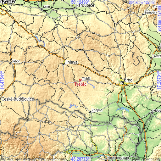
| Width | 6.38 km = 4 mi | 12.77 km = 7.9 mi | 204.3 km = 126.9 mi |
| Height | 6.38 km = 4 mi | 12.77 km = 7.9 mi | 204.3 km = 126.9 mi |
| ↑Max Latitude | 49.243618° | 49.272299° | 50.12499° |
| Latitude at center | 49.21492° | 49.21492° | 49.21492° |
| ↓Min Latitude | 49.186206° | 49.157474° | 48.28778° |
| ← Min Longitude | 15.837715° | 15.793769° | 14.47541° |
| Longitude center | 15.88166° | 15.88166° | 15.88166° |
| →Max Longitude | 15.925605° | 15.969551° | 17.28791° |
Nearby cities:
Cities around Třebíč sort by population:
• Velké Meziříčí elevation 426 m
18.2 km,  31°
31°
• Moravské Budějovice 467 m
18.9 km,  196°
196°
• Jaroměřice nad Rokytnou 423 m
13.5 km,  176°
176°
• Brtnice 518 m
18.1 km,  304°
304°
• Okříšky 477 m
8.8 km,  292°
292°
• Hrotovice 411 m
17.7 km,  132°
132°
• Kamenice 521 m
18.4 km,  336°
336°
• Želetava 575 m
17.2 km,  241°
241°
• Stařeč 453 m
4.3 km, 244°
• Kněžice 547 m
16.4 km, 292°
• Vladislav 388 m
7.8 km,  93°
93°
• Budišov 484 m
10.9 km,  54°
54°
Multilingual:
 En español:
Třebíč elevación 405 m.
 En France:
Třebíč élévation 405 m.
 Auf Deutsch:
Trebitsch-Stadt höhe über dem Meeresspiegel ist 405 m.

Sources and notes:
- [note 1] Map square and city borders are not equal. Map elevation data is calculated only from area inside that square.
- [src 1] Elevation data from geonames database provided with same terms of usage.
- [src 2] The elevation map of Třebíč is generated using elevation data from NASA's 3 arcsec (90m) resolution SRTM data.
- [src 3] Base (background) map © OpenStreetMap contributors tiles are generated by Geofabrik and OpenTopoMap.
Copyright & License:
This Třebíč Elevation Map is licensed under CC BY-SA. You may reuse any part from this page, if you give a proper credit by linking to this URL:
 More info on terms of use page.