Varnsdorf elevation
Varnsdorf (Ústecký kraj, Okres Děčín), Czech Republic elevation is 339 meters and Varnsdorf elevation in feet is 1112 ft above sea level [src 1]. Varnsdorf is a populated place (feature code) with elevation that is 6 meters (20 ft) smaller than average city elevation in Czech Republic.
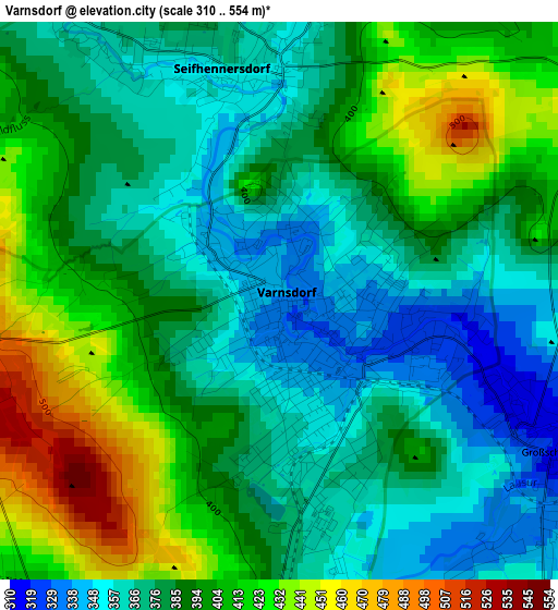
Below is the Elevation map of Varnsdorf, which displays elevation range with different colors. Scale of the first map is from 310 to 554 m (1017 to 1818 ft) with average elevation of 388.7 meters (=1275 ft) [note 1]
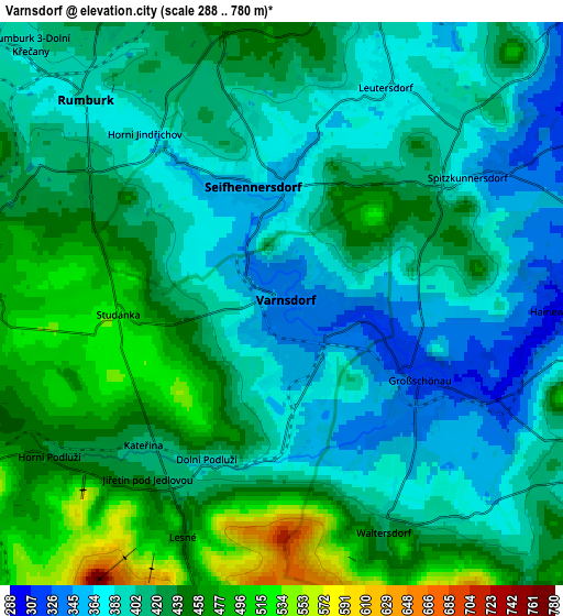
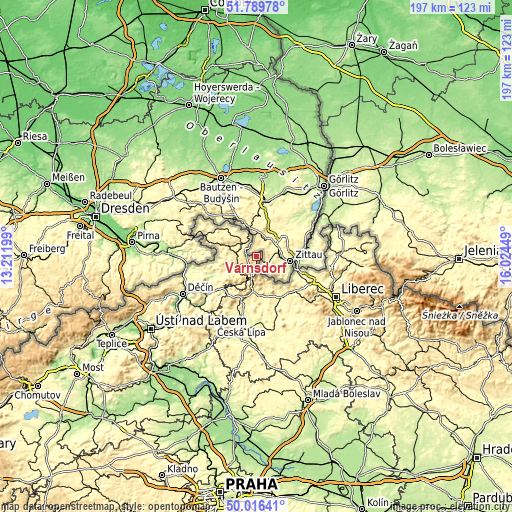
These maps also provides idea of topography and contour of this city, they are displayed at different zoom levels. More info about maps, scale and edge coordinates you can find below images.
| \ | Map #1 | Map #2 | Topo.Map |
| Scale [m] | 310..554 m | 288..780 m | × |
| Scale [ft] | 1017..1818 ft | 945..2559 ft | × |
| Average | 388.7 m = 1275 ft | 417.5 m = 1370 ft | × |
| Width | 6.16 km = 3.8 mi | 12.32 km = 7.7 mi | 197.2 km = 122.5 mi |
| Height | 6.16 km = 3.8 mi | 12.32 km = 7.7 mi | 197.2 km = 122.5 mi |
| ↑Max Latitude | 50.93924° | 50.966924° | 51.78978° |
| Latitude at center | 50.91154° | 50.91154° | 50.91154° |
| ↓Min Latitude | 50.883823° | 50.85609° | 50.01641° |
| ← Min Longitude | 14.574295° | 14.530349° | 13.21199° |
| Longitude center | 14.61824° | 14.61824° | 14.61824° |
| →Max Longitude | 14.662185° | 14.706131° | 16.02449° |
Nearby cities:
Cities around Varnsdorf sort by population:
• Nový Bor elevation 371 m
17.7 km,  194°
194°
• Rumburk 388 m
6.2 km,  315°
315°
• Hrádek nad Nisou 253 m
17.2 km,  112°
112°
• Šluknov 355 m
15.5 km,  311°
311°
• Cvikov 359 m
15 km,  176°
176°
• Kamenický Šenov 528 m
18.4 km,  213°
213°
• Jiříkov 371 m
9.9 km,  339°
339°
• Krásná Lípa 428 m
7.6 km,  271°
271°
• Mikulášovice 424 m
18.8 km,  288°
288°
• Chřibská 352 m
11 km,  238°
238°
• Staré Křečany 402 m
9.6 km,  296°
296°
• Dolní Podluží 392 m
3.9 km,  204°
204°
Multilingual:
 En español:
Varnsdorf elevación 339 m.
 En France:
Varnsdorf élévation 339 m.
 Auf Deutsch:
Warnsdorf höhe über dem Meeresspiegel ist 339 m.

Sources and notes:
- [note 1] Map square and city borders are not equal. Map elevation data is calculated only from area inside that square.
- [src 1] Elevation data from geonames database provided with same terms of usage.
- [src 2] The elevation map of Varnsdorf is generated using elevation data from NASA's 3 arcsec (90m) resolution SRTM data.
- [src 3] Base (background) map © OpenStreetMap contributors tiles are generated by Geofabrik and OpenTopoMap.
Copyright & License:
This Varnsdorf Elevation Map is licensed under CC BY-SA. You may reuse any part from this page, if you give a proper credit by linking to this URL:
 More info on terms of use page.