Nový Bor elevation
Nový Bor (Liberecký kraj, Okres Česká Lípa), Czech Republic elevation is 371 meters and Nový Bor elevation in feet is 1217 ft above sea level [src 1]. Nový Bor is a populated place (feature code) with elevation that is 26 meters (85 ft) bigger than average city elevation in Czech Republic.
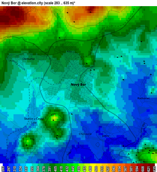
Below is the Elevation map of Nový Bor, which displays elevation range with different colors. Scale of the first map is from 283 to 635 m (928 to 2083 ft) with average elevation of 375.7 meters (=1233 ft) [note 1]
These maps also provides idea of topography and contour of this city, they are displayed at different zoom levels. More info about maps, scale and edge coordinates you can find below images.
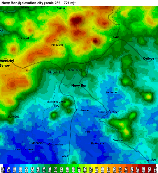
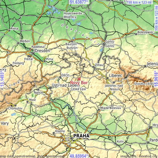
| \ | Map #1 | Map #2 | Topo.Map |
| Scale [m] | 283..635 m | 252..721 m | × |
| Scale [ft] | 928..2083 ft | 827..2365 ft | × |
| Average | 375.7 m = 1233 ft | 403.7 m = 1324 ft | × |
| Width | 6.18 km = 3.8 mi | 12.36 km = 7.7 mi | 197.8 km = 122.9 mi |
| Height | 6.18 km = 3.8 mi | 12.36 km = 7.7 mi | 197.8 km = 122.9 mi |
| ↑Max Latitude | 50.785402° | 50.813177° | 51.63877° |
| Latitude at center | 50.75761° | 50.75761° | 50.75761° |
| ↓Min Latitude | 50.729802° | 50.701977° | 49.85954° |
| ← Min Longitude | 14.511605° | 14.467659° | 13.1493° |
| Longitude center | 14.55555° | 14.55555° | 14.55555° |
| →Max Longitude | 14.599495° | 14.643441° | 15.9618° |
Nearby cities:
Cities around Nový Bor sort by population:
• Česká Lípa elevation 263 m
8.1 km,  188°
188°
• Mimoň 281 m
16.2 km,  132°
132°
• Česká Kamenice 313 m
10.7 km,  294°
294°
• Cvikov 359 m
5.8 km,  68°
68°
• Benešov nad Ploučnicí 212 m
17.2 km,  264°
264°
• Kamenický Šenov 528 m
6.1 km, 286°
• Jablonné v Podještědí 323 m
14.4 km,  86°
86°
• Zákupy 272 m
10.3 km,  142°
142°
• Žandov 258 m
12.2 km,  246°
246°
• Chřibská 352 m
12.5 km,  336°
336°
• Brniště 300 m
10.9 km,  106°
106°
• Dolní Podluží 392 m
13.9 km,  11°
11°
Multilingual:
 En español:
Nový Bor elevación 371 m.
 En France:
Nový Bor élévation 371 m.


Sources and notes:
- [note 1] Map square and city borders are not equal. Map elevation data is calculated only from area inside that square.
- [src 1] Elevation data from geonames database provided with same terms of usage.
- [src 2] The elevation map of Nový Bor is generated using elevation data from NASA's 3 arcsec (90m) resolution SRTM data.
- [src 3] Base (background) map © OpenStreetMap contributors tiles are generated by Geofabrik and OpenTopoMap.
Copyright & License:
This Nový Bor Elevation Map is licensed under CC BY-SA. You may reuse any part from this page, if you give a proper credit by linking to this URL:
 More info on terms of use page.