Vrbátky elevation
Vrbátky (Olomoucký, Okres Prostějov), Czech Republic elevation is 211 meters and Vrbátky elevation in feet is 692 ft above sea level [src 1]. Vrbátky is a populated place (feature code) with elevation that is 134 meters (440 ft) smaller than average city elevation in Czech Republic.
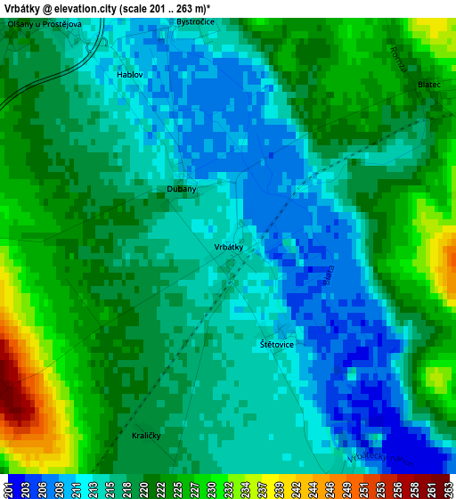
Below is the Elevation map of Vrbátky, which displays elevation range with different colors. Scale of the first map is from 201 to 263 m (659 to 863 ft) with average elevation of 218.3 meters (=716 ft) [note 1]
These maps also provides idea of topography and contour of this city, they are displayed at different zoom levels. More info about maps, scale and edge coordinates you can find below images.
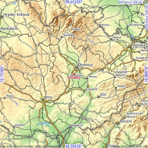
| \ | Map #1 | Topo.Map |
| Scale [m] | 201..263 m | × |
| Scale [ft] | 659..863 ft | × |
| Average | 218.3 m = 716 ft | × |
| Width | 6.35 km = 3.9 mi | 203.1 km = 126.2 mi |
| Height | 6.35 km = 3.9 mi | 203.1 km = 126.2 mi |
| ↑Max Latitude | 49.536577° | 50.41268° |
| Latitude at center | 49.50805° | 49.50805° |
| ↓Min Latitude | 49.479506° | 48.58638° |
| ← Min Longitude | 17.155995° | 15.79369° |
| Longitude center | 17.19994° | 17.19994° |
| →Max Longitude | 17.243885° | 18.60619° |
Nearby cities:
Cities around Vrbátky sort by population:
• Prostějov elevation 227 m
7.5 km,  237°
237°
• Lutín 222 m
7.3 km,  320°
320°
• Smržice 223 m
6.7 km,  267°
267°
• Dub nad Moravou 212 m
6.3 km,  116°
116°
• Slatinice 233 m
9.4 km,  309°
309°
• Kralice na Hané 213 m
5.2 km,  195°
195°
• Grygov 204 m
8.6 km,  66°
66°
• Věrovany 203 m
8.2 km,  129°
129°
• Čelechovice na Hané 239 m
7.7 km,  276°
276°
• Hněvotín 244 m
7.3 km,  348°
348°
• Majetín 206 m
9.7 km,  96°
96°
• Bedihošť 208 m
7.1 km, 200°
Multilingual:
 En español:
Vrbátky elevación 211 m.
 En France:
Vrbátky élévation 211 m.


Sources and notes:
- [note 1] Map square and city borders are not equal. Map elevation data is calculated only from area inside that square.
- [src 1] Elevation data from geonames database provided with same terms of usage.
- [src 2] The elevation map of Vrbátky is generated using elevation data from NASA's 3 arcsec (90m) resolution SRTM data.
- [src 3] Base (background) map © OpenStreetMap contributors tiles are generated by Geofabrik and OpenTopoMap.
Copyright & License:
This Vrbátky Elevation Map is licensed under CC BY-SA. You may reuse any part from this page, if you give a proper credit by linking to this URL:
 More info on terms of use page.