Vyškov elevation
Vyškov (South Moravian, Okres Vyškov), Czech Republic elevation is 254 meters and Vyškov elevation in feet is 833 ft above sea level [src 1]. Vyškov is a populated place (feature code) with elevation that is 91 meters (299 ft) smaller than average city elevation in Czech Republic.
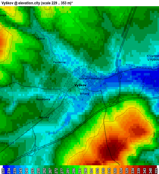
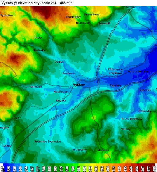
Below is the Elevation map of Vyškov, which displays elevation range with different colors. Scale of the first map is from 229 to 353 m (751 to 1158 ft) with average elevation of 273 meters (=896 ft) [note 1]
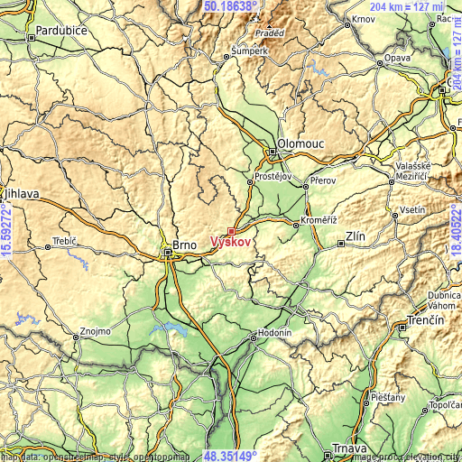
These maps also provides idea of topography and contour of this city, they are displayed at different zoom levels. More info about maps, scale and edge coordinates you can find below images.
| \ | Map #1 | Map #2 | Topo.Map |
| Scale [m] | 229..353 m | 214..488 m | × |
| Scale [ft] | 751..1158 ft | 702..1601 ft | × |
| Average | 273 m = 896 ft | 300 m = 984 ft | × |
| Width | 6.38 km = 4 mi | 12.75 km = 7.9 mi | 204 km = 126.8 mi |
| Height | 6.38 km = 4 mi | 12.75 km = 7.9 mi | 204 km = 126.8 mi |
| ↑Max Latitude | 49.306131° | 49.334776° | 50.18638° |
| Latitude at center | 49.27747° | 49.27747° | 49.27747° |
| ↓Min Latitude | 49.248792° | 49.220097° | 48.35149° |
| ← Min Longitude | 16.955025° | 16.911079° | 15.59272° |
| Longitude center | 16.99897° | 16.99897° | 16.99897° |
| →Max Longitude | 17.042915° | 17.086861° | 18.40522° |
Nearby cities:
Cities around Vyškov sort by population:
• Bučovice elevation 219 m
14.3 km,  179°
179°
• Slavkov u Brna 211 m
16.4 km,  212°
212°
• Rousínov 235 m
12 km,  225°
225°
• Ivanovice na Hané 224 m
7.5 km,  65°
65°
• Drnovice 266 m
3.4 km,  267°
267°
• Němčice nad Hanou 204 m
16.6 km,  64°
64°
• Pustiměř 286 m
5.4 km,  22°
22°
• Letonice 260 m
11.5 km,  194°
194°
• Nezamyslice 207 m
13.7 km, 67°
• Otaslavice 252 m
13.4 km, 22°
• Nesovice 239 m
15.3 km,  157°
157°
• Viničné Šumice 293 m
14.5 km,  240°
240°
Multilingual:
 En español:
Vyškov elevación 254 m.
 En France:
Vyškov élévation 254 m.


Sources and notes:
- [note 1] Map square and city borders are not equal. Map elevation data is calculated only from area inside that square.
- [src 1] Elevation data from geonames database provided with same terms of usage.
- [src 2] The elevation map of Vyškov is generated using elevation data from NASA's 3 arcsec (90m) resolution SRTM data.
- [src 3] Base (background) map © OpenStreetMap contributors tiles are generated by Geofabrik and OpenTopoMap.
Copyright & License:
This Vyškov Elevation Map is licensed under CC BY-SA. You may reuse any part from this page, if you give a proper credit by linking to this URL:
 More info on terms of use page.