Léfka elevation
Léfka (Nicosia), Cyprus elevation is 129 meters and Léfka elevation in feet is 423 ft above sea level [src 1]. Léfka is a populated place (feature code) with elevation that is 49 meters (161 ft) smaller than average city elevation in Cyprus.
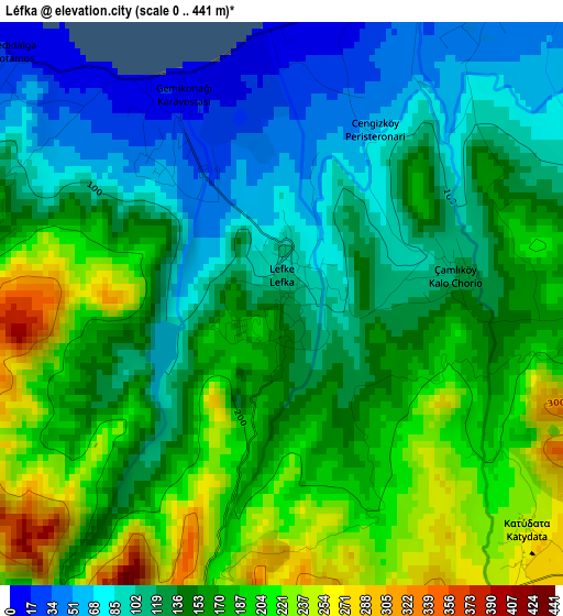
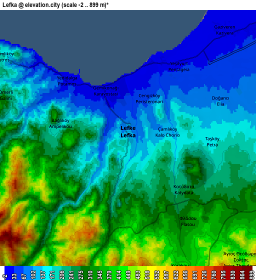
Below is the Elevation map of Léfka, which displays elevation range with different colors. Scale of the first map is from 0 to 441 m (0 to 1447 ft) with average elevation of 150 meters (=492 ft) [note 1]
These maps also provides idea of topography and contour of this city, they are displayed at different zoom levels. More info about maps, scale and edge coordinates you can find below images.
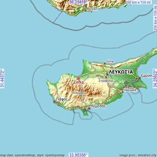
| \ | Map #1 | Map #2 | Topo.Map |
| Scale [m] | 0..441 m | -2..899 m | × |
| Scale [ft] | 0..1447 ft | -7..2949 ft | × |
| Average | 150 m = 492 ft | 247.3 m = 811 ft | × |
| Width | 7.99 km = 5 mi | 15.99 km = 9.9 mi | 255.8 km = 158.9 mi |
| Height | 7.99 km = 5 mi | 15.99 km = 9.9 mi | 255.8 km = 158.9 mi |
| ↑Max Latitude | 35.147931° | 35.183855° | 36.25419° |
| Latitude at center | 35.11199° | 35.11199° | 35.11199° |
| ↓Min Latitude | 35.076034° | 35.040061° | 33.95356° |
| ← Min Longitude | 32.806025° | 32.762079° | 31.44372° |
| Longitude center | 32.84997° | 32.84997° | 32.84997° |
| →Max Longitude | 32.893915° | 32.937861° | 34.25622° |
Nearby cities:
Cities around Léfka sort by population:
• Mórfou elevation 48 m
16.2 km,  53°
53°
• Kokkinotrimithiá 218 m
32.1 km,  81°
81°
• Akáki 207 m
25.5 km, 84°
• Astromerítis 158 m
17.4 km, 79°
• Peristeróna 230 m
20.9 km, 84°
• Klírou 451 m
31.6 km,  108°
108°
• Kyperoúnta 1134 m
22.5 km,  149°
149°
• Kakopetriá 694 m
14.7 km,  160°
160°
• Peléndri 898 m
26.3 km, 155°
• Káto Pýrgos 25 m
16.7 km,  296°
296°
• Aredioú 362 m
32.3 km,  102°
102°
• Méniko 248 m
26.8 km,  90°
90°
Multilingual:
 En español:
Léfka elevación 129 m.
 En France:
Léfka élévation 129 m.


Sources and notes:
- [note 1] Map square and city borders are not equal. Map elevation data is calculated only from area inside that square.
- [src 1] Elevation data from geonames database provided with same terms of usage.
- [src 2] The elevation map of Léfka is generated using elevation data from NASA's 3 arcsec (90m) resolution SRTM data.
- [src 3] Base (background) map © OpenStreetMap contributors tiles are generated by Geofabrik and OpenTopoMap.
Copyright & License:
This Léfka Elevation Map is licensed under CC BY-SA. You may reuse any part from this page, if you give a proper credit by linking to this URL:
 More info on terms of use page.