Jaruco elevation
Jaruco (Mayabeque), Cuba elevation is 134 meters and Jaruco elevation in feet is 440 ft above sea level [src 1]. Jaruco is a seat of a second-order administrative division (feature code) with elevation that is 65 meters (213 ft) bigger than average city elevation in Cuba.
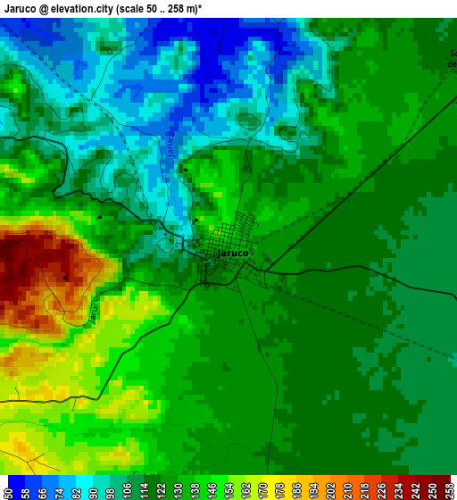
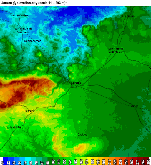
Below is the Elevation map of Jaruco, which displays elevation range with different colors. Scale of the first map is from 50 to 258 m (164 to 846 ft) with average elevation of 122.1 meters (=401 ft) [note 1]
These maps also provides idea of topography and contour of this city, they are displayed at different zoom levels. More info about maps, scale and edge coordinates you can find below images.
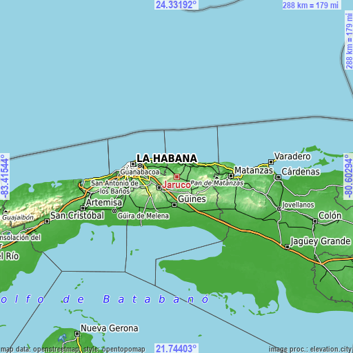
| \ | Map #1 | Map #2 | Topo.Map |
| Scale [m] | 50..258 m | 11..293 m | × |
| Scale [ft] | 164..846 ft | 36..961 ft | × |
| Average | 122.1 m = 401 ft | 113.9 m = 374 ft | × |
| Width | 8.99 km = 5.6 mi | 17.99 km = 11.2 mi | 287.7 km = 178.8 mi |
| Height | 8.99 km = 5.6 mi | 17.99 km = 11.2 mi | 287.8 km = 178.8 mi |
| ↑Max Latitude | 23.084623° | 23.125043° | 24.33192° |
| Latitude at center | 23.04419° | 23.04419° | 23.04419° |
| ↓Min Latitude | 23.003745° | 22.963289° | 21.74403° |
| ← Min Longitude | -82.053135° | -82.097081° | -83.41544° |
| Longitude center | -82.00919° | -82.00919° | -82.00919° |
| →Max Longitude | -81.965245° | -81.921299° | -80.60294° |
Nearby cities:
Cities around Jaruco sort by population:
• San Miguel del Padrón elevation 97 m
29.3 km,  274°
274°
• Guanabacoa 36 m
31.1 km,  286°
286°
• Alamar 38 m
30.3 km, 294°
• Güines 66 m
23.1 km,  184°
184°
• San José de las Lajas 138 m
17.2 km,  237°
237°
• Madruga 150 m
21.6 km,  133°
133°
• Santa Cruz del Norte 11 m
14.9 km,  34°
34°
• Jamaica 137 m
18 km, 244°
• San Nicolás de Bari 31 m
30.5 km,  161°
161°
• Guara 47 m
32.7 km,  217°
217°
• Melena del Sur 34 m
32 km,  207°
207°
• Mañalich 45 m
29.5 km, 208°
Multilingual:
 En español:
Jaruco elevación 134 m.
 En France:
Jaruco élévation 134 m.


Sources and notes:
- [note 1] Map square and city borders are not equal. Map elevation data is calculated only from area inside that square.
- [src 1] Elevation data from geonames database provided with same terms of usage.
- [src 2] The elevation map of Jaruco is generated using elevation data from NASA's 3 arcsec (90m) resolution SRTM data.
- [src 3] Base (background) map © OpenStreetMap contributors tiles are generated by Geofabrik and OpenTopoMap.
Copyright & License:
This Jaruco Elevation Map is licensed under CC BY-SA. You may reuse any part from this page, if you give a proper credit by linking to this URL:
 More info on terms of use page.